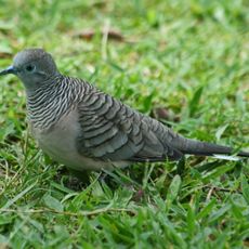
Oyala Thumotang National Park, Nature reserve in Queensland, Australia
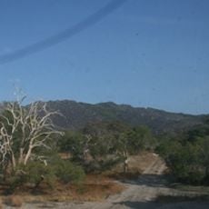
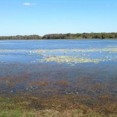
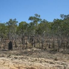
Oyala Thumotang National Park spreads from the McIlwraith Range foothills down to the Archer River, offering eucalyptus woodlands and wetland areas filled with melaleuca trees. The landscape shifts between different plant zones depending on how close you are to the water.
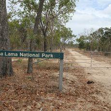
The park was established in 1994 as part of Queensland's conservation efforts for the region. The creation of this reserve became connected to broader discussions about Aboriginal land recognition in Australia.
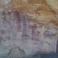
The lands here hold deep connections to the Wik Mungkan, Southern Kaanju, and Ayapathu Aboriginal peoples who cared for these territories for countless generations. Visitors can sense this heritage when moving through the landscape and its natural features.
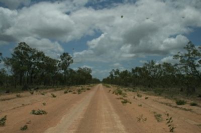
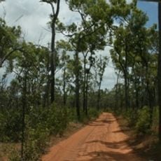
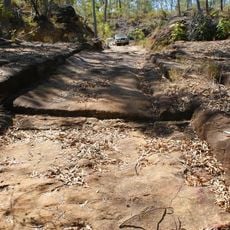
The park requires a four-wheel drive vehicle to reach, as the access roads are unpaved and can be rough depending on the season. Bring your own drinking water since supplies are limited once you are inside the reserve.
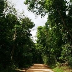
The Archer River flows through the park in a single deep channel lined with dense myrtle scrub, making it different from the branching waterways seen elsewhere in the region. This unusual pattern shapes how water moves through the landscape during different seasons.
Operator: Queensland Department of Environment and Science
GPS coordinates: -13.57939,142.80002
Latest update: December 14, 2025 11:21
Quinkan rock art
303.9 km
Cape Melville National Park (Cape York Peninsula Aboriginal Land)
202.3 km
Kutini-Payamu National Park
118.8 km
Apudthama National Park
248.3 km
Rinyirru (Lakefield) National Park
206.7 km
Juunju Daarrba Nhirrpan National Park (Cape York Peninsula Aboriginal Land)
287.3 km
Lama Lama National Park
123.8 km
Claremont Isles National Park
110.8 km
Piper Islands National Park
155.7 km
Wenlock Goldfield
56.7 km
Old Laura Homestead
265.4 km
Alwal National Park
199.4 km
Raine Island Beacon
258.9 km
Laura to Maytown Coach Road
313.6 km
Wuthathi (Saunders Islands) National Park (Cape York Peninsula Aboriginal Land)
204 km
Turtle Group National Park
289.3 km
Sir Charles Hardy Group National Park
199.8 km
Musgrave Telegraph Station
153 km
Musgrave
153.8 km
Mrs Watson's Cottage
311.7 km
Denham Group National Park
234.2 km
Coen Carrier Station
58.9 km
Palmer River Gold Company Dredge
269.9 km
Ebagoola Township and Battery
94.7 km
Errk Oykangand National Park
224.1 km
Gordon's Mine and Mill
110.3 km
Wild Irish Girl Mine and Battery
313.6 km
KULLA (McIlwraith Range) National Park (Cape York Peninsula Aboriginal Land)
67.3 kmVisited this place? Tap the stars to rate it and share your experience / photos with the community! Try now! You can cancel it anytime.
Discover hidden gems everywhere you go!
From secret cafés to breathtaking viewpoints, skip the crowded tourist spots and find places that match your style. Our app makes it easy with voice search, smart filtering, route optimization, and insider tips from travelers worldwide. Download now for the complete mobile experience.
A unique approach to discovering new places❞
— Le Figaro
All the places worth exploring❞
— France Info
A tailor-made excursion in just a few clicks❞
— 20 Minutes