Enable Location

We need your location to show you interesting places around you

Discover nearby places

Find interesting locations and hidden gems around you

Precise directions

Get accurate directions and distances to places

Your location is never shared with other users. It's only used when you tap the location button.

Log in to your account

Start exploring — it's free

Trusted by 62,487 travelers worldwide

Continue with Google
Continue with Apple
or

We will send you a code to connect

By continuing, you accept our Terms and Conditions and our Privacy Policy

Check your inbox

We've sent a pincode in your inbox. Please enter the code below.

Cluff Ranch Ponds

Cluff Ranch Ponds, Wildlife area in Graham County, Arizona

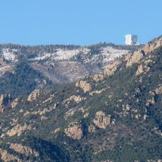
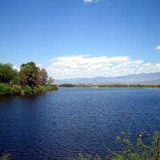
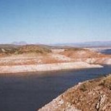
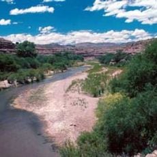
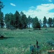
Cluff Ranch Ponds is a reservoir in southeastern Arizona, located on the north side of the Pinaleno Mountains at about 3500 feet in elevation. The site contains three ponds that are regularly stocked with rainbow trout, largemouth bass, crappie, channel catfish, and flathead catfish.

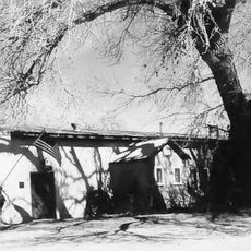
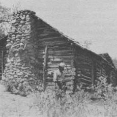
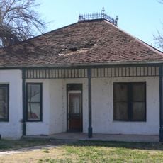
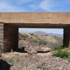
The land was inhabited from around 1880 before being developed as a ranch in 1949. The area evolved from a small community with its own school and plant center into a larger wildlife area that is now managed by the Arizona Game and Fish Department.

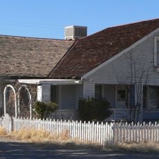
The name Cluff Ranch comes from the family that has owned the land since 1949. Visitors can see traces of the earlier community that lived here from around 1880 in the landscape and old structures.

The site is open year-round and can be easily reached from Highway 70 in Pima. Visitors may bring boats with electric motors, swimming and camping are not permitted, and the grounds are wheelchair accessible.

Volunteers regularly plant trees and support wildlife protection programs at this location. This local involvement has made the place an important refuge for many bird and animal species.

The community of curious travelers

AroundUs brings together thousands of curated places, local tips, and hidden gems, enriched daily by 60,000 contributors worldwide.

Start exploring
Location
GPS coordinates
32.81539,-109.84620
Latest update
February 9, 2026 08:22
Around this place
Large Binocular Telescope
United States of America

Large Binocular Telescope

13.3 km
Vatican Advanced Technology Telescope
United States of America

Vatican Advanced Technology Telescope

13.4 km
Mount Graham
United States of America

Mount Graham

12.9 km
Morenci Mine
United States of America

Morenci Mine

54.3 km
Mount Graham International Observatory
United States of America

Mount Graham International Observatory

13.4 km
Sierra Bonita Ranch
United States of America

Sierra Bonita Ranch

38.5 km
Roper Lake State Park
United States of America

Roper Lake State Park

14.8 km
San Carlos Lake
United States of America

San Carlos Lake

68.7 km
Heinrich Hertz Submillimeter Telescope
United States of America

Heinrich Hertz Submillimeter Telescope

13.3 km
Oracle State Park
United States of America

Oracle State Park

73 km
Gila Box Riparian National Conservation Area
United States of America

Gila Box Riparian National Conservation Area

35.9 km
Galiuro Wilderness
United States of America

Galiuro Wilderness

52 km
Point of Pines Sites
United States of America

Point of Pines Sites

12.3 km
Rex Allen Arizona Cowboy Museum and Willcox Cowboy Hall of Fame
United States of America

Rex Allen Arizona Cowboy Museum and Willcox Cowboy Hall of Fame

62.6 km
Park Avenue Bridge
United States of America

Park Avenue Bridge

57.7 km
Clifton Townsite Historic District
United States of America

Clifton Townsite Historic District

57.8 km
William Talley House
United States of America

William Talley House

12.9 km
Benjamin F. Billingsley House
United States of America

Benjamin F. Billingsley House

70.1 km
Gila River Bridge
United States of America

Gila River Bridge

52.9 km
Graham County Courthouse
United States of America

Graham County Courthouse

12.3 km
Columbine Work Station
United States of America

Columbine Work Station

13.9 km
Black Gap Bridge
United States of America

Black Gap Bridge

51.4 km
Johnson-Tillotson House
United States of America

Johnson-Tillotson House

62.5 km
John Gung'l House
United States of America

John Gung'l House

62.6 km
James R. Welker House
United States of America

James R. Welker House

12.7 km
Benjamin E. Briscoe House
United States of America

Benjamin E. Briscoe House

62.1 km
Woman's Club
United States of America

Woman's Club

12.9 km
Bowie School District No. 14
United States of America

Bowie School District No. 14

64 km
Show the full map
« Cluff Ranch Ponds - Wildlife area in Graham County, Arizona » is provided by Around Us (aroundus.com). Images and texts are derived from Wikimedia project under a Creative Commons license. You are allowed to copy, distribute, and modify copies of this page, under the conditions set by the license, as long as this note is clearly visible.

Discover hidden gems everywhere you go!

From secret cafés to breathtaking viewpoints, skip the crowded tourist spots and find places that match your style. Our app makes it easy with voice search, smart filtering, route optimization, and insider tips from travelers worldwide. Download now for the complete mobile experience.

Around Us App Screenshot

A unique approach to discovering new places

Le Figaro

All the places worth exploring

France Info

A tailor-made excursion in just a few clicks

20 Minutes

Around Us
Travel Guide & Maps
Download

Send to your phone

QR Code
1

Open the camera app on your mobile.

2

Point at the QR code with your camera. A notification will appear.

3

Tap the notification to open the link.