Chest opened
+${chestReward.xp} XP
Explorer
NOUVEAU ×${chestReward.collectible.quantity}
tapez pour fermer
Chest locked

Open chests in the app

Around Us is built for your phone — chests unlock when you walk, explore and capture nearby places.

Enable Location

We need your location to show you interesting places around you

Discover nearby places

Find interesting locations and hidden gems around you

Precise directions

Get accurate directions and distances to places

Your location is never shared with other users. It's only used when you tap the location button.

Artibonite River

Log in to your account

Start exploring — it's free

Trusted by 72,890 travelers worldwide

Continue with Google
Continue with Apple
or

We will send you a code to connect

By continuing, you accept our Terms and Conditions and our Privacy Policy

Check your inbox

We've sent a pincode in your inbox. Please enter the code below.

Artibonite River
Discussion Reviews 1 Photos
12.6k Popularity

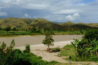
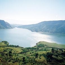
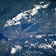
Artibonite River, Major river in Haiti and Dominican Republic.

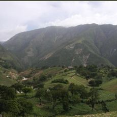
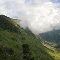
The Artibonite River is a waterway on Hispaniola that stretches over 300 kilometers from the Cordillera Central mountains through valleys and lowlands until it empties into the Gulf of Gonâve. The river passes through farmland and serves multiple purposes for the region's economy.

The river served as a vital trade route and water source for the region throughout its history. The completion of the Péligre Dam in 1956 transformed its role by enabling hydroelectric power generation and controlled irrigation systems.

The river shapes daily life for people living along its banks, supporting farming practices and determining where settlements developed in the valley. Water from the river flows to fields and orchards, playing a central role in how communities organize themselves.

The lower portion of the river is navigable by small boats, especially during rainy seasons when water levels rise. Visitors should be prepared for changing conditions and know that access depends on seasonal water flow and local conditions.

The river forms a natural border between Haiti and the Dominican Republic for several kilometers before joining the Macasía River. This boundary role shapes the geography and lives of people in communities near the frontier.

The community of curious travelers

AroundUs brings together thousands of curated places, local tips, and hidden gems, enriched daily by 60,000 contributors worldwide.

Start exploring
GPS coordinates
18.98608,-72.23221
Latest update
December 7, 2025 20:44
Reviews
Share your experience

No review yet

Discussions
Start a discussion...

No discussion yet

« Artibonite River - Major river in Haiti and Dominican Republic » is provided by Around Us (aroundus.com). Images and texts are derived from Wikimedia project under a Creative Commons license. You are allowed to copy, distribute, and modify copies of this page, under the conditions set by the license, as long as this note is clearly visible.

Discover hidden gems everywhere you go!

From secret cafés to breathtaking viewpoints, skip the crowded tourist spots and find places that match your style. Our app makes it easy with voice search, smart filtering, route optimization, and insider tips from travelers worldwide. Download now for the complete mobile experience.

Around Us App Screenshot

A unique approach to discovering new places

Le Figaro

All the places worth exploring

France Info

A tailor-made excursion in just a few clicks

20 Minutes

Around Us
Travel Guide & Maps
Download

Send to your phone

QR Code
1

Open the camera app on your mobile.

2

Point at the QR code with your camera. A notification will appear.

3

Tap the notification to open the link.