Chest opened
+${chestReward.xp} XP
Explorer
NOUVEAU ×${chestReward.collectible.quantity}
tapez pour fermer
Chest locked

Open chests in the app

Around Us is built for your phone — chests unlock when you walk, explore and capture nearby places.

Enable Location

We need your location to show you interesting places around you

Discover nearby places

Find interesting locations and hidden gems around you

Precise directions

Get accurate directions and distances to places

Your location is never shared with other users. It's only used when you tap the location button.

Winyah Bay

Log in to your account

Start exploring — it's free

Trusted by 72,887 travelers worldwide

Continue with Google
Continue with Apple
or

We will send you a code to connect

By continuing, you accept our Terms and Conditions and our Privacy Policy

Check your inbox

We've sent a pincode in your inbox. Please enter the code below.

Winyah Bay
Discussion Reviews 1 Photos
11.8k Popularity

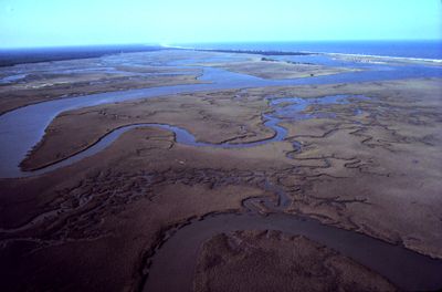
Winyah Bay, Coastal estuary in Georgetown County, South Carolina.

Winyah Bay is a coastal bay in eastern South Carolina where four major rivers converge: the Waccamaw, Pee Dee, Sampit, and Black Rivers. The freshwater from these rivers mixes with ocean water to create a brackish ecosystem with marshlands and islands.

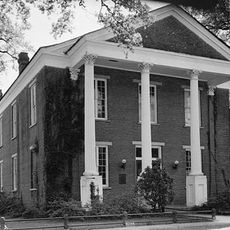
Spanish explorers reached this body of water in 1521 and called it San Juan Bautista. With the founding of Georgetown later, the bay became a major port for trade and shipping during the colonial period.

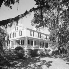
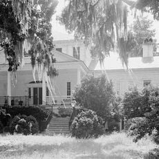
The area around this bay has long served as a crucial port, shaping life in Georgetown with its strong fishing and hunting heritage that persists today. Local residents maintain deep ties to the water and the rivers that converge here.

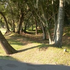
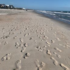
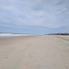
The North Inlet-Winyah Bay National Reserve offers hiking trails through wetlands and viewing spots for birds and wildlife. Visitors should wear sturdy shoes and prepare for wet terrain, particularly as tides shift throughout the day.

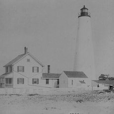
A significant wildlife refuge was created through the donation of islands to the state by a former Major League Baseball owner. These islands today frame the bay entrance naturally and serve as habitat for numerous rare bird species.

The community of curious travelers

AroundUs brings together thousands of curated places, local tips, and hidden gems, enriched daily by 60,000 contributors worldwide.

Start exploring
Location
GPS coordinates
33.29120,-79.27560
Latest update
December 7, 2025 20:48
Around this place
Hobcaw Barony
United States of America

Hobcaw Barony

6.4 km
Hampton Plantation
United States of America

Hampton Plantation

18.3 km
Mansfield Plantation
United States of America

Mansfield Plantation

16.1 km
Hopsewee
United States of America

Hopsewee

13.6 km
Wedge Plantation
United States of America

Wedge Plantation

17.6 km
Arcadia Plantation
United States of America

Arcadia Plantation

11.4 km
Black River Plantation House
United States of America

Black River Plantation House

24.5 km
Beneventum Plantation House
United States of America

Beneventum Plantation House

17.2 km
Annandale Plantation
United States of America

Annandale Plantation

8.6 km
Fairfield Plantation
United States of America

Fairfield Plantation

17.1 km
Chicora Wood Plantation
United States of America

Chicora Wood Plantation

26.9 km
Harrietta Plantation
United States of America

Harrietta Plantation

17.4 km
Battery White
United States of America

Battery White

2.2 km
All Saints' Episcopal Church, Waccamaw
United States of America

All Saints' Episcopal Church, Waccamaw

23.3 km
Georgetown Light
United States of America

Georgetown Light

11.4 km
Pee Dee River Rice Planters Historic District
United States of America

Pee Dee River Rice Planters Historic District

11.2 km
Temple Beth Elohim
United States of America

Temple Beth Elohim

8.5 km
Pawleys Island Historic District
United States of America

Pawleys Island Historic District

20 km
Prince Frederick's Chapel Ruins
United States of America

Prince Frederick's Chapel Ruins

25.5 km
Wicklow Hall Plantation
United States of America

Wicklow Hall Plantation

9.4 km
Georgetown Historic District
United States of America

Georgetown Historic District

8.4 km
Cedar Grove Plantation Chapel
United States of America

Cedar Grove Plantation Chapel

23.4 km
Joseph H. Rainey House
United States of America

Joseph H. Rainey House

8.7 km
Winyah Indigo School
United States of America

Winyah Indigo School

9.1 km
Kaminski House Museum
United States of America

Kaminski House Museum

8.6 km
Magnolia Beach
United States of America

Magnolia Beach

27.7 km
St. Mary's Church
United States of America

St. Mary's Church

8.7 km
Debidue Beach
United States of America

Debidue Beach

15.7 km
Show the full map
Reviews
Share your experience

No review yet

Discussions
Start a discussion...

No discussion yet

« Winyah Bay - Coastal estuary in Georgetown County, South Carolina » is provided by Around Us (aroundus.com). Images and texts are derived from Wikimedia project under a Creative Commons license. You are allowed to copy, distribute, and modify copies of this page, under the conditions set by the license, as long as this note is clearly visible.

Discover hidden gems everywhere you go!

From secret cafés to breathtaking viewpoints, skip the crowded tourist spots and find places that match your style. Our app makes it easy with voice search, smart filtering, route optimization, and insider tips from travelers worldwide. Download now for the complete mobile experience.

Around Us App Screenshot

A unique approach to discovering new places

Le Figaro

All the places worth exploring

France Info

A tailor-made excursion in just a few clicks

20 Minutes

Around Us
Travel Guide & Maps
Download

Send to your phone

QR Code
1

Open the camera app on your mobile.

2

Point at the QR code with your camera. A notification will appear.

3

Tap the notification to open the link.