Chest opened
+${chestReward.xp} XP
Explorer
NOUVEAU ×${chestReward.collectible.quantity}
tapez pour fermer
Chest locked

Open chests in the app

Around Us is built for your phone — chests unlock when you walk, explore and capture nearby places.

Enable Location

We need your location to show you interesting places around you

Discover nearby places

Find interesting locations and hidden gems around you

Precise directions

Get accurate directions and distances to places

Your location is never shared with other users. It's only used when you tap the location button.

Point Reyes Station

Log in to your account

Start exploring — it's free

Trusted by 72,891 travelers worldwide

Continue with Google
Continue with Apple
or

We will send you a code to connect

By continuing, you accept our Terms and Conditions and our Privacy Policy

Check your inbox

We've sent a pincode in your inbox. Please enter the code below.

Discussion Reviews 1 Photos
15.8k Popularity

Point Reyes Station, Rural community center in Marin County, United States

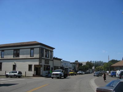
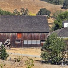
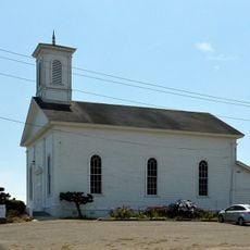
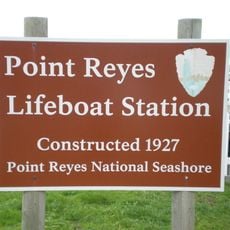
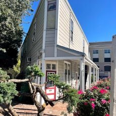
Point Reyes Station is a rural settlement in Marin County, California, that serves as the gateway to Point Reyes National Seashore. The town center holds shops, restaurants, and cheese producers that shape the economy and character of the place.

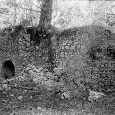
The settlement started in 1875 as Olema Station when the railroad arrived, connecting the farming area to the ferry route toward Sausalito. The rail line made it easier to ship local goods and helped the community grow.

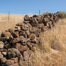
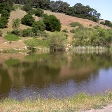
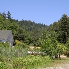
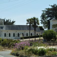
Local cheese and dairy businesses shape everyday life and reflect the deep connection to cattle ranching that has defined this area for generations. Visitors can see this heritage throughout the community, from the green pastures to small shops selling locally made products.

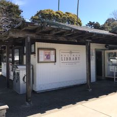
The town is the natural hub for visitors exploring Point Reyes National Seashore, with restaurants, shops, and information points. It makes sense to visit this spot upon arrival to get food and directions before heading out to the beaches and hiking trails.

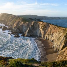
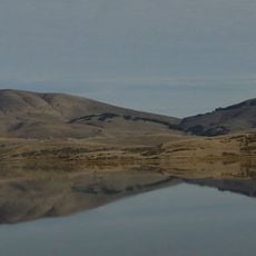
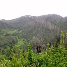
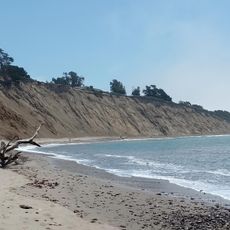
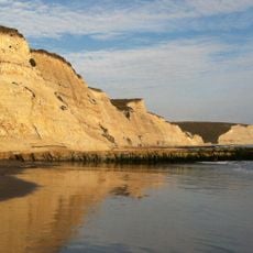
The San Andreas Fault runs directly east of the town and has shaped the geological formation of the surrounding landscape. This tectonic line is a quiet but powerful feature that influences the entire Point Reyes region.

The community of curious travelers

AroundUs brings together thousands of curated places, local tips, and hidden gems, enriched daily by 60,000 contributors worldwide.

Start exploring
Location
Elevation above the sea
12 m
GPS coordinates
38.07333,-122.80583
Latest update
December 7, 2025 19:29
Around this place
Skywalker Ranch
United States of America

Skywalker Ranch

14.2 km
Alamere Falls
United States of America

Alamere Falls

13.5 km
Point Reyes National Seashore
United States of America

Point Reyes National Seashore

6.8 km
Point Reyes Lighthouse
United States of America

Point Reyes Lighthouse

20.9 km
East Bay Walls
United States of America

East Bay Walls

20.3 km
Samuel P. Taylor State Park
United States of America

Samuel P. Taylor State Park

9.3 km
Olompali State Historic Park
United States of America

Olompali State Historic Park

21.8 km
Novato meteorite
United States of America

Novato meteorite

18.3 km
Alpine Lake
United States of America

Alpine Lake

20.9 km
Tomales Bay State Park
United States of America

Tomales Bay State Park

9.1 km
Bon Tempe Lake
United States of America

Bon Tempe Lake

21.5 km
Nicasio Reservoir
United States of America

Nicasio Reservoir

4.5 km
Kule Loklo
United States of America

Kule Loklo

3.1 km
Tomales Presbyterian Church and Cemetery
United States of America

Tomales Presbyterian Church and Cemetery

21.1 km
Harkleroad wind turbine
United States of America

Harkleroad wind turbine

21.5 km
Helen Putnam Regional Park
United States of America

Helen Putnam Regional Park

20.4 km
Point Reyes Lifeboat Station
United States of America

Point Reyes Lifeboat Station

17.2 km
Marin Museum of Bicycling
United States of America

Marin Museum of Bicycling

21.2 km
Phillip Burton Wilderness
United States of America

Phillip Burton Wilderness

7.4 km
Mount Burdell Open Space Preserve
United States of America

Mount Burdell Open Space Preserve

19.6 km
Audubon Canyon
United States of America

Audubon Canyon

19.4 km
Olema Lime Kilns
United States of America

Olema Lime Kilns

10.8 km
Flatiron Building
United States of America

Flatiron Building

21.4 km
Cypress Tree Tunnel
United States of America

Cypress Tree Tunnel

12.4 km
Church of the Assumption, Tomales
United States of America

Church of the Assumption, Tomales

21 km
Agate Beach
United States of America

Agate Beach

21.3 km
Drakes Bay Historic and Archeological District
United States of America

Drakes Bay Historic and Archeological District

12.1 km
Bolinas Library
United States of America

Bolinas Library

21.1 km
Show the full map
Reviews
Share your experience

No review yet

Discussions
Start a discussion...

No discussion yet

« Point Reyes Station - Rural community center in Marin County, United States » is provided by Around Us (aroundus.com). Images and texts are derived from Wikimedia project under a Creative Commons license. You are allowed to copy, distribute, and modify copies of this page, under the conditions set by the license, as long as this note is clearly visible.

Discover hidden gems everywhere you go!

From secret cafés to breathtaking viewpoints, skip the crowded tourist spots and find places that match your style. Our app makes it easy with voice search, smart filtering, route optimization, and insider tips from travelers worldwide. Download now for the complete mobile experience.

Around Us App Screenshot

A unique approach to discovering new places

Le Figaro

All the places worth exploring

France Info

A tailor-made excursion in just a few clicks

20 Minutes

Around Us
Travel Guide & Maps
Download

Send to your phone

QR Code
1

Open the camera app on your mobile.

2

Point at the QR code with your camera. A notification will appear.

3

Tap the notification to open the link.