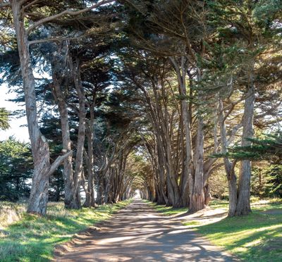
Cypress Tree Tunnel, Tree tunnel in Point Reyes National Seashore, California, United States.
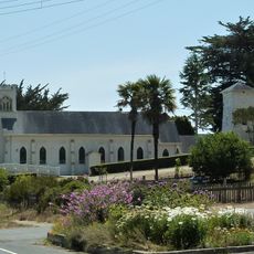
The Cypress Tree Tunnel is a tree-lined passage at Point Reyes National Seashore in California that stretches about 400 feet toward a white Art Deco radio station. Twin rows of Monterey cypress trees form a natural canopy overhead, creating a defined corridor through the landscape.
The trees were planted in 1930 to mark the entrance to an RCA maritime radio receiving station. The site reflects how communication infrastructure was integrated into the natural landscape during that period.
The twin rows of trees reflect how people shaped Northern California's landscape, creating a popular subject for photographers drawn to this distinctive natural gateway. The formation reveals how functional structures were often enhanced with living elements to improve their visual appeal.
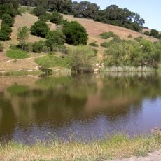
The tunnel lies along Sir Francis Drake Boulevard and is accessible directly from the road, with level ground that is easy to walk. Visitors should be aware that wind can be strong in the area and shade is minimal, particularly on sunny days.
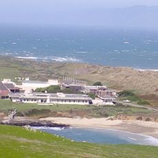
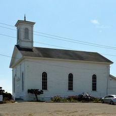
The white building at the tunnel's end is a former radio receiving station that once served maritime communication across vast distances. It still operates today and remains the last functioning Morse code maritime station on the Pacific coast of North America.
The community of curious travelers
AroundUs brings together thousands of curated places, local tips, and hidden gems, enriched daily by 60,000 contributors worldwide.