Chest opened
+${chestReward.xp} XP
Explorer
NOUVEAU ×${chestReward.collectible.quantity}
tapez pour fermer
Chest locked

Open chests in the app

Around Us is built for your phone — chests unlock when you walk, explore and capture nearby places.

Enable Location

We need your location to show you interesting places around you

Discover nearby places

Find interesting locations and hidden gems around you

Precise directions

Get accurate directions and distances to places

Your location is never shared with other users. It's only used when you tap the location button.

Parkfield

Log in to your account

Start exploring — it's free

Trusted by 72,888 travelers worldwide

Continue with Google
Continue with Apple
or

We will send you a code to connect

By continuing, you accept our Terms and Conditions and our Privacy Policy

Check your inbox

We've sent a pincode in your inbox. Please enter the code below.

Discussion Reviews 1 Photos
18k Popularity

Parkfield, unincorporated community in Monterey County, California, United States

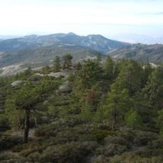
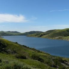
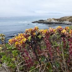
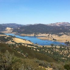
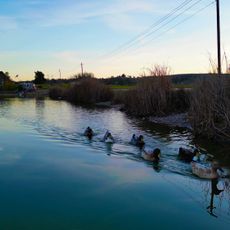
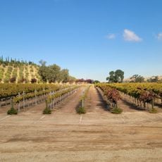
Parkfield is a small unincorporated community in Monterey County, California, located in the Cholame Valley along the San Andreas Fault. The settlement sits in rolling terrain dotted with oak trees, with Little Cholame Creek running through it and a population of about 18 residents who mainly raise cattle and horses.

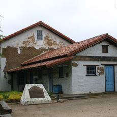
The area was originally home to the Salinan people, and later settlers established homesteads, with the first settlement called Russelsville in the 19th century before being renamed Parkfield. The town grew rapidly through mining and oil activity until 1899 when about 900 people lived there, but after the 1920s most residents left as resources became depleted.

Parkfield takes its name from the open land and oak trees that once resembled a park. Today, ranching culture shapes daily life here, with families raising cattle and horses, gathering for brandings in spring and rodeos that keep rural traditions alive.

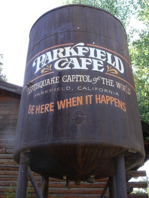
Visitors should expect a very small settlement with limited services and amenities since it focuses on seismic research rather than tourism. Plan a visit during May or June when the weather is warm and dry, local festivals like bluegrass music and rodeos take place, making it a good time to experience the community.

A bridge built in the 1930s displays a remarkable sign of aseismic creep, with its piers having shifted more than 5 feet apart without causing major earthquakes. This visible feature shows how tectonic plates continuously and imperceptibly move past each other at this location.

The community of curious travelers

AroundUs brings together thousands of curated places, local tips, and hidden gems, enriched daily by 60,000 contributors worldwide.

Start exploring
Location
Elevation above the sea
466 m
GPS coordinates
35.89917,-120.43278
Latest update
February 17, 2026 00:00
Around this place
Avenal State Prison
United States of America

Avenal State Prison

29.4 km
Mission San Miguel Arcángel
United States of America

Mission San Miguel Arcángel

29.5 km
Lake Nacimiento
United States of America

Lake Nacimiento

50.7 km
Lake San Antonio
United States of America

Lake San Antonio

48.6 km
Morro Strand State Beach
United States of America

Morro Strand State Beach

70.1 km
Cayucos State Beach
United States of America

Cayucos State Beach

65.9 km
Santa Margarita Lake
United States of America

Santa Margarita Lake

63.7 km
Charles Paddock Zoo
United States of America

Charles Paddock Zoo

52.7 km
Kettleman Hills Hazardous Waste Facility
United States of America

Kettleman Hills Hazardous Waste Facility

38.8 km
San Benito mountain
United States of America

San Benito mountain

55.7 km
Santa Margarita de Cortona Asistencia
United States of America

Santa Margarita de Cortona Asistencia

57.8 km
Whale Rock Reservoir
United States of America

Whale Rock Reservoir

63.1 km
Harmony Headlands State Park
United States of America

Harmony Headlands State Park

69 km
Carlton Hotel
United States of America

Carlton Hotel

50.4 km
Laguna Mountain Recreation Area
United States of America

Laguna Mountain Recreation Area

62.6 km
Hernandez Reservoir
United States of America

Hernandez Reservoir

64.4 km
Rios-Caledonia Adobe
United States of America

Rios-Caledonia Adobe

30 km
San Luis Obispo Botanical Garden
United States of America

San Luis Obispo Botanical Garden

67.4 km
Leaning Pine Arboretum
United States of America

Leaning Pine Arboretum

68.8 km
Estero Bluffs State Park
United States of America

Estero Bluffs State Park

67.5 km
Estrella Adobe Church
United States of America

Estrella Adobe Church

30.7 km
Paso Robles Carnegie Library
United States of America

Paso Robles Carnegie Library

38.2 km
Bank of Italy
United States of America

Bank of Italy

38.1 km
Atascadero Administration Building
United States of America

Atascadero Administration Building

50.3 km
Franklin Hot Springs
United States of America

Franklin Hot Springs

39.5 km
Sculpterra Winery and Sculpture Garden
United States of America

Sculpterra Winery and Sculpture Garden

36.9 km
Cayucos Beach
United States of America

Cayucos Beach

65.9 km
Call-Booth House
United States of America

Call-Booth House

38.5 km
Show the full map
Reviews
Share your experience

No review yet

Discussions
Start a discussion...

No discussion yet

« Parkfield - unincorporated community in Monterey County, California, United States » is provided by Around Us (aroundus.com). Images and texts are derived from Wikimedia project under a Creative Commons license. You are allowed to copy, distribute, and modify copies of this page, under the conditions set by the license, as long as this note is clearly visible.

Discover hidden gems everywhere you go!

From secret cafés to breathtaking viewpoints, skip the crowded tourist spots and find places that match your style. Our app makes it easy with voice search, smart filtering, route optimization, and insider tips from travelers worldwide. Download now for the complete mobile experience.

Around Us App Screenshot

A unique approach to discovering new places

Le Figaro

All the places worth exploring

France Info

A tailor-made excursion in just a few clicks

20 Minutes

Around Us
Travel Guide & Maps
Download

Send to your phone

QR Code
1

Open the camera app on your mobile.

2

Point at the QR code with your camera. A notification will appear.

3

Tap the notification to open the link.