Chest opened
+${chestReward.xp} XP
Explorer
NOUVEAU ×${chestReward.collectible.quantity}
tapez pour fermer
Chest locked

Open chests in the app

Around Us is built for your phone — chests unlock when you walk, explore and capture nearby places.

Enable Location

We need your location to show you interesting places around you

Discover nearby places

Find interesting locations and hidden gems around you

Precise directions

Get accurate directions and distances to places

Your location is never shared with other users. It's only used when you tap the location button.

Byron

Log in to your account

Start exploring — it's free

Trusted by 72,880 travelers worldwide

Continue with Google
Continue with Apple
or

We will send you a code to connect

By continuing, you accept our Terms and Conditions and our Privacy Policy

Check your inbox

We've sent a pincode in your inbox. Please enter the code below.

Discussion Reviews 1 Photos
14.7k Popularity

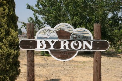
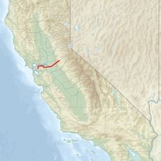
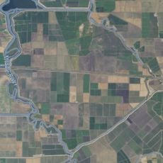
Byron, Census-designated place in Contra Costa County, California.

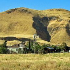
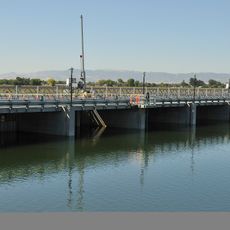
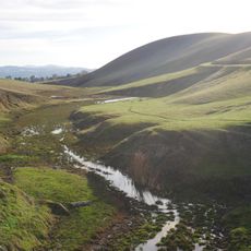
Byron is a census-designated place in Contra Costa County, California, located in a rural area with scattered homes and open land. The community maintains a residential character with local roads connecting small neighborhoods across the region.

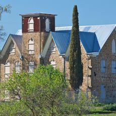
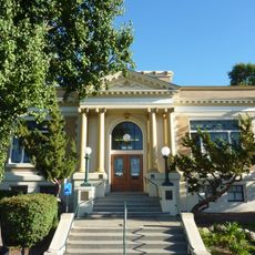
The first post office was established in 1878, marking the beginning of organized settlement in the area. The Byron Hot Springs Resort then drew visitors to the region starting in the early 1900s.

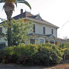
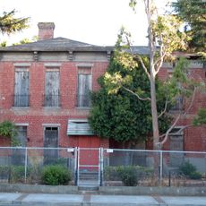
During World War II, the local Byron Hot Springs facility served as a military interrogation center, housing both German and Japanese prisoners.

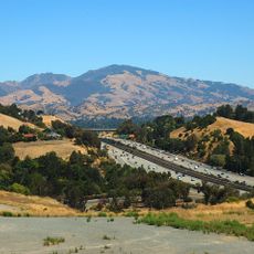
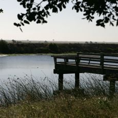
The area offers a quiet, rural setting best explored by car, with local roads connecting to nearby communities. Visitors should plan to spend time driving between points of interest in this dispersed settlement.

The Byron Hot Springs Resort, built in 1913, served a surprising second purpose during World War II as a military interrogation facility. This transformation marked a dramatic change in how the once-popular resort was used during wartime.

The community of curious travelers

AroundUs brings together thousands of curated places, local tips, and hidden gems, enriched daily by 60,000 contributors worldwide.

Start exploring
Elevation above the sea
10 m
GPS coordinates
37.87167,-121.63917
Latest update
December 7, 2025 20:20
Around this place
Centennial Light
United States of America

Centennial Light

23.1 km
Mount Diablo
United States of America

Mount Diablo

24.2 km
California Aqueduct
United States of America

California Aqueduct

8.6 km
Altamont Raceway Park
United States of America

Altamont Raceway Park

16.3 km
Altamont Pass
United States of America

Altamont Pass

14.1 km
Black Diamond Mines Regional Preserve
United States of America

Black Diamond Mines Regional Preserve

21 km
Antioch Bridge
United States of America

Antioch Bridge

19.6 km
Blackhawk Museum
United States of America

Blackhawk Museum

25.7 km
Franks Tract State Recreation Area
United States of America

Franks Tract State Recreation Area

19.7 km
Antioch Dunes National Wildlife Refuge
United States of America

Antioch Dunes National Wildlife Refuge

20.9 km
Stone House of John Marsh
United States of America

Stone House of John Marsh

7.7 km
Mokelumne Aqueduct
United States of America

Mokelumne Aqueduct

16.6 km
Contra Costa Canal
United States of America

Contra Costa Canal

14.8 km
Marsh Creek State Park
United States of America

Marsh Creek State Park

9.1 km
Bethany Reservoir
United States of America

Bethany Reservoir

11.7 km
Contra Loma Regional Park
United States of America

Contra Loma Regional Park

21.9 km
Boomers Livermore
United States of America

Boomers Livermore

24.4 km
Jones Tract
United States of America

Jones Tract

15.3 km
Livermore Carnegie Library and Park
United States of America

Livermore Carnegie Library and Park

24.2 km
Twitchell Island
United States of America

Twitchell Island

26.5 km
Shannon-Williamson Ranch
United States of America

Shannon-Williamson Ranch

14.7 km
Roswell Butler Hard House
United States of America

Roswell Butler Hard House

22.5 km
Doolan Canyon
United States of America

Doolan Canyon

24.7 km
Riverview Union High School Building
United States of America

Riverview Union High School Building

23 km
Bank of Tracy
United States of America

Bank of Tracy

24.1 km
Bank of Italy
United States of America

Bank of Italy

24.2 km
Tracy City Hall and Jail
United States of America

Tracy City Hall and Jail

24.1 km
Antioch WaterPark
United States of America

Antioch WaterPark

15.7 km
Show the full map
Reviews
Share your experience

No review yet

Discussions
Start a discussion...

No discussion yet

« Byron - Census-designated place in Contra Costa County, California » is provided by Around Us (aroundus.com). Images and texts are derived from Wikimedia project under a Creative Commons license. You are allowed to copy, distribute, and modify copies of this page, under the conditions set by the license, as long as this note is clearly visible.

Discover hidden gems everywhere you go!

From secret cafés to breathtaking viewpoints, skip the crowded tourist spots and find places that match your style. Our app makes it easy with voice search, smart filtering, route optimization, and insider tips from travelers worldwide. Download now for the complete mobile experience.

Around Us App Screenshot

A unique approach to discovering new places

Le Figaro

All the places worth exploring

France Info

A tailor-made excursion in just a few clicks

20 Minutes

Around Us
Travel Guide & Maps
Download

Send to your phone

QR Code
1

Open the camera app on your mobile.

2

Point at the QR code with your camera. A notification will appear.

3

Tap the notification to open the link.