Chest opened
+${chestReward.xp} XP
Explorer
NOUVEAU ×${chestReward.collectible.quantity}
tapez pour fermer
Chest locked

Open chests in the app

Around Us is built for your phone — chests unlock when you walk, explore and capture nearby places.

Enable Location

We need your location to show you interesting places around you

Discover nearby places

Find interesting locations and hidden gems around you

Precise directions

Get accurate directions and distances to places

Your location is never shared with other users. It's only used when you tap the location button.

California Coast Ranges

Log in to your account

Start exploring — it's free

Trusted by 72,984 travelers worldwide

Continue with Google
Continue with Apple
or

We will send you a code to connect

By continuing, you accept our Terms and Conditions and our Privacy Policy

Check your inbox

We've sent a pincode in your inbox. Please enter the code below.

California Coast Ranges
Discussion Reviews 1 Photos
52.6k Popularity

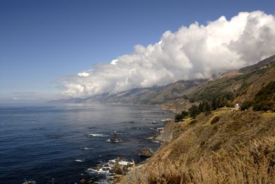
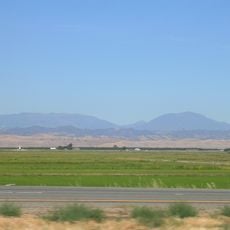
California Coast Ranges, Mountain range along Pacific Coast in California, United States.

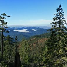
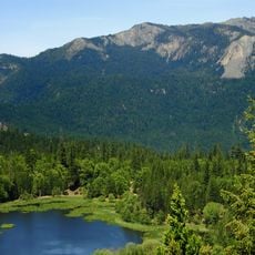
The California Coast Ranges stretch for several hundred kilometers along the Pacific shore and run parallel to the coastline. The mountains are marked by forested slopes, open valleys, and steep ridges that display varying elevations and plant communities.

Indigenous people such as the Chumash and Ohlone inhabited these mountains for thousands of years before Europeans began exploring the region in the 1700s. The arrival of settlers brought major changes to how the land was used and understood.

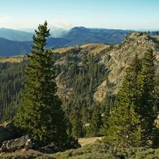
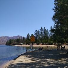
The range contains hiking paths and recreational spaces that visitors can explore today to experience the landscape. Many of these trails connect with larger walking systems and draw people seeking outdoor activity.

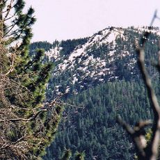
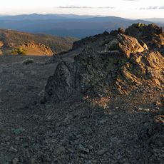
The highest peak exceeds 2,400 meters and offers multiple access routes through established forest roads and marked trails. Visitors can choose different difficulty levels based on their abilities and explore the entire region.

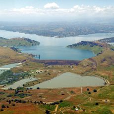
Near Clear Lake lie substantial deposits of cinnabar, a mineral that was once extracted for mercury production. Mining operations in this area played a role in the region's industrial development during the 1800s.

The community of curious travelers

AroundUs brings together thousands of curated places, local tips, and hidden gems, enriched daily by 60,000 contributors worldwide.

Start exploring
Location
Elevation above the sea
2,468 m
GPS coordinates
40.03682,-122.85501
Latest update
December 14, 2025 18:01
Around this place
Mendocino National Forest
United States of America

Mendocino National Forest

48.2 km
Whiskeytown Lake
United States of America

Whiskeytown Lake

68.1 km
United States of America

Thunderhill Raceway Park

71.2 km
Abbey of New Clairvaux
United States of America

Abbey of New Clairvaux

68.7 km
Saint Herman of Alaska Brotherhood
United States of America

Saint Herman of Alaska Brotherhood

34.7 km
Snow Mountain Wilderness
United States of America

Snow Mountain Wilderness

70 km
Yolla Bolly-Middle Eel Wilderness
United States of America

Yolla Bolly-Middle Eel Wilderness

12.5 km
Black Butte Lake
United States of America

Black Butte Lake

49.6 km
Keswick Dam
United States of America

Keswick Dam

72.8 km
Mount Linn
United States of America

Mount Linn

86 m
Whiskeytown Dam
United States of America

Whiskeytown Dam

68.1 km
South Fork Eel River Wilderness
United States of America

South Fork Eel River Wilderness

69.7 km
Cascade Theatre
United States of America

Cascade Theatre

72.4 km
Stony Gorge Dam
United States of America

Stony Gorge Dam

57.3 km
Anthony Peak
United States of America

Anthony Peak

23.2 km
North Yolla Bolly Mountain
United States of America

North Yolla Bolly Mountain

20.4 km
State Theatre
United States of America

State Theatre

55.1 km
Saint John Mountain
United States of America

Saint John Mountain

68.5 km
Odd Fellows Building
United States of America

Odd Fellows Building

55.1 km
Old Bank of America Building
United States of America

Old Bank of America Building

55.2 km
Saint Mary's Parish
United States of America

Saint Mary's Parish

55.2 km
United States of America

Signal Peak

68.1 km
Cottonwood Historic District
United States of America

Cottonwood Historic District

62.2 km
Maywood Woman's Club
United States of America

Maywood Woman's Club

59.2 km
Brandy Creek Beach
United States of America

Brandy Creek Beach

69 km
Historic Hawes Farms
United States of America

Historic Hawes Farms

71.4 km
Fantasy Fountain
United States of America

Fantasy Fountain

71.7 km
Rodgers Theatre
United States of America

Rodgers Theatre

58.7 km
Show the full map
Reviews
Share your experience

No review yet

Discussions
Start a discussion...

No discussion yet

« California Coast Ranges - Mountain range along Pacific Coast in California, United States » is provided by Around Us (aroundus.com). Images and texts are derived from Wikimedia project under a Creative Commons license. You are allowed to copy, distribute, and modify copies of this page, under the conditions set by the license, as long as this note is clearly visible.

Discover hidden gems everywhere you go!

From secret cafés to breathtaking viewpoints, skip the crowded tourist spots and find places that match your style. Our app makes it easy with voice search, smart filtering, route optimization, and insider tips from travelers worldwide. Download now for the complete mobile experience.

Around Us App Screenshot

A unique approach to discovering new places

Le Figaro

All the places worth exploring

France Info

A tailor-made excursion in just a few clicks

20 Minutes

Around Us
Travel Guide & Maps
Download

Send to your phone

QR Code
1

Open the camera app on your mobile.

2

Point at the QR code with your camera. A notification will appear.

3

Tap the notification to open the link.