Enable Location

We need your location to show you interesting places around you

Discover nearby places

Find interesting locations and hidden gems around you

Precise directions

Get accurate directions and distances to places

Your location is never shared with other users. It's only used when you tap the location button.

Log in to your account

Start exploring — it's free

Trusted by 63,023 travelers worldwide

Continue with Google
Continue with Apple
or

We will send you a code to connect

By continuing, you accept our Terms and Conditions and our Privacy Policy

Check your inbox

We've sent a pincode in your inbox. Please enter the code below.

Big Sage Reservoir
Discussion Reviews Photo
1.3k Popularity

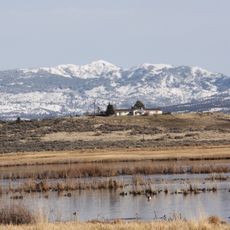
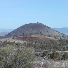
Big Sage Reservoir, body of water

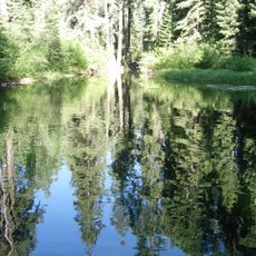
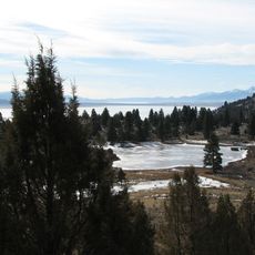
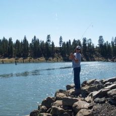
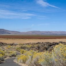
Big Sage Reservoir is an artificial lake in Modoc County, northern California, created by a dam completed in 1921. The body of water stretches several miles across the landscape and is surrounded by pine trees and open spaces, with a modest campground and boat launch nearby.

The reservoir was created in 1921 when the Hot Springs Valley Irrigation District built an earthen dam to store water for regional agriculture. The dam represented part of broader development in rural California to provide infrastructure for settlement and farmland expansion.

Visitors reach the reservoir via Big Sage Road from nearby towns such as Alturas. It is wise to check local road conditions beforehand, as the area is remote and weather can shift quickly.

Water stored in the reservoir flows out through Rattlesnake Creek, which eventually joins the larger Pit River system. This connection reveals how the artificial basin integrates into the broader watershed of the region.

The community of curious travelers

AroundUs brings together thousands of curated places, local tips, and hidden gems, enriched daily by 60,000 contributors worldwide.

Start exploring
Location
GPS coordinates
41.60420,-120.65100
Latest update
February 9, 2026 07:46
Around this place
Lava Beds National Monument
United States of America

Lava Beds National Monument

72.3 km
Modoc National Forest
United States of America

Modoc National Forest

51 km
Captain Jack's Stronghold
United States of America

Captain Jack's Stronghold

75 km
Clear Lake National Wildlife Refuge
United States of America

Clear Lake National Wildlife Refuge

47.7 km
South Warner Wilderness
United States of America

South Warner Wilderness

49.1 km
Modoc National Wildlife Refuge
United States of America

Modoc National Wildlife Refuge

19.8 km
Fandango Pass
United States of America

Fandango Pass

43 km
Eagle Peak
United States of America

Eagle Peak

51.8 km
Petroglyph Point Archaeological Site
United States of America

Petroglyph Point Archaeological Site

67.1 km
Goose Lake State Recreation Area
United States of America

Goose Lake State Recreation Area

51.3 km
Schonchin Butte
United States of America

Schonchin Butte

74.5 km
Hunter's Hot Springs
United States of America

Hunter's Hot Springs

72.5 km
Gerber Reservoir
United States of America

Gerber Reservoir

76 km
Canby's Cross
United States of America

Canby's Cross

78 km
Booth State Scenic Corridor
United States of America

Booth State Scenic Corridor

65.3 km
Goose Lake meteorite
United States of America

Goose Lake meteorite

42.8 km
Hat Mountain
United States of America

Hat Mountain

67 km
Lake County Round Sale Barn
United States of America

Lake County Round Sale Barn

70.1 km
John N. and Cornelia Watson House
United States of America

John N. and Cornelia Watson House

69.8 km
Jess Valley Schoolhouse
United States of America

Jess Valley Schoolhouse

47.1 km
William P. Heryford House
United States of America

William P. Heryford House

69.8 km
Tule Lake National Monument
United States of America

Tule Lake National Monument

68 km
Schonchin Butte Lookout
United States of America

Schonchin Butte Lookout

74.5 km
Skull Cave
United States of America

Skull Cave

72.9 km
Mushpot Cave
United States of America

Mushpot Cave

72.4 km
Hospital Rock Trail
United States of America

Hospital Rock Trail

72.7 km
Lava Beds Visitor Center
United States of America

Lava Beds Visitor Center

72.5 km
Niles Theater
United States of America

Niles Theater

16.2 km
Show the full map
Reviews
Share your experience

No review yet

Discussions
Start a discussion...

No discussion yet

« Big Sage Reservoir - body of water » is provided by Around Us (aroundus.com). Images and texts are derived from Wikimedia project under a Creative Commons license. You are allowed to copy, distribute, and modify copies of this page, under the conditions set by the license, as long as this note is clearly visible.

Discover hidden gems everywhere you go!

From secret cafés to breathtaking viewpoints, skip the crowded tourist spots and find places that match your style. Our app makes it easy with voice search, smart filtering, route optimization, and insider tips from travelers worldwide. Download now for the complete mobile experience.

Around Us App Screenshot

A unique approach to discovering new places

Le Figaro

All the places worth exploring

France Info

A tailor-made excursion in just a few clicks

20 Minutes

Around Us
Travel Guide & Maps
Download

Send to your phone

QR Code
1

Open the camera app on your mobile.

2

Point at the QR code with your camera. A notification will appear.

3

Tap the notification to open the link.