Enable Location

We need your location to show you interesting places around you

Discover nearby places

Find interesting locations and hidden gems around you

Precise directions

Get accurate directions and distances to places

Your location is never shared with other users. It's only used when you tap the location button.

Fandango Pass

Log in to your account

Start exploring — it's free

Trusted by 63,029 travelers worldwide

Continue with Google
Continue with Apple
or

We will send you a code to connect

By continuing, you accept our Terms and Conditions and our Privacy Policy

Check your inbox

We've sent a pincode in your inbox. Please enter the code below.

Discussion Reviews 1 Photos
2.8k Popularity

Fandango Pass, Mountain pass in Modoc County, California, US

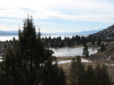
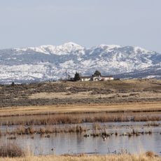
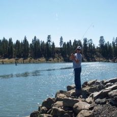
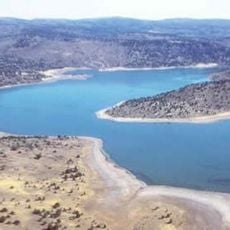
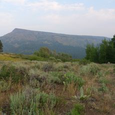
Fandango Pass is a mountain pass in Modoc County that sits at approximately 1,900 feet (579 meters) elevation and is primarily accessed by unpaved road. The route follows historical terrain with steep grades and tight curves between Upper Alkali Lake and Goose Lake.

The pass became important starting in 1846 as a junction where the Applegate Trail and Lassen Trail met for westbound pioneers. It remained a major route through the mountains until 1850 when emigration patterns shifted.

The name came from travelers who burned their wagons and danced to stay warm during harsh conditions in this mountain valley. The pass carries the memory of how early pioneers survived extreme cold in this remote location.

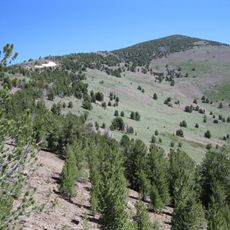
The unpaved road is passable most of the year but becomes impassable during heavy snow in winter months. Visitors should use a vehicle with good ground clearance and prepare for changing weather conditions.

Remnants of the original emigrant trail remain visible on the eastern approach, showing the exact path pioneers took through this terrain. These physical traces make the historical route tangible and reveal how early travelers actually moved across the landscape.

The community of curious travelers

AroundUs brings together thousands of curated places, local tips, and hidden gems, enriched daily by 60,000 contributors worldwide.

Start exploring
Location
GPS coordinates
41.80210,-120.20700
Latest update
December 12, 2025 14:24
Around this place
Sheldon National Wildlife Refuge
United States of America

Sheldon National Wildlife Refuge

78 km
Clear Lake National Wildlife Refuge
United States of America

Clear Lake National Wildlife Refuge

75.3 km
South Warner Wilderness
United States of America

South Warner Wilderness

52.2 km
Modoc National Wildlife Refuge
United States of America

Modoc National Wildlife Refuge

46.4 km
Abert Rim
United States of America

Abert Rim

65.3 km
David L. Shirk Ranch
United States of America

David L. Shirk Ranch

74.8 km
Greaser Petroglyph Site
United States of America

Greaser Petroglyph Site

53.7 km
Eagle Peak
United States of America

Eagle Peak

57.7 km
Camp Warner
United States of America

Camp Warner

80.3 km
Goose Lake State Recreation Area
United States of America

Goose Lake State Recreation Area

23.5 km
United States of America

Little High Rock Canyon Wilderness

91.3 km
Chandler State Wayside
United States of America

Chandler State Wayside

67.7 km
High Rock Canyon Wilderness
United States of America

High Rock Canyon Wilderness

77.9 km
Hunter's Hot Springs
United States of America

Hunter's Hot Springs

48.5 km
Stone Bridge and the Oregon Central Military Wagon Road
United States of America

Stone Bridge and the Oregon Central Military Wagon Road

68.6 km
Gerber Reservoir
United States of America

Gerber Reservoir

86.2 km
United States of America

East Fork High Rock Canyon Wilderness

81.9 km
Booth State Scenic Corridor
United States of America

Booth State Scenic Corridor

53.1 km
Goose Lake meteorite
United States of America

Goose Lake meteorite

34.1 km
Dodge Reservoir
United States of America

Dodge Reservoir

93 km
Hat Mountain
United States of America

Hat Mountain

73 km
Deep Creek Falls
United States of America

Deep Creek Falls

46.5 km
Lake County Round Sale Barn
United States of America

Lake County Round Sale Barn

45.6 km
John N. and Cornelia Watson House
United States of America

John N. and Cornelia Watson House

44.7 km
Jess Valley Schoolhouse
United States of America

Jess Valley Schoolhouse

60.3 km
William P. Heryford House
United States of America

William P. Heryford House

44.5 km
Alger Theatre
United States of America

Alger Theatre

44.5 km
Niles Theater
United States of America

Niles Theater

45.1 km
Show the full map
Reviews
Share your experience

No review yet

Discussions
Start a discussion...

No discussion yet

« Fandango Pass - Mountain pass in Modoc County, California, US » is provided by Around Us (aroundus.com). Images and texts are derived from Wikimedia project under a Creative Commons license. You are allowed to copy, distribute, and modify copies of this page, under the conditions set by the license, as long as this note is clearly visible.

Discover hidden gems everywhere you go!

From secret cafés to breathtaking viewpoints, skip the crowded tourist spots and find places that match your style. Our app makes it easy with voice search, smart filtering, route optimization, and insider tips from travelers worldwide. Download now for the complete mobile experience.

Around Us App Screenshot

A unique approach to discovering new places

Le Figaro

All the places worth exploring

France Info

A tailor-made excursion in just a few clicks

20 Minutes

Around Us
Travel Guide & Maps
Download

Send to your phone

QR Code
1

Open the camera app on your mobile.

2

Point at the QR code with your camera. A notification will appear.

3

Tap the notification to open the link.