Enable Location

We need your location to show you interesting places around you

Discover nearby places

Find interesting locations and hidden gems around you

Precise directions

Get accurate directions and distances to places

Your location is never shared with other users. It's only used when you tap the location button.

Log in to your account

Start exploring — it's free

Trusted by 63,029 travelers worldwide

Continue with Google
Continue with Apple
or

We will send you a code to connect

By continuing, you accept our Terms and Conditions and our Privacy Policy

Check your inbox

We've sent a pincode in your inbox. Please enter the code below.

Clear Lake Reservoir
Discussion Reviews Photo
2.5k Popularity

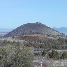
Clear Lake Reservoir, artificial lake in Modoc County, northern California, United States

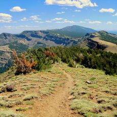
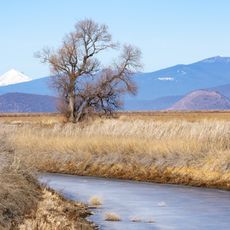
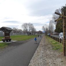
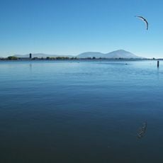
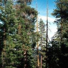
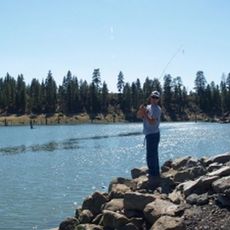
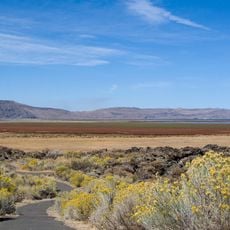
Clear Lake Reservoir is a large artificial lake in Modoc County in northern California, created by damming the Lost River. The water body spans a wide area surrounded by forest, with accessible shorelines that offer spots for fishing and outdoor activities.

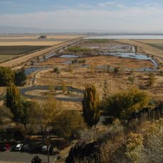
The reservoir was created in 1910 with a rock dam that gradually deteriorated, leading to lowered water levels for safety. A new concrete dam replaced the aging structure in 2002 to restore the original storage capacity and reliability.

The reservoir serves as a gathering place for local fishermen and outdoor enthusiasts who come to relax and spend time with nature. The water holds practical importance for the region, connecting people to the landscape they depend on for their livelihoods.

Visitors should prepare for the remote location by bringing necessary supplies, as there are no large towns nearby. The best fishing times are during warmer months, but the reservoir remains accessible year-round depending on weather and water levels.

The lake loses significant amounts of water through evaporation, especially in dry years, making it less efficient for water storage than typical reservoirs. Despite this challenge, it plays an important role in the region's water management system and helps protect wetlands and refuges like Tule Lake.

The community of curious travelers

AroundUs brings together thousands of curated places, local tips, and hidden gems, enriched daily by 60,000 contributors worldwide.

Start exploring
Location
GPS coordinates
41.86000,-121.14600
Latest update
February 9, 2026 08:22
Around this place
Medicine Lake Volcano
United States of America

Medicine Lake Volcano

48.7 km
Modoc National Forest
United States of America

Modoc National Forest

46 km
Captain Jack's Stronghold
United States of America

Captain Jack's Stronghold

30.1 km
Lower Klamath National Wildlife Refuge
United States of America

Lower Klamath National Wildlife Refuge

46.7 km
Tule Lake National Wildlife Refuge
United States of America

Tule Lake National Wildlife Refuge

28.8 km
OC&E Woods Line State Trail
United States of America

OC&E Woods Line State Trail

63.3 km
Clear Lake National Wildlife Refuge
United States of America

Clear Lake National Wildlife Refuge

2.9 km
Lake Ewauna
United States of America

Lake Ewauna

65.4 km
Petroglyph Point Archaeological Site
United States of America

Petroglyph Point Archaeological Site

20.4 km
Bear Valley National Wildlife Refuge
United States of America

Bear Valley National Wildlife Refuge

66 km
Schonchin Butte
United States of America

Schonchin Butte

34.6 km
Klamath Basin National Wildlife Refuge Complex
United States of America

Klamath Basin National Wildlife Refuge Complex

36 km
Gerber Reservoir
United States of America

Gerber Reservoir

37.9 km
Canby's Cross
United States of America

Canby's Cross

33.3 km
Booth State Scenic Corridor
United States of America

Booth State Scenic Corridor

59.3 km
Baldwin Hotel
United States of America

Baldwin Hotel

66.5 km
Goose Lake meteorite
United States of America

Goose Lake meteorite

51.8 km
Bly Ranger Station
United States of America

Bly Ranger Station

60.7 km
Klamath Falls City Hall
United States of America

Klamath Falls City Hall

66.3 km
Blackburn Sanitarium
United States of America

Blackburn Sanitarium

66.4 km
Tule Lake National Monument
United States of America

Tule Lake National Monument

19.2 km
Schonchin Butte Lookout
United States of America

Schonchin Butte Lookout

34.6 km
Klamath County Museum
United States of America

Klamath County Museum

66.2 km
Skull Cave
United States of America

Skull Cave

33.5 km
Mushpot Cave
United States of America

Mushpot Cave

34.2 km
Hospital Rock Trail
United States of America

Hospital Rock Trail

27 km
Lava Beds Visitor Center
United States of America

Lava Beds Visitor Center

34.3 km
Niles Theater
United States of America

Niles Theater

65.4 km
Show the full map
Reviews
Share your experience

No review yet

Discussions
Start a discussion...

No discussion yet

« Clear Lake Reservoir - artificial lake in Modoc County, northern California, United States » is provided by Around Us (aroundus.com). Images and texts are derived from Wikimedia project under a Creative Commons license. You are allowed to copy, distribute, and modify copies of this page, under the conditions set by the license, as long as this note is clearly visible.

Discover hidden gems everywhere you go!

From secret cafés to breathtaking viewpoints, skip the crowded tourist spots and find places that match your style. Our app makes it easy with voice search, smart filtering, route optimization, and insider tips from travelers worldwide. Download now for the complete mobile experience.

Around Us App Screenshot

A unique approach to discovering new places

Le Figaro

All the places worth exploring

France Info

A tailor-made excursion in just a few clicks

20 Minutes

Around Us
Travel Guide & Maps
Download

Send to your phone

QR Code
1

Open the camera app on your mobile.

2

Point at the QR code with your camera. A notification will appear.

3

Tap the notification to open the link.