Enable Location

We need your location to show you interesting places around you

Discover nearby places

Find interesting locations and hidden gems around you

Precise directions

Get accurate directions and distances to places

Your location is never shared with other users. It's only used when you tap the location button.

Dosewallips State Park

Log in to your account

Start exploring — it's free

Trusted by 64,576 travelers worldwide

Continue with Google
Continue with Apple
or

We will send you a code to connect

By continuing, you accept our Terms and Conditions and our Privacy Policy

Check your inbox

We've sent a pincode in your inbox. Please enter the code below.

Discussion Reviews 1 Photos
6.3k Popularity

Dosewallips State Park, State park in Jefferson County, US

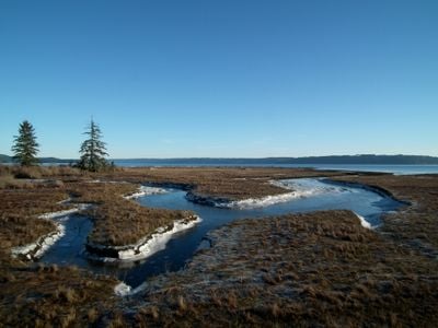
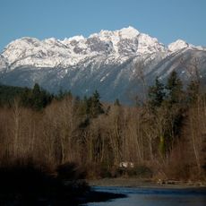
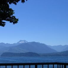
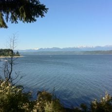
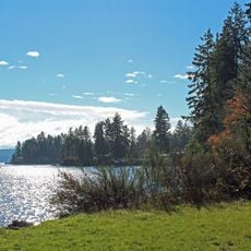
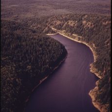
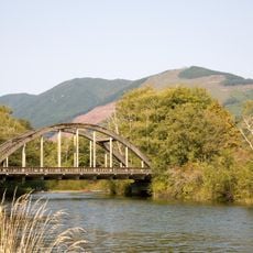
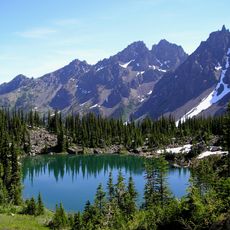
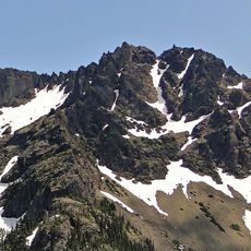
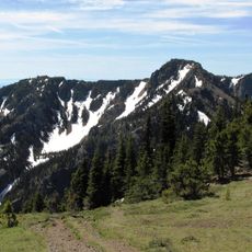
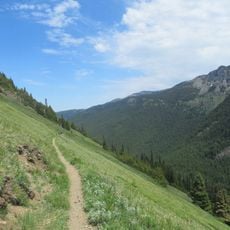
Dosewallips State Park is a Washington state park in Jefferson County, located where the Dosewallips River meets Hood Canal on the Olympic Peninsula. The park covers meadows, forested areas, and campgrounds, with access to both the river and the saltwater shore.

The land was once known as Dose Meadows and was farmed by homesteaders before the state took it over. Old rail beds from logging operations were left behind and can still be spotted in parts of the park.

The name Dosewallips comes from the Twana people, who lived in this region long before it became a park. Walking along the river, visitors can still sense a connection to that history through the land itself.

A Discover Pass is required to enter the park by vehicle, so it is worth getting one before arriving. The park is open year-round, though facilities and seasonal programs are more available in summer.

The park is one of the few places in Washington state where visitors can harvest shellfish on the saltwater shore and fish in a river on the same visit. Having two such different water environments this close together is not common along the Pacific Northwest coast.

The community of curious travelers

AroundUs brings together thousands of curated places, local tips, and hidden gems, enriched daily by 60,000 contributors worldwide.

Start exploring
Location
Operator
Washington State Parks and Recreation Commission
Address
306996 Highway 101, Brinnon, WA 98320
Phone
GPS coordinates
47.68870,-122.90700
Latest update
March 3, 2026 22:40
Around this place
Mount Constance
United States of America

Mount Constance

19 km
Scenic Beach State Park
United States of America

Scenic Beach State Park

6.3 km
Puget Sound Naval Shipyard Historic District
United States of America

Puget Sound Naval Shipyard Historic District

24.8 km
Kitsap Memorial State Park
United States of America

Kitsap Memorial State Park

23.9 km
Buckhorn Wilderness
United States of America

Buckhorn Wilderness

21.3 km
Gold Mountain
United States of America

Gold Mountain

18 km
The Brothers Wilderness
United States of America

The Brothers Wilderness

13.9 km
Triton Cove State Park
United States of America

Triton Cove State Park

10.9 km
Suquamish Museum and Cultural Center
United States of America

Suquamish Museum and Cultural Center

24.4 km
Mount Townsend
United States of America

Mount Townsend

22.9 km
Green Mountain
United States of America

Green Mountain

15.8 km
Norseman Statue
United States of America

Norseman Statue

20 km
Casad Dam
United States of America

Casad Dam

19.3 km
Hospital Reservation Historic District
United States of America

Hospital Reservation Historic District

24.1 km
Naval Undersea Museum
United States of America

Naval Undersea Museum

21.2 km
Duckabush River Bridge
United States of America

Duckabush River Bridge

4.9 km
Warrior Peak
United States of America

Warrior Peak

20 km
Buckhorn Mountain
United States of America

Buckhorn Mountain

22.1 km
United States of America

Mount Lena

23.7 km
United States of America

Mount Bretherton

24 km
United States Post Office-Port Townsend Main
United States of America

United States Post Office-Port Townsend Main

17.2 km
Bremerton Elks Temple Lodge No. 1181 Building
United States of America

Bremerton Elks Temple Lodge No. 1181 Building

25.1 km
Iron Mountain
United States of America

Iron Mountain

21.7 km
Welch Peaks
United States of America

Welch Peaks

21 km
Roxy Theater
United States of America

Roxy Theater

25.1 km
Admiral Theatre
United States of America

Admiral Theatre

25.2 km
Pendergast Park
United States of America

Pendergast Park

22.2 km
Tubal Cain Trail
United States of America

Tubal Cain Trail

23.1 km
Show the full map
Reviews
Share your experience

No review yet

Discussions
Start a discussion...

No discussion yet

« Dosewallips State Park - State park in Jefferson County, US » is provided by Around Us (aroundus.com). Images and texts are derived from Wikimedia project under a Creative Commons license. You are allowed to copy, distribute, and modify copies of this page, under the conditions set by the license, as long as this note is clearly visible.

Discover hidden gems everywhere you go!

From secret cafés to breathtaking viewpoints, skip the crowded tourist spots and find places that match your style. Our app makes it easy with voice search, smart filtering, route optimization, and insider tips from travelers worldwide. Download now for the complete mobile experience.

Around Us App Screenshot

A unique approach to discovering new places

Le Figaro

All the places worth exploring

France Info

A tailor-made excursion in just a few clicks

20 Minutes

Around Us
Travel Guide & Maps
Download

Send to your phone

QR Code
1

Open the camera app on your mobile.

2

Point at the QR code with your camera. A notification will appear.

3

Tap the notification to open the link.