Enable Location

We need your location to show you interesting places around you

Discover nearby places

Find interesting locations and hidden gems around you

Precise directions

Get accurate directions and distances to places

Your location is never shared with other users. It's only used when you tap the location button.

Los Padres National Forest

Log in to your account

Start exploring — it's free

Trusted by 67,494 travelers worldwide

Continue with Google
Continue with Apple
or

We will send you a code to connect

By continuing, you accept our Terms and Conditions and our Privacy Policy

Check your inbox

We've sent a pincode in your inbox. Please enter the code below.

Discussion Reviews 2 Photos
54.5k Popularity

Los Padres National Forest, National forest in Southern and Central California, United States.

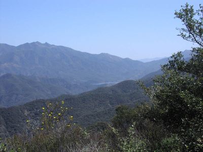
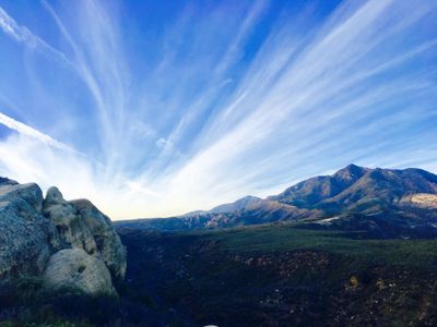
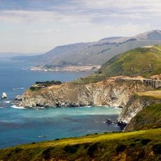
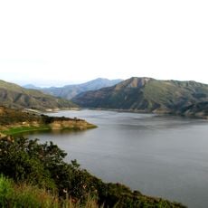
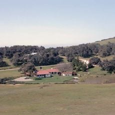
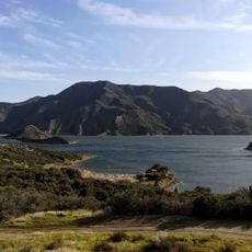
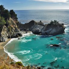
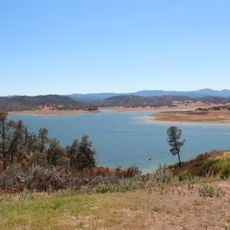
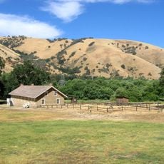
Los Padres National Forest stretches across large parts of Southern and Central California, covering several mountain ranges, deep valleys, and a long Pacific coastline. The landscape shifts from dry chaparral slopes to dense conifer woods, crossed by rivers and streams that wind through steep canyons.

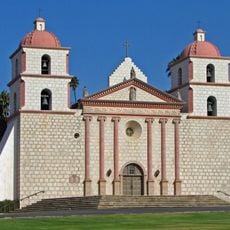
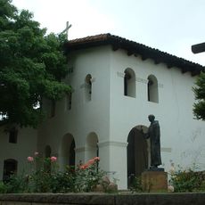
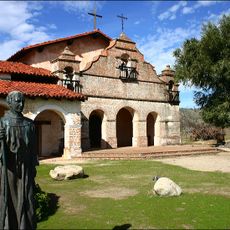
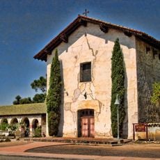
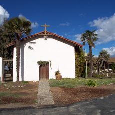
The first protected forest areas were designated in the late 19th century when the federal government began setting aside reserves in the mountains along the coast. The name was officially adopted in 1936 to merge several smaller units under a shared administration and highlight the connection to the Catholic mission history of the region.

The name refers to Spanish Franciscan friars who founded missions along the California coast. Hikers today encounter traces of this era through old paths and place names that recall the early colonial presence.

Visitors should bring plenty of water since many trails lack reliable sources and inland temperatures can climb sharply. During summer and fall, access restrictions often apply because of elevated wildfire risk, so checking current conditions before heading out is worthwhile.

The southern section holds one of the largest populations of wild pigs in North America, descended from domestic hogs that escaped in the early 20th century. These animals shape the ecology of many valleys and are occasionally spotted by visitors rooting through the underbrush.

The community of curious travelers

AroundUs brings together thousands of curated places, local tips, and hidden gems, enriched daily by 60,000 contributors worldwide.

Start exploring
Location
Inception
December 3, 1936
Operator
United States Forest Service
Shares border with
Ojai
GPS coordinates
34.66670,-119.75100
Latest update
December 14, 2025 17:33
Around this place
Show the full map
Reviews
Share your experience

No review yet

Discussions
Start a discussion...

No discussion yet

« Los Padres National Forest - National forest in Southern and Central California, United States » is provided by Around Us (aroundus.com). Images and texts are derived from Wikimedia project under a Creative Commons license. You are allowed to copy, distribute, and modify copies of this page, under the conditions set by the license, as long as this note is clearly visible.

Discover hidden gems everywhere you go!

From secret cafés to breathtaking viewpoints, skip the crowded tourist spots and find places that match your style. Our app makes it easy with voice search, smart filtering, route optimization, and insider tips from travelers worldwide. Download now for the complete mobile experience.

Around Us App Screenshot

A unique approach to discovering new places

Le Figaro

All the places worth exploring

France Info

A tailor-made excursion in just a few clicks

20 Minutes

Around Us
Travel Guide & Maps
Download

Send to your phone

QR Code
1

Open the camera app on your mobile.

2

Point at the QR code with your camera. A notification will appear.

3

Tap the notification to open the link.