Chest opened
+${chestReward.xp} XP
Explorer
NOUVEAU ×${chestReward.collectible.quantity}
tapez pour fermer
Chest locked

Open chests in the app

Around Us is built for your phone — chests unlock when you walk, explore and capture nearby places.

Enable Location

We need your location to show you interesting places around you

Discover nearby places

Find interesting locations and hidden gems around you

Precise directions

Get accurate directions and distances to places

Your location is never shared with other users. It's only used when you tap the location button.

George Air Force Base

Log in to your account

Start exploring — it's free

Trusted by 72,952 travelers worldwide

Continue with Google
Continue with Apple
or

We will send you a code to connect

By continuing, you accept our Terms and Conditions and our Privacy Policy

Check your inbox

We've sent a pincode in your inbox. Please enter the code below.

George Air Force Base
Discussion Reviews 1 Photos
45.4k Popularity

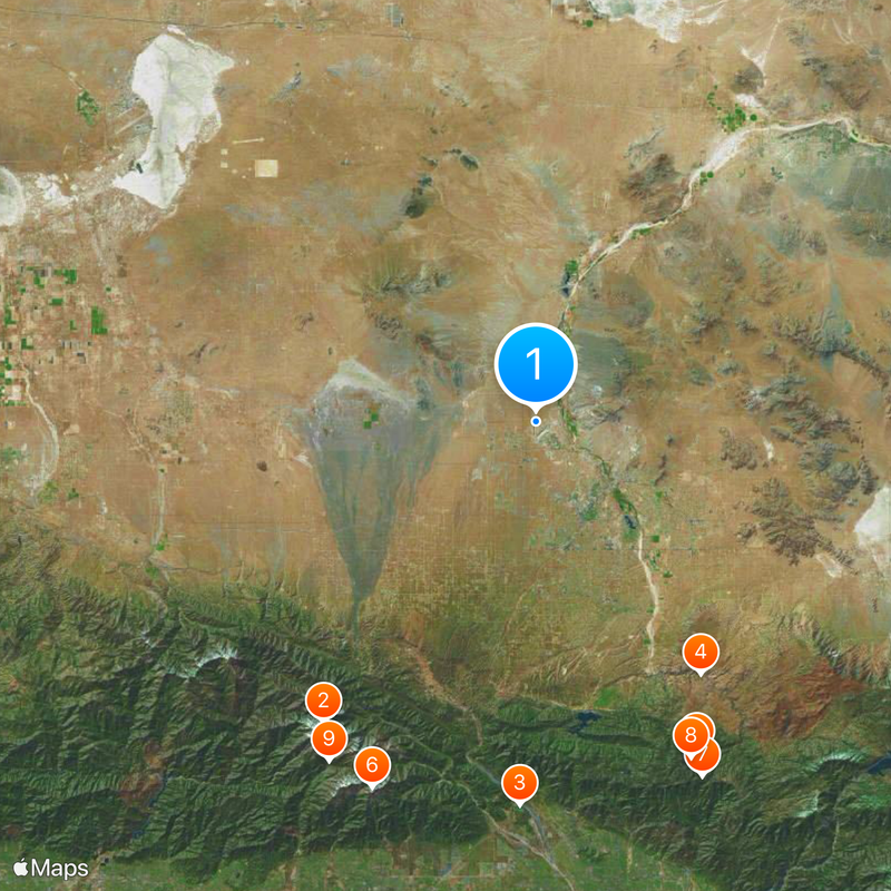
George Air Force Base, Military installation in Victorville, California, United States.

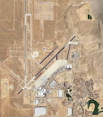
George Air Force Base is a former military installation in the Mojave Desert near Victorville that operated aircraft training and operations for decades. The site now functions as Southern California Logistics Airport, with various aviation companies and technical training facilities spread across the sprawling grounds.

The facility began in 1941 as Victorville Army Airfield, training pilots and bombardiers during World War II for combat operations. After the war, it was transformed into George Air Force Base and served as an active military training and operational center through the Cold War era.

The base employed over 5,000 military and civilian personnel, creating a strong military community that influenced the development of Victorville.

Visitors can explore the grounds and view aircraft operations, with some areas accessible for tours while others require advance permission from facility management. Weekday visits offer better chances to see active aviation work and technical training in progress.

The base was home to advanced aircraft testing and development programs during the Cold War, with some of the earliest jet fighters evaluated and refined on these runways. Walking the grounds today, you can still spot remnants of specialized military hangars designed for experimental aviation work.

The community of curious travelers

AroundUs brings together thousands of curated places, local tips, and hidden gems, enriched daily by 60,000 contributors worldwide.

Start exploring
Location
Inception
1941
Official opening
1941
GPS coordinates
34.59750,-117.38300
Latest update
December 14, 2025 20:14
Around this place
Mount San Antonio
United States of America

Mount San Antonio

42 km
Glen Helen Amphitheater
United States of America

Glen Helen Amphitheater

43.8 km
Deep Creek Hot Springs
United States of America

Deep Creek Hot Springs

34.4 km
Lake Arrowhead Reservoir
United States of America

Lake Arrowhead Reservoir

42 km
Cucamonga Peak
United States of America

Cucamonga Peak

45.7 km
Santa's Village
United States of America

Santa's Village

44.7 km
Lake Arrowhead Village Beach
United States of America

Lake Arrowhead Village Beach

42.2 km
Mount Baldy Zen Center
United States of America

Mount Baldy Zen Center

45.2 km
Mount Baden-Powell
United States of America

Mount Baden-Powell

44 km
Glen Helen Regional Park
United States of America

Glen Helen Regional Park

43.7 km
Antelope Valley Indian Museum State Historic Park
United States of America

Antelope Valley Indian Museum State Historic Park

43.1 km
Saddleback Butte State Park
United States of America

Saddleback Butte State Park

39 km
Table Mountain Observatory
United States of America

Table Mountain Observatory

36.4 km
California Route 66 Museum
United States of America

California Route 66 Museum

10.5 km
Bonita Falls
United States of America

Bonita Falls

42.4 km
Devil Canyon
United States of America

Devil Canyon

44.8 km
Iron Mountain
United States of America

Iron Mountain

45.9 km
Mount Burnham
United States of America

Mount Burnham

45.2 km
Mount Harwood
United States of America

Mount Harwood

41.5 km
Desert Lighthouse
United States of America

Desert Lighthouse

43 km
Telegraph Peak
United States of America

Telegraph Peak

42.3 km
Cajon Pass
United States of America

Cajon Pass

30.5 km
Santa Fe And Salt Lake Trail Monument
United States of America

Santa Fe And Salt Lake Trail Monument

33.3 km
Monument Peak
United States of America

Monument Peak

39.3 km
Mormon Trail Monument
United States of America

Mormon Trail Monument

30.4 km
Arboreto Heaps Peak
United States of America

Arboreto Heaps Peak

46.1 km
Mountain History Museum
United States of America

Mountain History Museum

40.6 km
Tavern Bay Beach
United States of America

Tavern Bay Beach

41.4 km
Show the full map
Reviews
Share your experience

No review yet

Discussions
Start a discussion...

No discussion yet

« George Air Force Base - Military installation in Victorville, California, United States » is provided by Around Us (aroundus.com). Images and texts are derived from Wikimedia project under a Creative Commons license. You are allowed to copy, distribute, and modify copies of this page, under the conditions set by the license, as long as this note is clearly visible.

Discover hidden gems everywhere you go!

From secret cafés to breathtaking viewpoints, skip the crowded tourist spots and find places that match your style. Our app makes it easy with voice search, smart filtering, route optimization, and insider tips from travelers worldwide. Download now for the complete mobile experience.

Around Us App Screenshot

A unique approach to discovering new places

Le Figaro

All the places worth exploring

France Info

A tailor-made excursion in just a few clicks

20 Minutes

Around Us
Travel Guide & Maps
Download

Send to your phone

QR Code
1

Open the camera app on your mobile.

2

Point at the QR code with your camera. A notification will appear.

3

Tap the notification to open the link.