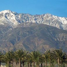
Victorville, city in the Victor Valley in San Bernardino County, California, United States
Location: San Bernardino County
Inception: 1895
Elevation above the sea: 831 m
Shares border with: Oro Grande
Website: http://ci.victorville.ca.us
GPS coordinates: 34.53611,-117.28833
Latest update: March 9, 2025 16:24
Mount San Antonio
42.9 km
Big Bear Lake
43.5 km
Glen Helen Amphitheater
38.4 km
Deep Creek Hot Springs
24.2 km
Lake Arrowhead Reservoir
32.4 km
Cucamonga Peak
44.3 km
Santa's Village
1392.4 km
Big Bear Solar Observatory
45.8 km
Mount Baldy Zen Center
45.3 km
Glen Helen Regional Park
37.9 km
Table Mountain Observatory
40 km
California Route 66 Museum
567 m
Bonita Falls
39.4 km
Devil Canyon
38 km
Ontario Peak
46.1 km
Mount Harwood
42.1 km
Goode Solar Telescope
45.8 km
Telegraph Peak
41.8 km
Cajon Pass
26.7 km
Santa Fe And Salt Lake Trail Monument
30.4 km
Monument Peak
32.9 km
Santos Manuel Student Union
39.6 km
Mormon Trail Monument
30 km
San Bernardino Valley Water Conservation Demonstration Garden
39.4 km
Highland Historic District
46.1 km
Arboreto Heaps Peak
36.2 km
Mountain History Museum
31.4 km
Keller Peak Lookout
43.8 kmReviews
Visited this place? Tap the stars to rate it and share your experience / photos with the community! Try now! You can cancel it anytime.
Discover hidden gems everywhere you go!
From secret cafés to breathtaking viewpoints, skip the crowded tourist spots and find places that match your style. Our app makes it easy with voice search, smart filtering, route optimization, and insider tips from travelers worldwide. Download now for the complete mobile experience.
A unique approach to discovering new places❞
— Le Figaro
All the places worth exploring❞
— France Info
A tailor-made excursion in just a few clicks❞
— 20 Minutes