Chest opened
+${chestReward.xp} XP
Explorer
NOUVEAU ×${chestReward.collectible.quantity}
tapez pour fermer
Chest locked

Open chests in the app

Around Us is built for your phone — chests unlock when you walk, explore and capture nearby places.

Enable Location

We need your location to show you interesting places around you

Discover nearby places

Find interesting locations and hidden gems around you

Precise directions

Get accurate directions and distances to places

Your location is never shared with other users. It's only used when you tap the location button.

Amargosa River

Log in to your account

Start exploring — it's free

Trusted by 72,880 travelers worldwide

Continue with Google
Continue with Apple
or

We will send you a code to connect

By continuing, you accept our Terms and Conditions and our Privacy Policy

Check your inbox

We've sent a pincode in your inbox. Please enter the code below.

Amargosa River
Discussion Reviews 1 Photos
13.6k Popularity

Amargosa River, Seasonal river in Nye County and San Bernardino County, United States

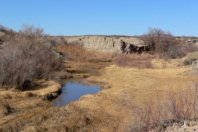
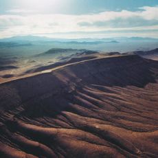
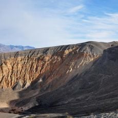
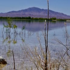
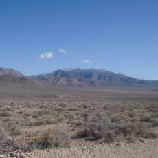
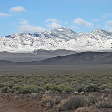
The Amargosa River is a seasonal waterway that flows through Nevada and California, traveling mostly beneath the ground and surfacing only in scattered sections. It winds through desert terrain with visible stretches near Beatty and within the canyon walls of its lower course.

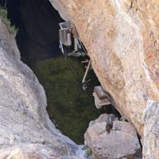
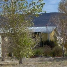
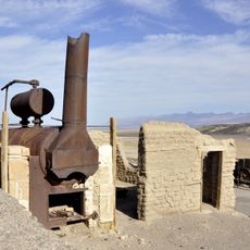
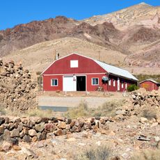
The river served as a vital water source for early miners and settlers pushing into the desert during the 1800s. Its unpredictable surface flow made it both a lifeline and a challenge for those establishing outposts in the region.

Native American tribes utilized the river's intermittent water sources for generations, establishing seasonal settlements along its underground path through the desert.

The easiest viewing points lie near Beatty, Nevada and along the lower canyon in California. Keep in mind that much of the waterway runs underground and surface water varies greatly depending on the season.

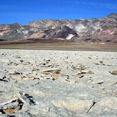
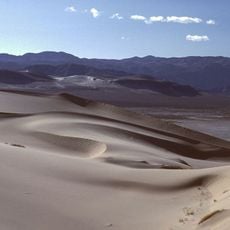
The water flows northward into Death Valley National Park and terminates at one of the lowest points in North America below sea level. This unusual geographical feature makes it one of the desert's most distinctive waterways.

The community of curious travelers

AroundUs brings together thousands of curated places, local tips, and hidden gems, enriched daily by 60,000 contributors worldwide.

Start exploring
Location
Location
GPS coordinates
37.07216,-116.68867
Latest update
December 7, 2025 20:25
Around this place
Death Valley
United States of America

Death Valley

70.3 km
Devils Hole
United States of America

Devils Hole

80.3 km
Sedan Crater
United States of America

Sedan Crater

58.2 km
Scotty's Castle
United States of America

Scotty's Castle

58.2 km
Yucca Mountain
United States of America

Yucca Mountain

25.3 km
Goldfield Hotel
United States of America

Goldfield Hotel

85.7 km
Ubehebe Crater
United States of America

Ubehebe Crater

68 km
Shady Lady Ranch
United States of America

Shady Lady Ranch

35.1 km
Ash Meadows National Wildlife Refuge
United States of America

Ash Meadows National Wildlife Refuge

79.3 km
Harmony Borax Works
United States of America

Harmony Borax Works

67.9 km
Goldwell Open Air Museum
United States of America

Goldwell Open Air Museum

24 km
Cottontail Ranch
United States of America

Cottontail Ranch

64.9 km
Angel's Ladies
United States of America

Angel's Ladies

15.1 km
Skidoo
United States of America

Skidoo

81.8 km
Eureka Dunes
United States of America

Eureka Dunes

87.6 km
Fallon Range Training Complex
United States of America

Fallon Range Training Complex

66.7 km
Esmeralda County Courthouse
United States of America

Esmeralda County Courthouse

85.7 km
Goldfield Historic District
United States of America

Goldfield Historic District

85.7 km
T&T Ranch
United States of America

T&T Ranch

62.2 km
Grapevine Peak
United States of America

Grapevine Peak

42.7 km
Borax Museum
United States of America

Borax Museum

70.3 km
Lower Vine Ranch
United States of America

Lower Vine Ranch

62.4 km
Death Valley Scotty Historic District
United States of America

Death Valley Scotty Historic District

62.4 km
Beatty Museum & Historical Society
United States of America

Beatty Museum & Historical Society

19.6 km
Goldfield Visitor’s Center
United States of America

Goldfield Visitor’s Center

86 km
Furnace Creek Visitor Center
United States of America

Furnace Creek Visitor Center

69.8 km
Old Stovepipe Wells
United States of America

Old Stovepipe Wells

57.7 km
International Car Forest of The Last Church
United States of America

International Car Forest of The Last Church

84.5 km
Show the full map
Reviews
Share your experience

No review yet

Discussions
Start a discussion...

No discussion yet

« Amargosa River - Seasonal river in Nye County and San Bernardino County, United States » is provided by Around Us (aroundus.com). Images and texts are derived from Wikimedia project under a Creative Commons license. You are allowed to copy, distribute, and modify copies of this page, under the conditions set by the license, as long as this note is clearly visible.

Discover hidden gems everywhere you go!

From secret cafés to breathtaking viewpoints, skip the crowded tourist spots and find places that match your style. Our app makes it easy with voice search, smart filtering, route optimization, and insider tips from travelers worldwide. Download now for the complete mobile experience.

Around Us App Screenshot

A unique approach to discovering new places

Le Figaro

All the places worth exploring

France Info

A tailor-made excursion in just a few clicks

20 Minutes

Around Us
Travel Guide & Maps
Download

Send to your phone

QR Code
1

Open the camera app on your mobile.

2

Point at the QR code with your camera. A notification will appear.

3

Tap the notification to open the link.