Enable Location

We need your location to show you interesting places around you

Discover nearby places

Find interesting locations and hidden gems around you

Precise directions

Get accurate directions and distances to places

Your location is never shared with other users. It's only used when you tap the location button.

Bonneville Salt Flats

Log in to your account

Start exploring — it's free

Trusted by 61,518 travelers worldwide

Continue with Google
Continue with Apple
or

We will send you a code to connect

By continuing, you accept our Terms and Conditions and our Privacy Policy

Check your inbox

We've sent a pincode in your inbox. Please enter the code below.

Bonneville Salt Flats

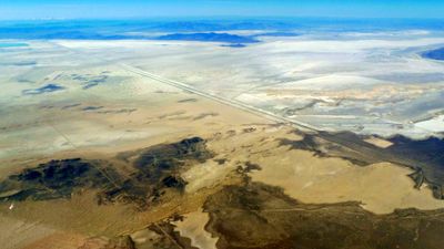
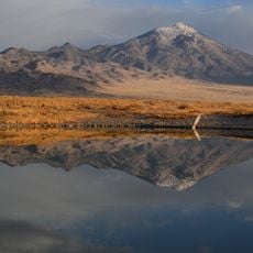
Bonneville Salt Flats, Salt pan in northwestern Utah, United States.

Description

Bonneville Salt Flats is a large salt pan in northwestern Utah that stretches across much of Tooele County. The hard white crust consists of dense salt and forms a nearly level surface that extends to the horizon.

History

The area was once part of a huge lake that covered much of Utah and gradually dried up after the last ice age. Evaporation left behind a thick layer of salt that compacted over thousands of years.

Culture

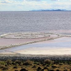
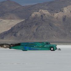
For decades, racing enthusiasts and engineers have gathered here to attempt speed records on the perfectly level surface. The open expanse and clear air allow visitors to watch vehicles approach from great distances.

Practical

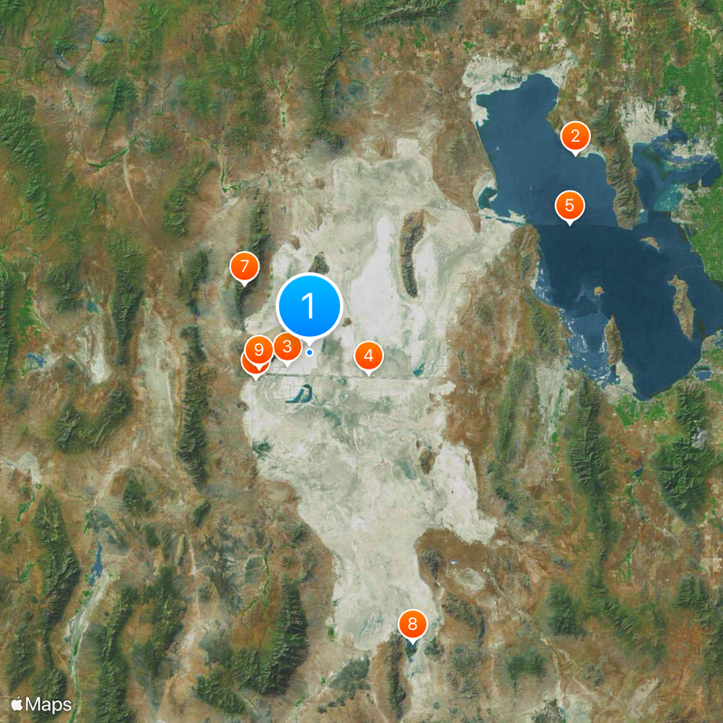
The approach follows Interstate 80, from which an exit leads onto the salt flat. The nearest town with fuel stations and lodging lies to the west in Wendover, which works well for preparation or overnight stays.

Did you know?

The salt layer reaches a thickness of about five feet (1.5 m) at the center and shifts with the seasons due to rain and evaporation. In summer, the surface forms a pattern of polygonal cracks, while in winter it often lies under a thin sheet of water.

Location
Part of
Great Salt Lake Desert
GPS coordinates
40.79970,-113.80000
Latest update
December 12, 2025 16:52

AroundUs brings together thousands of curated places, local tips, and hidden gems, enriched daily by 60,000 contributors worldwide. Discover all places nearby (Tooele County).

Natural monuments in Utah: archaeological sites, rock formations, thermal springs

Utah preserves thousands of years of human history alongside some of North America's most varied geological landscapes. The region contains extensive rock art panels and Ancestral Pueblo ruins, including the 13th-century stone structures at Bears Ears National Monument and the 650-plus petroglyphs...

Around this place
Spiral Jetty
United States of America

Spiral Jetty

118.5 km
Bonneville Speedway
United States of America

Bonneville Speedway

9.1 km
Metaphor: The Tree of Utah
United States of America

Metaphor: The Tree of Utah

22.2 km
Lucin Cutoff
United States of America

Lucin Cutoff

103.8 km
Wendover Air Force Base
United States of America

Wendover Air Force Base

21.5 km
Pilot Peak
United States of America

Pilot Peak

34 km
Fish Springs National Wildlife Refuge
United States of America

Fish Springs National Wildlife Refuge

110.9 km
Danger Cave
United States of America

Danger Cave

19 km
Deseret Peak
United States of America

Deseret Peak

106.1 km
Hogup Cave
United States of America

Hogup Cave

95.3 km
Cedar Mountain Wilderness
United States of America

Cedar Mountain Wilderness

75.4 km
Deseret Peak Wilderness
United States of America

Deseret Peak Wilderness

97.5 km
Sun Tunnels
United States of America

Sun Tunnels

56.3 km
Benson Grist Mill
United States of America

Benson Grist Mill

127.9 km
Goshute Canyon Wilderness
United States of America

Goshute Canyon Wilderness

124.9 km
Lincoln Highway Bridge
United States of America

Lincoln Highway Bridge

101.1 km
Thomas N. Taylor House
United States of America

Thomas N. Taylor House

95.8 km
Stockton Jail
United States of America

Stockton Jail

127.4 km
A. N. Tanner House
United States of America

A. N. Tanner House

100.8 km
Hilda Erickson House
United States of America

Hilda Erickson House

114.3 km
Alex and Mary Alice Johnson House
United States of America

Alex and Mary Alice Johnson House

115 km
James and Penninah Wrathall House
United States of America

James and Penninah Wrathall House

114.5 km
Maverick Canyon
United States of America

Maverick Canyon

73.9 km
Grantsville First Ward Meetinghouse
United States of America

Grantsville First Ward Meetinghouse

114.1 km
Grantsville School and Meetinghouse
United States of America

Grantsville School and Meetinghouse

114.1 km
John T. Rich House
United States of America

John T. Rich House

114.2 km
Johnson Hall-Deseret Mercantile Building
United States of America

Johnson Hall-Deseret Mercantile Building

114.9 km
David E. Davis House
United States of America

David E. Davis House

126.3 km
Show the full map
« Bonneville Salt Flats - Salt pan in northwestern Utah, United States » is provided by Around Us (aroundus.com). Images and texts are derived from Wikimedia project under a Creative Commons license. You are allowed to copy, distribute, and modify copies of this page, under the conditions set by the license, as long as this note is clearly visible.

Discover hidden gems everywhere you go!

From secret cafés to breathtaking viewpoints, skip the crowded tourist spots and find places that match your style. Our app makes it easy with voice search, smart filtering, route optimization, and insider tips from travelers worldwide. Download now for the complete mobile experience.

Around Us App Screenshot

A unique approach to discovering new places

Le Figaro

All the places worth exploring

France Info

A tailor-made excursion in just a few clicks

20 Minutes

Around Us
Travel Guide & Maps
Download

Send to your phone

QR Code
1

Open the camera app on your mobile.

2

Point at the QR code with your camera. A notification will appear.

3

Tap the notification to open the link.