Enable Location

We need your location to show you interesting places around you

Discover nearby places

Find interesting locations and hidden gems around you

Precise directions

Get accurate directions and distances to places

Your location is never shared with other users. It's only used when you tap the location button.

High Desert

Log in to your account

Start exploring — it's free

Trusted by 68,083 travelers worldwide

Continue with Google
Continue with Apple
or

We will send you a code to connect

By continuing, you accept our Terms and Conditions and our Privacy Policy

Check your inbox

We've sent a pincode in your inbox. Please enter the code below.

High Desert
Discussion Reviews 1 Photos
43.4k Popularity

High Desert, Geographic region in eastern Oregon, United States.

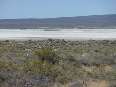
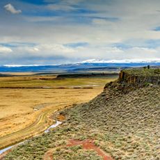
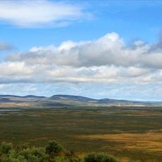
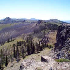
The High Desert is a plateau east of the Cascade Range marked by volcanic rock formations and elevated terrain. The landscape shows layers of lava, cinders, and basalt across an expansive area.

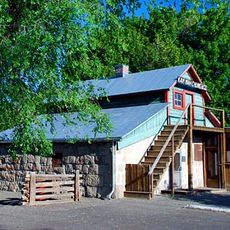
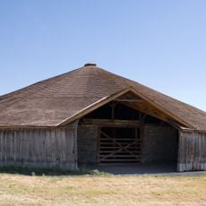
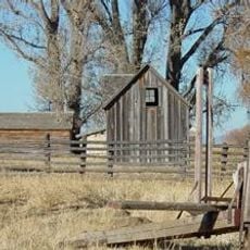
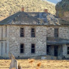
Human communities have inhabited this region for many thousands of years, leaving behind tools and objects embedded in the ground. Archaeological finds show how early people adapted to life in this arid landscape.

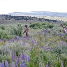
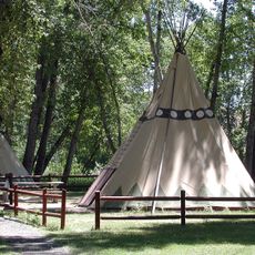
The Northern Paiute people shaped this land over thousands of years through hunting and gathering practices suited to dry conditions. Today, visitors can see how communities adapted to scarce water and extreme seasons.

This region experiences severe temperature swings between seasons, with very hot summers and freezing winters. Visitors should prepare for high elevation, dry air, and limited water availability throughout.

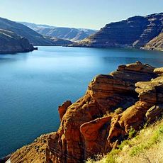
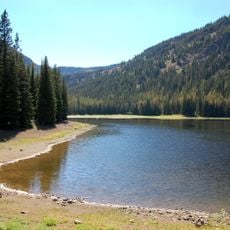
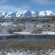
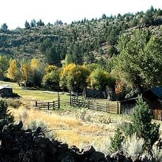
The region contains several rivers protected for their natural values that flow through volcanic terrain and create water corridors. These unexpected waterways contrast sharply with the surrounding dryness.

The community of curious travelers

AroundUs brings together thousands of curated places, local tips, and hidden gems, enriched daily by 60,000 contributors worldwide.

Start exploring
Location
GPS coordinates
43.31605,-118.78418
Latest update
March 5, 2026 18:15
Around this place
Malheur National Wildlife Refuge
United States of America

Malheur National Wildlife Refuge

7.4 km
Harney Basin
United States of America

Harney Basin

8.9 km
Kam Wah Chung Company Building
United States of America

Kam Wah Chung Company Building

123.5 km
Owyhee Reservoir
United States of America

Owyhee Reservoir

118.1 km
Hart Mountain National Antelope Refuge
United States of America

Hart Mountain National Antelope Refuge

111.1 km
Steens Mountain Wilderness
United States of America

Steens Mountain Wilderness

72.3 km
Strawberry Mountain Wilderness
United States of America

Strawberry Mountain Wilderness

109.8 km
Pete French Round Barn
United States of America

Pete French Round Barn

23.4 km
Mickey Hot Springs
United States of America

Mickey Hot Springs

79.6 km
Sod House Ranch
United States of America

Sod House Ranch

9.8 km
Frenchglen Hotel State Heritage Site
United States of America

Frenchglen Hotel State Heritage Site

55.4 km
P Ranch
United States of America

P Ranch

55 km
Camp Warner
United States of America

Camp Warner

125.2 km
Monument Rock Wilderness
United States of America

Monument Rock Wilderness

117.3 km
Riddle Ranch
United States of America

Riddle Ranch

31.6 km
Clyde Holliday State Recreation Site
United States of America

Clyde Holliday State Recreation Site

124.9 km
Double-O Ranch Historic District
United States of America

Double-O Ranch Historic District

42.8 km
Chickahominy Reservoir
United States of America

Chickahominy Reservoir

71.7 km
Moses and Mary Hart Stone House and Ranch Complex
United States of America

Moses and Mary Hart Stone House and Ranch Complex

113.1 km
Advent Christian Church
United States of America

Advent Christian Church

123.3 km
Allison Ranger Station
United States of America

Allison Ranger Station

93.5 km
St. Thomas' Episcopal Church
United States of America

St. Thomas' Episcopal Church

119.8 km
Sheep Ranch Fortified House
United States of America

Sheep Ranch Fortified House

109.9 km
Supervisor's House No. 1001
United States of America

Supervisor's House No. 1001

123.2 km
John Day Compound
United States of America

John Day Compound

123.5 km
Kam Wah Chung State Heritage Site
United States of America

Kam Wah Chung State Heritage Site

123.5 km
Desert Theatre
United States of America

Desert Theatre

37.2 km
Kam Wah Chung Chinese Heritage Site
United States of America

Kam Wah Chung Chinese Heritage Site

123.4 km
Show the full map
Reviews
Share your experience

No review yet

Discussions
Start a discussion...

No discussion yet

« High Desert - Geographic region in eastern Oregon, United States » is provided by Around Us (aroundus.com). Images and texts are derived from Wikimedia project under a Creative Commons license. You are allowed to copy, distribute, and modify copies of this page, under the conditions set by the license, as long as this note is clearly visible.

Discover hidden gems everywhere you go!

From secret cafés to breathtaking viewpoints, skip the crowded tourist spots and find places that match your style. Our app makes it easy with voice search, smart filtering, route optimization, and insider tips from travelers worldwide. Download now for the complete mobile experience.

Around Us App Screenshot

A unique approach to discovering new places

Le Figaro

All the places worth exploring

France Info

A tailor-made excursion in just a few clicks

20 Minutes

Around Us
Travel Guide & Maps
Download

Send to your phone

QR Code
1

Open the camera app on your mobile.

2

Point at the QR code with your camera. A notification will appear.

3

Tap the notification to open the link.