Dyer State Wayside

Log in to your account

AroundUs is a community-driven map of interesting places, built by curious explorers like you. It grows with every review, story, and photo you share.
Connect to save your favorite spots, contribute locations, and create personalized routes.
Continue with Google
Continue with Apple
Continue with X
Continue with Facebook
Continue with email
By continuing, you accept our Terms and Conditions and our Privacy Policy
Create an account
Add to collection
Map
Suggest a change
Share

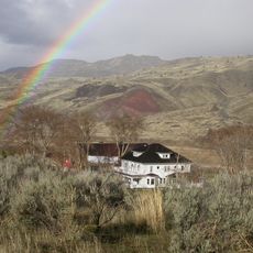
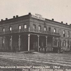
Dyer State Wayside, State park in Gilliam County, United States.

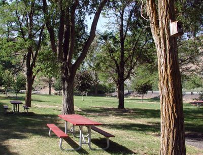
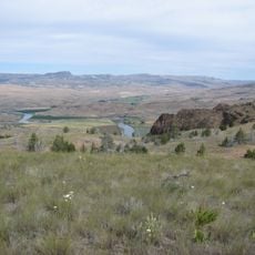
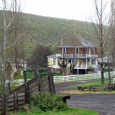
Dyer State Wayside is a small roadside park set within a narrow canyon along a branch of Thirty Mile Creek. The space features grassy grounds, locust trees, and basic facilities positioned to serve passersby.

J.W. Dyer donated this land to Oregon State in 1931 to create a rest stop along Route 19. Later, local volunteers undertook major renovations in 1997 to improve the facilities.

The Dyer Partners volunteer group transformed this park in 1997 through extensive renovations, demonstrating local community dedication to public spaces.

This spot sits about 10 miles south of Condon along Route 19 and offers picnic tables, restrooms, and parking. It works well as a brief stop during road trips.

At just 0,6 acres, this park ranks among Oregon's six smallest state parks. Its narrow canyon setting gives it character despite its tiny footprint.

Location: Gilliam County

GPS coordinates: 45.12444,-120.18694

Latest update: December 13, 2025 17:04

Photos
Around this place
Maryhill Stonehenge
United States of America

Maryhill Stonehenge

79.8 km
Painted Hills
United States of America

Painted Hills

52 km
John Day Dam
United States of America

John Day Dam

76.9 km
White River Falls State Park
United States of America

White River Falls State Park

72.5 km
Cottonwood Canyon State Park
United States of America

Cottonwood Canyon State Park

45.3 km
Sam Hill Memorial Bridge
United States of America

Sam Hill Memorial Bridge

79.6 km
Maryhill State Park
United States of America

Maryhill State Park

79.8 km
Deschutes River State Recreation Area
United States of America

Deschutes River State Recreation Area

80 km
Bridge Creek Wilderness
United States of America

Bridge Creek Wilderness

72.4 km
James Cant Ranch
United States of America

James Cant Ranch

76.4 km
Mill Creek Wilderness
United States of America

Mill Creek Wilderness

76.8 km
Charles E. Nelson House
United States of America

Charles E. Nelson House

80.3 km
Spring Basin Wilderness
United States of America

Spring Basin Wilderness

30.1 km
United States of America

Boxcar Rapids

72.5 km
Shaniko Hotel
United States of America

Shaniko Hotel

46.5 km
Imperial Stock Ranch Headquarters Complex
United States of America

Imperial Stock Ranch Headquarters Complex

47.4 km
Maupin Section Foreman's House
United States of America

Maupin Section Foreman's House

70.6 km
John and Helen Moore House
United States of America

John and Helen Moore House

57 km
Thomas Benton Hoover House
United States of America

Thomas Benton Hoover House

14.1 km
Morrow County Courthouse
United States of America

Morrow County Courthouse

56.1 km
First Day Advent Christian Church
United States of America

First Day Advent Christian Church

79.5 km
S. B. Barker Building
United States of America

S. B. Barker Building

12.2 km
Fossil Public School
United States of America

Fossil Public School

14 km
Silas A. Rice Log House
United States of America

Silas A. Rice Log House

13 km
Heppner Library-Museum
United States of America

Heppner Library-Museum

56 km
Thomas Condon Paleontology Center
United States of America

Thomas Condon Paleontology Center

76.6 km
Sherman County Courthouse
United States of America

Sherman County Courthouse

53.1 km
Shaniko Historic District
United States of America

Shaniko Historic District

46.4 km
Show the full map
Reviews

Visited this place? Tap the stars to rate it and share your experience / photos with the community! Try now! You can cancel it anytime.

« Dyer State Wayside - State park in Gilliam County, United States » is provided by Around Us (aroundus.com). Images and texts are derived from Wikimedia project under a Creative Commons license. You are allowed to copy, distribute, and modify copies of this page, under the conditions set by the license, as long as this note is clearly visible.

Discover hidden gems everywhere you go!

From secret cafés to breathtaking viewpoints, skip the crowded tourist spots and find places that match your style. Our app makes it easy with voice search, smart filtering, route optimization, and insider tips from travelers worldwide. Download now for the complete mobile experience.

Around Us App Screenshot

A unique approach to discovering new places

Le Figaro

All the places worth exploring

France Info

A tailor-made excursion in just a few clicks

20 Minutes