Enable Location

We need your location to show you interesting places around you

Discover nearby places

Find interesting locations and hidden gems around you

Precise directions

Get accurate directions and distances to places

Your location is never shared with other users. It's only used when you tap the location button.

Walla Walla County

Log in to your account

Start exploring — it's free

Trusted by 62,895 travelers worldwide

Continue with Google
Continue with Apple
or

We will send you a code to connect

By continuing, you accept our Terms and Conditions and our Privacy Policy

Check your inbox

We've sent a pincode in your inbox. Please enter the code below.

Discussion Reviews 1 Photos
21.8k Popularity

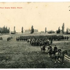
Walla Walla County, Administrative county in southeastern Washington, United States

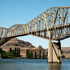
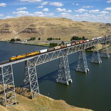
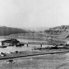
Walla Walla County is an administrative county in southeastern Washington featuring rivers and mountain ranges. The Columbia River and Snake River flow through varied terrain shaped by the Blue Mountains.

The county was established in 1854 during the period of western expansion across the region. Its creation reflected the growing settlement of European colonists in what had long been indigenous territory.

The name comes from the Walla Walla people who lived here for generations before settlers arrived in the region. This indigenous heritage shapes how the community understands its place and connection to the land.

The county manages road maintenance, infrastructure projects, and emergency services across the region. Visitors should prepare for changing road conditions, especially during winter weather and severe storms.

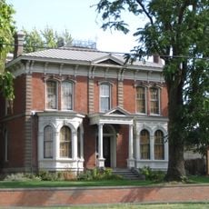
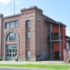
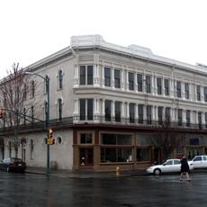
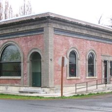
The area contains one of the smallest metropolitan areas in the United States, centered on the county seat of Walla Walla. This unusual status offers insight into settlement patterns and community size in the Pacific Northwest.

The community of curious travelers

AroundUs brings together thousands of curated places, local tips, and hidden gems, enriched daily by 60,000 contributors worldwide.

Start exploring
Location
Inception
1854
Capital city
Walla Walla
Shares border with
Columbia County, Umatilla County, Benton County, Franklin County
GPS coordinates
46.23000,-118.48000
Latest update
December 23, 2025 02:43
Around this place
Wallula Gap
United States of America

Wallula Gap

41.5 km
Fort Walla Walla
United States of America

Fort Walla Walla

22.4 km
Ice Harbor Dam
United States of America

Ice Harbor Dam

30.9 km
Fort Nez Percés
United States of America

Fort Nez Percés

36.8 km
Touchet Formation
United States of America

Touchet Formation

27 km
Little Goose Dam
United States of America

Little Goose Dam

52.9 km
Juniper Dunes Wilderness
United States of America

Juniper Dunes Wilderness

34.1 km
Lower Monumental Dam
United States of America

Lower Monumental Dam

37.3 km
United States of America

McNary National Wildlife Refuge

36.8 km
Snake River Bridge
United States of America

Snake River Bridge

44.8 km
Borleske Stadium
United States of America

Borleske Stadium

20.3 km
United States of America

Lewis & Clark Trail State Park

32.1 km
United States of America

Lake Sacajawea

30.8 km
United States of America

Soaring Stones

21.1 km
United States of America

Lake Herbert G. West

37.3 km
Joso High Bridge
United States of America

Joso High Bridge

44.9 km
Kirkman House
United States of America

Kirkman House

20.8 km
Riparia Bridge
United States of America

Riparia Bridge

48.7 km
Electric Light Works Building
United States of America

Electric Light Works Building

21 km
Dacres Hotel
United States of America

Dacres Hotel

21.2 km
United States of America

Mid-Columbia River National Wildlife Refuge Complex

39.7 km
Bank of Starbuck
United States of America

Bank of Starbuck

42.2 km
Preston Hall
United States of America

Preston Hall

25.5 km
United States of America

Fort Walla Walla Military Cemetery

22.2 km
Children's Museum of Walla Walla
United States of America

Children's Museum of Walla Walla

21.6 km
Liberty Theatre
United States of America

Liberty Theatre

21.2 km
United States of America

Wallula State Park

37.5 km
United States of America

Madame Dorion Memorial Park

37.8 km
Show the full map
Administrative divisions
« Walla Walla County - Administrative county in southeastern Washington, United States » is provided by Around Us (aroundus.com). Images and texts are derived from Wikimedia project under a Creative Commons license. You are allowed to copy, distribute, and modify copies of this page, under the conditions set by the license, as long as this note is clearly visible.

Discover hidden gems everywhere you go!

From secret cafés to breathtaking viewpoints, skip the crowded tourist spots and find places that match your style. Our app makes it easy with voice search, smart filtering, route optimization, and insider tips from travelers worldwide. Download now for the complete mobile experience.

Around Us App Screenshot

A unique approach to discovering new places

Le Figaro

All the places worth exploring

France Info

A tailor-made excursion in just a few clicks

20 Minutes

Around Us
Travel Guide & Maps
Download

Send to your phone

QR Code
1

Open the camera app on your mobile.

2

Point at the QR code with your camera. A notification will appear.

3

Tap the notification to open the link.