Log in to your account

AroundUs is a community-driven map of interesting places, built by curious explorers like you. It grows with every review, story, and photo you share.
Connect to save your favorite spots, contribute locations, and create personalized routes.
Continue with Google
Continue with Apple
Continue with X
Continue with Facebook
Continue with email
By continuing, you accept our Terms and Conditions and our Privacy Policy
Create an account

Lewis & Clark Trail State Park

Add to collection
Map
Suggest a change
Share

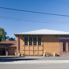
Lewis & Clark Trail State Park, State park in Columbia County, United States.

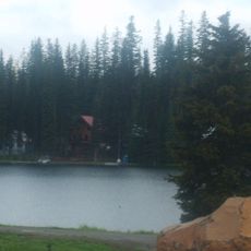
Lewis & Clark Trail State Park is a forested preserve along the Touchet River with mature woodland and direct access to the riverbank. The grounds offer camping facilities, kitchen shelters with electricity, and fire pits for day visits and overnight stays.

The park was established by the Washington State Parks and Recreation Commission to protect the natural landscape along this important historic waterway. This area served as a key passage for early explorers and travelers crossing the region.

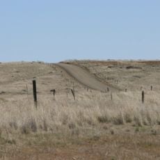
The park sits along the historic route traveled by the Lewis and Clark Expedition, with interpretive signs showing the importance of this passage for early regional exploration. Visitors can connect to the region's past through the natural landscape that travelers once saw centuries ago.

The park welcomes visitors from spring through fall, with basic amenities including restrooms and designated fire pits throughout the grounds. Winter closures run from November through March to protect the landscape.

The woodland contains an uncommon mix of ponderosa pine, alder, maple, and cottonwood trees that form a green canopy contrasting sharply with the dry grasslands surrounding it. This varied plant community thrives because of the river's moisture in what would otherwise be an arid region.

Location: Columbia County

Address: 36149 Highway 12, Dayton WA 99328-9500

Website: https://parks.wa.gov/539/Lewis-Clark-Trail

GPS coordinates: 46.28820,-118.07200

Latest update: December 13, 2025 12:20

Photos
Around this place
Palouse Falls
United States of America

Palouse Falls

43.4 km
Mullan Road
United States of America

Mullan Road

54.5 km
Marmes Rockshelter
United States of America

Marmes Rockshelter

37.7 km
Fort Walla Walla
United States of America

Fort Walla Walla

34.7 km
Palouse Falls State Park
United States of America

Palouse Falls State Park

43.7 km
Columbia Plateau State Park Trail
United States of America

Columbia Plateau State Park Trail

54.3 km
Touchet Formation
United States of America

Touchet Formation

55.1 km
Little Goose Dam
United States of America

Little Goose Dam

33.5 km
Juniper Dunes Wilderness
United States of America

Juniper Dunes Wilderness

61.3 km
Wenaha–Tucannon Wilderness
United States of America

Wenaha–Tucannon Wilderness

43.9 km
Lower Monumental Dam
United States of America

Lower Monumental Dam

47 km
Jubilee Lake
United States of America

Jubilee Lake

51.6 km
Snake River Bridge
United States of America

Snake River Bridge

35.4 km
Borleske Stadium
United States of America

Borleske Stadium

31.1 km
Wenaha Wildlife Area
United States of America

Wenaha Wildlife Area

60.2 km
Lewis and Clark Trail-Travois Road
United States of America

Lewis and Clark Trail-Travois Road

49.5 km
Joso High Bridge
United States of America

Joso High Bridge

36.1 km
Kirkman House
United States of America

Kirkman House

31.9 km
Riparia Bridge
United States of America

Riparia Bridge

31.9 km
Electric Light Works Building
United States of America

Electric Light Works Building

32.5 km
Langdon Lake
United States of America

Langdon Lake

56.8 km
Garfield County Courthouse
United States of America

Garfield County Courthouse

41.7 km
Bank of Starbuck
United States of America

Bank of Starbuck

26.1 km
Preston Hall
United States of America

Preston Hall

6.7 km
Lyons Ferry State Park
United States of America

Lyons Ferry State Park

39 km
Hoodoo Ridge Lookout
United States of America

Hoodoo Ridge Lookout

52 km
Walla Walla Valley Traction Company Car Barn
United States of America

Walla Walla Valley Traction Company Car Barn

32.9 km
Children's Museum of Walla Walla
United States of America

Children's Museum of Walla Walla

34.1 km
Show the full map
Reviews

Visited this place? Tap the stars to rate it and share your experience / photos with the community! Try now! You can cancel it anytime.

« Lewis & Clark Trail State Park - State park in Columbia County, United States » is provided by Around Us (aroundus.com). Images and texts are derived from Wikimedia project under a Creative Commons license. You are allowed to copy, distribute, and modify copies of this page, under the conditions set by the license, as long as this note is clearly visible.

Discover hidden gems everywhere you go!

From secret cafés to breathtaking viewpoints, skip the crowded tourist spots and find places that match your style. Our app makes it easy with voice search, smart filtering, route optimization, and insider tips from travelers worldwide. Download now for the complete mobile experience.

Around Us App Screenshot

A unique approach to discovering new places

Le Figaro

All the places worth exploring

France Info

A tailor-made excursion in just a few clicks

20 Minutes