Enable Location

We need your location to show you interesting places around you

Discover nearby places

Find interesting locations and hidden gems around you

Precise directions

Get accurate directions and distances to places

Your location is never shared with other users. It's only used when you tap the location button.

Mackay Reservoir

Log in to your account

Start exploring — it's free

Trusted by 62,324 travelers worldwide

Continue with Google
Continue with Apple
or

We will send you a code to connect

By continuing, you accept our Terms and Conditions and our Privacy Policy

Check your inbox

We've sent a pincode in your inbox. Please enter the code below.

Mackay Reservoir

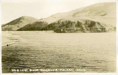
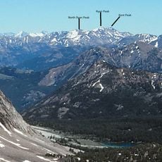
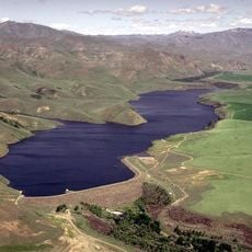
Mackay Reservoir, reservoir on the Big Lost River in Custer County, Idaho, United States

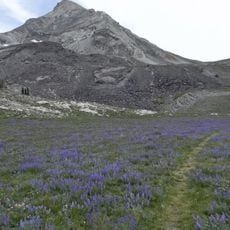
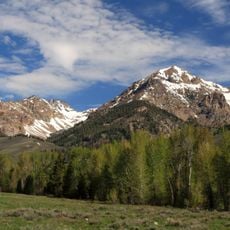
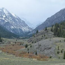
Mackay Reservoir is a large body of water in Idaho's high desert, created by a dam built in 1918 on the Big Lost River and stretching across more than 1,300 acres. The water sits surrounded by mountains, with calm surfaces that attract both shore and boat fishing, and the landscape features open terrain with recreation access points along the shoreline.

The dam was constructed in 1918 to support irrigation in the valley and stands about 67 feet tall. Mackay purchased the facility in 1936, after which it became central to local identity and has withstood significant challenges including a major earthquake in 1983 that tested its structural integrity.

Mackay Reservoir is a gathering place where fishing is the main draw for both locals and visitors seeking to spend time outdoors. The simple rhythm of casting lines and watching the water connects people to the landscape and to each other in a quiet, unhurried way.

The reservoir is about 5 miles north of Mackay town, easily accessible from Highway 93 without a long drive. Visitors can fish from shore or bring boats, access restrooms and designated recreation areas, and should bring proper safety gear and warm clothing for winter ice fishing when conditions allow.

The reservoir comes alive on Independence Day when the towns of Mackay and Arco host a fireworks display that lights up the night sky above the water. This shared community tradition draws locals and visitors together to celebrate in a place normally known for quiet reflection.

The community of curious travelers

AroundUs brings together thousands of curated places, local tips, and hidden gems, enriched daily by 60,000 contributors worldwide.

Start exploring
Location
GPS coordinates
43.95310,-113.67400
Latest update
February 9, 2026 08:21
Around this place
Craters of the Moon National Monument and Preserve
United States of America

Craters of the Moon National Monument and Preserve

55.4 km
Borah Peak
United States of America

Borah Peak

22.2 km
Bald Mountain
United States of America

Bald Mountain

67.8 km
Hyndman Peak
United States of America

Hyndman Peak

43.1 km
Birch Creek Charcoal Kilns
United States of America

Birch Creek Charcoal Kilns

56.1 km
Hemingway–Boulders Wilderness
United States of America

Hemingway–Boulders Wilderness

65.2 km
Jim McClure–Jerry Peak Wilderness
United States of America

Jim McClure–Jerry Peak Wilderness

52 km
Ryan Peak
United States of America

Ryan Peak

59.2 km
Sawtooth Botanical Garden
United States of America

Sawtooth Botanical Garden

65.2 km
USGS Peak
United States of America

USGS Peak

10 km
Gimlet Pegram Truss Railroad Bridge
United States of America

Gimlet Pegram Truss Railroad Bridge

66.9 km
Mount Breitenbach
United States of America

Mount Breitenbach

12.5 km
Standhope Peak
United States of America

Standhope Peak

33.8 km
Kent Peak
United States of America

Kent Peak

59 km
Cobb Peak
United States of America

Cobb Peak

43.9 km
Donaldson Peak
United States of America

Donaldson Peak

12.5 km
Old Hyndman Peak
United States of America

Old Hyndman Peak

42.7 km
Cold Springs Pegram Truss Railroad Bridge
United States of America

Cold Springs Pegram Truss Railroad Bridge

63.6 km
Glassford Peak
United States of America

Glassford Peak

64.9 km
United States of America

Mackay Methodist Episcopal Church

6.8 km
Eben S. and Elizabeth S. Chase House
United States of America

Eben S. and Elizabeth S. Chase House

70.2 km
Fox–Worswick House
United States of America

Fox–Worswick House

70.4 km
Roundhouse Gondola
United States of America

Roundhouse Gondola

65 km
Craters of the Moon National Monument Mission 66 Historic District
United States of America

Craters of the Moon National Monument Mission 66 Historic District

55.4 km
Bigwood Golf Course
United States of America

Bigwood Golf Course

62.6 km
Little Wood River Reservoir
United States of America

Little Wood River Reservoir

63.9 km
Craters of the Moon
United States of America

Craters of the Moon

61 km
Robert Limbert Visitor Center
United States of America

Robert Limbert Visitor Center

55.4 km
Show the full map
« Mackay Reservoir - reservoir on the Big Lost River in Custer County, Idaho, United States » is provided by Around Us (aroundus.com). Images and texts are derived from Wikimedia project under a Creative Commons license. You are allowed to copy, distribute, and modify copies of this page, under the conditions set by the license, as long as this note is clearly visible.

Discover hidden gems everywhere you go!

From secret cafés to breathtaking viewpoints, skip the crowded tourist spots and find places that match your style. Our app makes it easy with voice search, smart filtering, route optimization, and insider tips from travelers worldwide. Download now for the complete mobile experience.

Around Us App Screenshot

A unique approach to discovering new places

Le Figaro

All the places worth exploring

France Info

A tailor-made excursion in just a few clicks

20 Minutes

Around Us
Travel Guide & Maps
Download

Send to your phone

QR Code
1

Open the camera app on your mobile.

2

Point at the QR code with your camera. A notification will appear.

3

Tap the notification to open the link.