Chest opened
+${chestReward.xp} XP
Explorer
NOUVEAU ×${chestReward.collectible.quantity}
tapez pour fermer
Chest locked

Open chests in the app

Around Us is built for your phone — chests unlock when you walk, explore and capture nearby places.

Enable Location

We need your location to show you interesting places around you

Discover nearby places

Find interesting locations and hidden gems around you

Precise directions

Get accurate directions and distances to places

Your location is never shared with other users. It's only used when you tap the location button.

Cabinet Mountains

Log in to your account

Start exploring — it's free

Trusted by 72,890 travelers worldwide

Continue with Google
Continue with Apple
or

We will send you a code to connect

By continuing, you accept our Terms and Conditions and our Privacy Policy

Check your inbox

We've sent a pincode in your inbox. Please enter the code below.

Cabinet Mountains
Discussion Reviews 1 Photos
9.3k Popularity

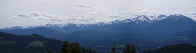
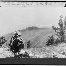
Cabinet Mountains, Mountain range in northwestern Montana and northern Idaho, United States.

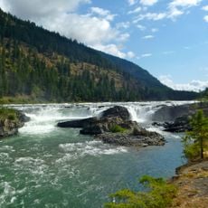
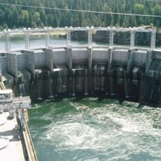
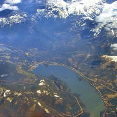
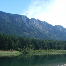
The Cabinet Mountains form a continuous ridge system spanning northwestern Montana and northern Idaho with numerous peaks that rise well above the surrounding landscape. This range is bordered by two major rivers and features a mix of forested slopes and exposed rocky ridges.

The name came from early trappers who observed rock formations that resembled storage containers. This simple observation during the fur trade era became the label for the entire mountain range.

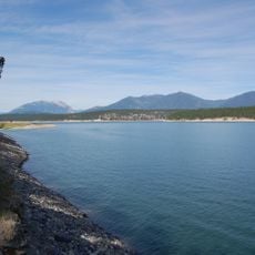
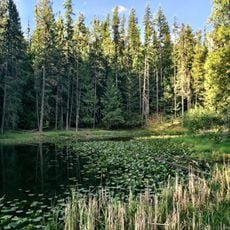
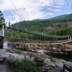
The name comes from French trappers who saw resemblances to storage boxes in the rock walls. Today people move through the area mostly on foot, using the many lakes and streams for recreation.

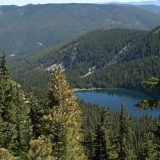
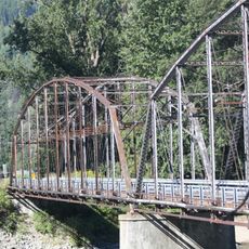
Access is best on foot via trails that crisscross the entire range and connect major lakes and river valleys. Most visitors can find routes suited to their fitness level without needing special permits or technical gear.

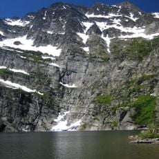
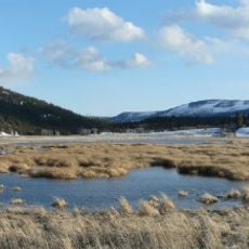
The highest peak contains water sources that feed mountain streams from its very base. This dramatic elevation change means that hikers can pass through multiple vegetation types in a short distance.

The community of curious travelers

AroundUs brings together thousands of curated places, local tips, and hidden gems, enriched daily by 60,000 contributors worldwide.

Start exploring
Location
Location
GPS coordinates
48.16661,-115.83433
Latest update
December 10, 2025 15:58
Around this place
Silverwood Theme Park
United States of America

Silverwood Theme Park

70.9 km
Lake Koocanusa
Canada

Lake Koocanusa

124.8 km
Corkscrew
United States of America

Corkscrew

71.2 km
Farragut State Park
United States of America

Farragut State Park

59.9 km
Libby Dam
United States of America

Libby Dam

47.2 km
Kootenai Falls
United States of America

Kootenai Falls

32.6 km
Tremors
United States of America

Tremors

71.4 km
Idaho Panhandle National Forests
United States of America

Idaho Panhandle National Forests

57.6 km
Snowshoe Peak
United States of America

Snowshoe Peak

12.5 km
Moyie River Canyon Bridge
United States of America

Moyie River Canyon Bridge

67.7 km
Cabinet Gorge Dam
United States of America

Cabinet Gorge Dam

19.2 km
Noxon Rapids Dam
United States of America

Noxon Rapids Dam

24.2 km
Round Lake State Park
United States of America

Round Lake State Park

59.6 km
Lost Trail National Wildlife Refuge
United States of America

Lost Trail National Wildlife Refuge

69.9 km
Thompson Falls State Park
United States of America

Thompson Falls State Park

69.5 km
Theodore Roosevelt Memorial Bridge
United States of America

Theodore Roosevelt Memorial Bridge

34 km
Boulder Beach Water Park
United States of America

Boulder Beach Water Park

70.6 km
Kootenai Falls Swinging Bridge
United States of America

Kootenai Falls Swinging Bridge

32.2 km
United States of America

Burke Canyon

72.7 km
Libby High School
United States of America

Libby High School

32.3 km
Cabinet National Forest
United States of America

Cabinet National Forest

22.3 km
Dover Church
United States of America

Dover Church

57.9 km
Boundary County Courthouse
United States of America

Boundary County Courthouse

68.7 km
Amanda Nesbitt House
United States of America

Amanda Nesbitt House

54.6 km
Sandpoint Federal Building
United States of America

Sandpoint Federal Building

54.4 km
Russell and Pearl Soderling House
United States of America

Russell and Pearl Soderling House

68.5 km
Bull River Guard Station
United States of America

Bull River Guard Station

7.9 km
Aftershock
United States of America

Aftershock

71.5 km
Show the full map
Reviews
Share your experience

No review yet

Discussions
Start a discussion...

No discussion yet

« Cabinet Mountains - Mountain range in northwestern Montana and northern Idaho, United States » is provided by Around Us (aroundus.com). Images and texts are derived from Wikimedia project under a Creative Commons license. You are allowed to copy, distribute, and modify copies of this page, under the conditions set by the license, as long as this note is clearly visible.

Discover hidden gems everywhere you go!

From secret cafés to breathtaking viewpoints, skip the crowded tourist spots and find places that match your style. Our app makes it easy with voice search, smart filtering, route optimization, and insider tips from travelers worldwide. Download now for the complete mobile experience.

Around Us App Screenshot

A unique approach to discovering new places

Le Figaro

All the places worth exploring

France Info

A tailor-made excursion in just a few clicks

20 Minutes

Around Us
Travel Guide & Maps
Download

Send to your phone

QR Code
1

Open the camera app on your mobile.

2

Point at the QR code with your camera. A notification will appear.

3

Tap the notification to open the link.