Enable Location

We need your location to show you interesting places around you

Discover nearby places

Find interesting locations and hidden gems around you

Precise directions

Get accurate directions and distances to places

Your location is never shared with other users. It's only used when you tap the location button.

Mount Batur

Log in to your account

Start exploring — it's free

Trusted by 62,916 travelers worldwide

Continue with Google
Continue with Apple
or

We will send you a code to connect

By continuing, you accept our Terms and Conditions and our Privacy Policy

Check your inbox

We've sent a pincode in your inbox. Please enter the code below.

Mount Batur
Discussion Reviews 7 Photos 1 Collections
74.8k Popularity

Mount Batur, Active volcano in Kintamani highlands, Indonesia

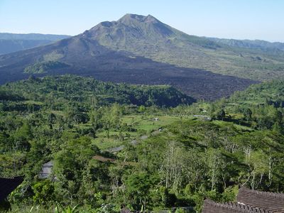
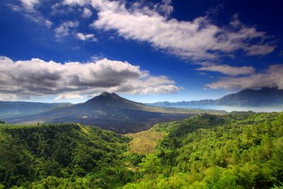
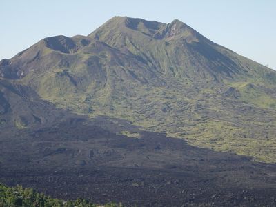
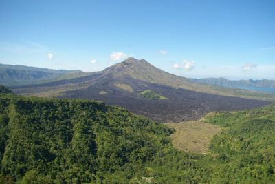
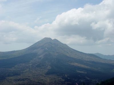
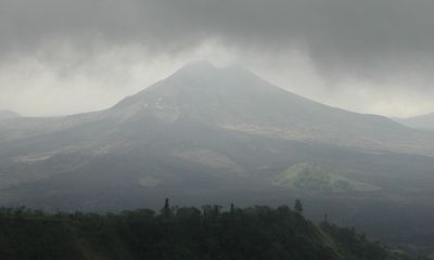
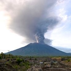
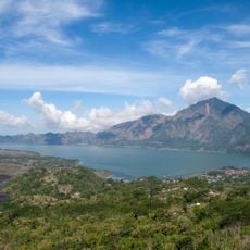
Mount Batur is an active volcano in the Kintamani highlands of Bali, Indonesia. Its summit sits at 1,717 meters (5,633 feet) and displays a double caldera structure with a crater lake in the southeastern section.

Formation happened through two major collapses of the magma chamber roughly 29,300 and 20,150 years ago. Several eruptions during the 20th century reshaped the inner cone and affected surrounding villages.

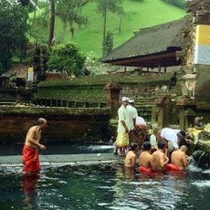
The name comes from a Balinese word meaning stone container, referring to volcanic rock. Many locals consider the crater a home for deities and build shrines at the base for offerings.

Hikers typically begin their climb around 4 AM and follow a roughly 3-kilometer (1.9-mile) trail with 500 meters (1,640 feet) of elevation gain to the top. Sturdy shoes and warm layers are advisable, as temperatures at the summit can be much cooler than in the valley below.

At the summit, hikers use the heat from steam vents to cook eggs or bananas. These natural openings reach temperatures that allow food to cook within minutes.

The community of curious travelers

AroundUs brings together thousands of curated places, local tips, and hidden gems, enriched daily by 60,000 contributors worldwide.

Start exploring
Location
Elevation above the sea
1,717 m
GPS coordinates
-8.23942,115.37796
Latest update
December 12, 2025 17:59
Walking routes in Bali: rice terraces, volcanoes, waterfalls

Walking routes in Bali traverse rice terraces, waterfalls and temple complexes, offering access to the island's varied landscape and cultural sites. The trails range from the sculpted rice paddies of Tegallalang and Jatiluwih to the clifftop setting of Uluwatu Temple and the volcanic slopes of Mount...

Reviews
Share your experience

No review yet

Discussions
Start a discussion...

No discussion yet

« Mount Batur - Active volcano in Kintamani highlands, Indonesia » is provided by Around Us (aroundus.com). Images and texts are derived from Wikimedia project under a Creative Commons license. You are allowed to copy, distribute, and modify copies of this page, under the conditions set by the license, as long as this note is clearly visible.

Discover hidden gems everywhere you go!

From secret cafés to breathtaking viewpoints, skip the crowded tourist spots and find places that match your style. Our app makes it easy with voice search, smart filtering, route optimization, and insider tips from travelers worldwide. Download now for the complete mobile experience.

Around Us App Screenshot

A unique approach to discovering new places

Le Figaro

All the places worth exploring

France Info

A tailor-made excursion in just a few clicks

20 Minutes

Around Us
Travel Guide & Maps
Download

Send to your phone

QR Code
1

Open the camera app on your mobile.

2

Point at the QR code with your camera. A notification will appear.

3

Tap the notification to open the link.