See the monuments around you in AROpen chests in the app
Around Us is built for your phone — point your camera at the streets and discover the monuments and places around you in augmented reality.Around Us is built for your phone — chests unlock when you walk, explore and capture nearby places.
Walking routes in Bali: rice terraces, volcanoes, waterfalls
Walking routes in Bali traverse rice terraces, waterfalls and temple complexes, offering access to the island's varied landscape and cultural sites. The trails range from the sculpted rice paddies of Tegallalang and Jatiluwih to the clifftop setting of Uluwatu Temple and the volcanic slopes of Mount Batur. Visitors will find a network of paths through traditional villages, water gardens and highland areas.
The routes include the rolling rice landscapes of Sidemen Valley, forest trails to Sekumpul and Banyumala waterfalls, and the Campuhan Ridge Walk through Ubud. Many paths connect natural features with cultural landmarks such as Gunung Kawi, Tirta Gangga and the rural village of Penglipuran. The coastal walks of Nusa Penida, including Kelingking Beach and Angel's Billabong, provide access to cliffs and sheltered coves along the shoreline.
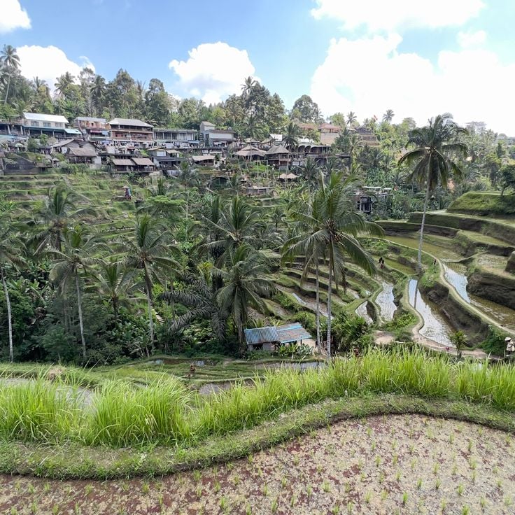
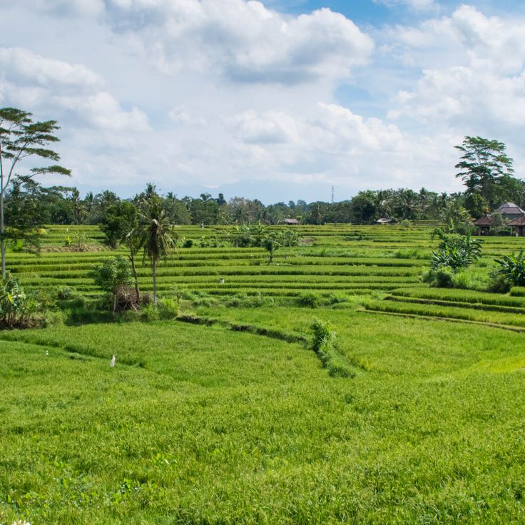
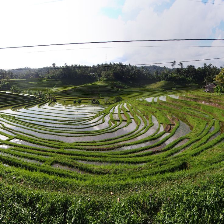
The Tegallalang Rice Terraces follow the traditional Subak irrigation system that distributes water across the terraced rice paddies. These agricultural steps stretch across several hillsides near Ubud and connect with the walking paths that lead through Bali's rice farming areas. The terraces demonstrate centuries-old cultivation methods where water cooperatives coordinate irrigation between farmers. Visitors can walk along the paths between the individual levels while observing farmers working the fields and harvesting crops.
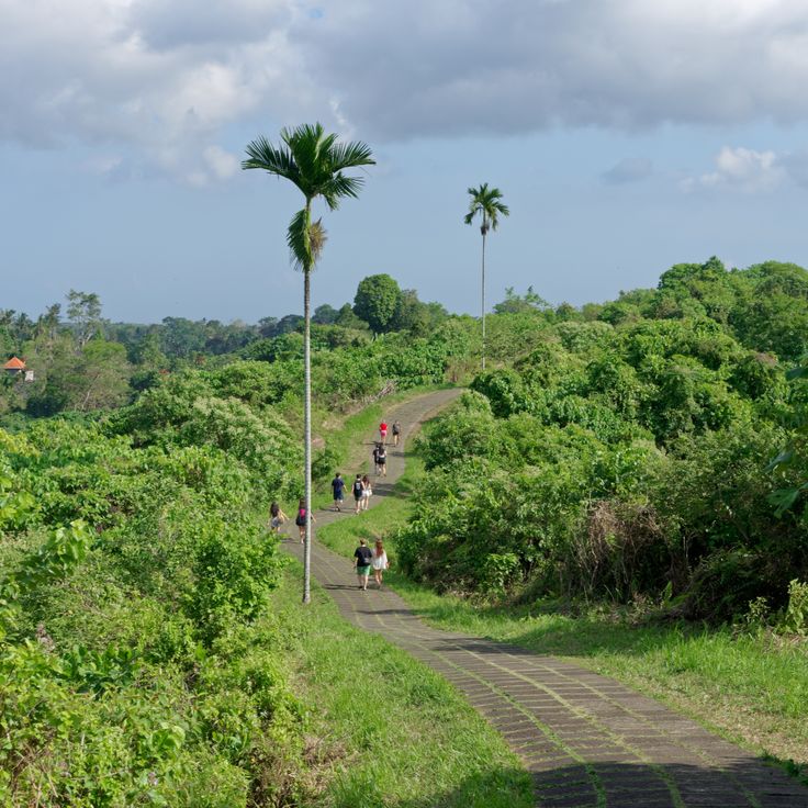
This walking route follows forested hills north of Ubud, connecting two river valleys through tropical vegetation. The Campuhan Ridge Walk extends 1.2 miles (2 kilometers) along a narrow ridge line, offering views across palm groves and rice fields in the surrounding valleys. The path begins at Gunung Lebah Temple and continues through grassy stretches and shaded sections that contrast with the more densely settled areas of Ubud. The route works well for early morning or late afternoon walks and connects with additional trails leading to traditional villages and rice terraces across the region.
This valley displays terraced rice fields and traditional mountain villages beneath the Agung volcano. The walking paths through Sidemen Valley lead through bamboo groves and agricultural areas that represent the rural structure of East Bali. The route connects natural landscapes with local settlements and provides insights into traditional farming methods and village life. The trail through this valley complements the collection of walking routes in Bali through its focus on agricultural terraces and mountain scenery.
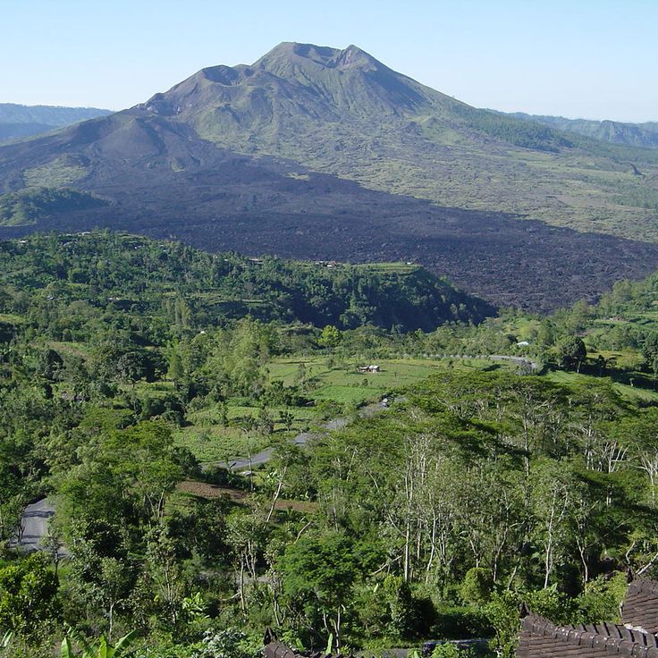
This 5,633-foot (1,717-meter) volcano in the Bangli district offers hikers a steep ascent through volcanic terrain to the summit. Mount Batur combines physical exertion with geological insights, and the trail passes through cooled lava fields and active steam vents. From the highest point, views extend across the crater lake within the caldera and the surrounding valleys toward Gunung Agung to the east. This route complements Bali's walking paths that connect rice fields, waterfalls and temples with an alpine volcanic trail through one of the island's most geologically active areas.
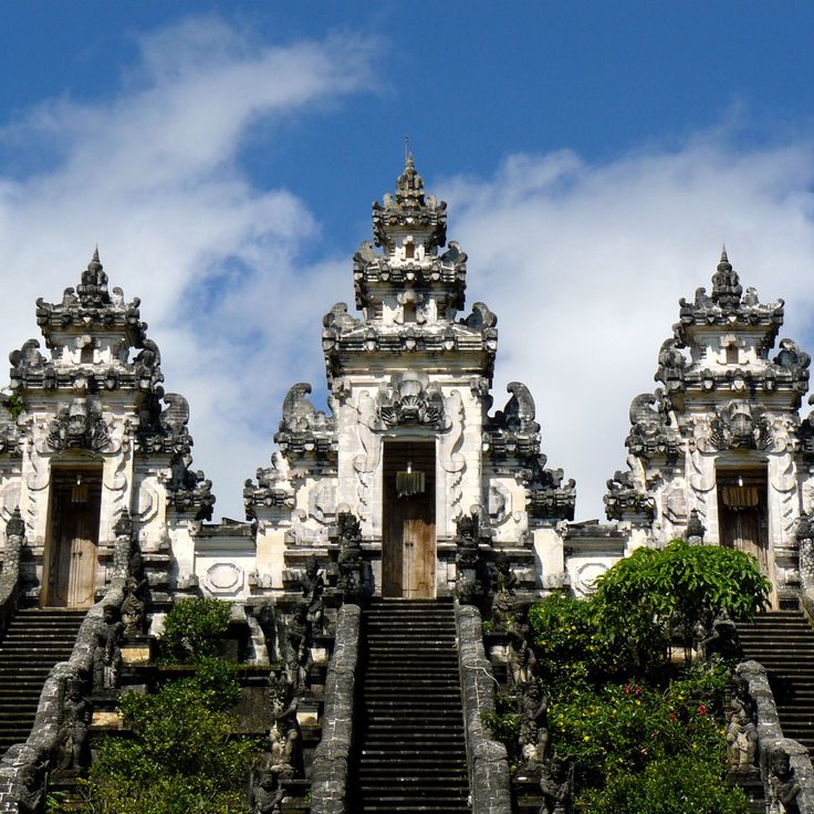
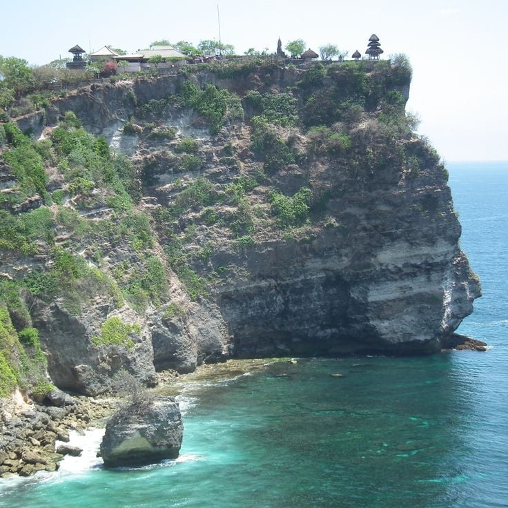
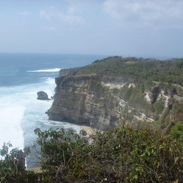
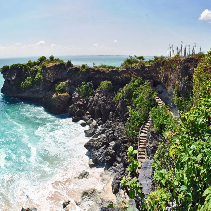
This Hindu temple rises from a 230-foot (70-meter) cliff above the Indian Ocean and stands as one of the defining waypoints among Bali's walking routes. Pura Luhur Uluwatu occupies the southwestern tip of the Bukit Peninsula, combining spiritual significance with dramatic coastal positioning. Stone pathways follow the cliff edge and provide access to different sections of the temple compound. The clifftop setting makes this site one that pairs temple architecture with ocean views. Access follows paved trails that trace the cliff rim.
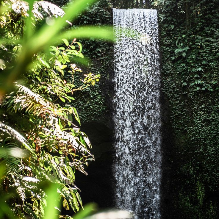
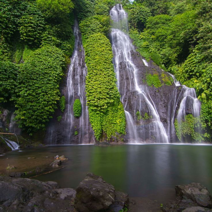
These waterfalls in northern Bali comprise seven individual cascades that drop through dense tropical forest at heights between 165 and 260 feet (50 and 80 meters). Sekumpul Waterfalls sit in a remote valley within Buleleng regency and are reached through a combination of paved paths and steep stairways. Access requires a descent through cacao and spice plantations, past rice paddies, before trails meet the falls. The route connects natural landscapes with views into local agriculture and provides perspectives on multiple waterfalls simultaneously from the valley floor.
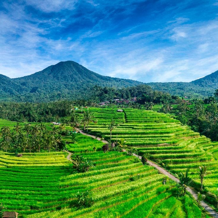
These rice terraces cover 600 hectares along the slopes of Mount Batukaru, using the traditional subak irrigation system practiced in Tabanan for centuries. The terraces at Jatiluwih combine rice cultivation with volcanic terrain, offering walking paths through multiple levels of rice fields. The route passes through the agricultural plots where farmers work using ancient methods, showing the irrigation techniques passed down through generations. The path follows the terraces with views of the surrounding mountains and rice cultivation in different growth stages.
This 190-square-kilometer national park in northwestern Bali combines monsoon forest, savanna, mangrove and coral reef ecosystems across different elevations and coastal zones. The walking routes in West Bali National Park lead through dry forest and wetlands to coves and viewpoints that provide access to both marine and terrestrial environments. The park protects the critically endangered Bali starling, a bird found only on this island, along with macaques, deer and reptile species. The trails connect natural landscapes with cultural sites and demonstrate Bali's ecological range from rice terraces to temple compounds.
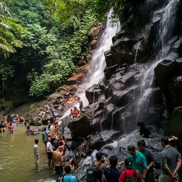
This 115-foot (35-meter) waterfall descends in three tiers through dense rainforest in Buleleng district. The walking trail to Gitgit Waterfall passes through fields and tropical vegetation typical of Bali's walking routes. The marked path connects natural landscapes with local villages. The route provides access to this waterfall, which offers a break between rice terrace visits and temple sites in northeastern Bali.
This water garden from 1946 spans several terraces in eastern Bali and contains stone pathways that wind between spring-fed pools and sculptures. The trails pass through pond systems with lotus flowers and traditional Balinese figures. Tirta Gangga serves as a starting point for walking routes through rice fields and villages in the Karangasem area. The site sits 0.9 miles from the main town at the slopes of Mount Agung.
This temple dedicated to the Hindu goddess Saraswati sits in central Ubud and combines red brick construction with detailed stone carving work. The compound features ornate reliefs depicting deities and floral patterns across its walls and gates. A pond filled with lotus plants surrounds the prayer pavilions, creating a calm foreground to the main structures. The architecture follows Balinese temple conventions with tiered towers and open courtyards. Saraswati Temple remains an active place of worship with daily ceremonies, while also welcoming visitors who want to understand the religious artistry and the maintained water gardens that define the site.
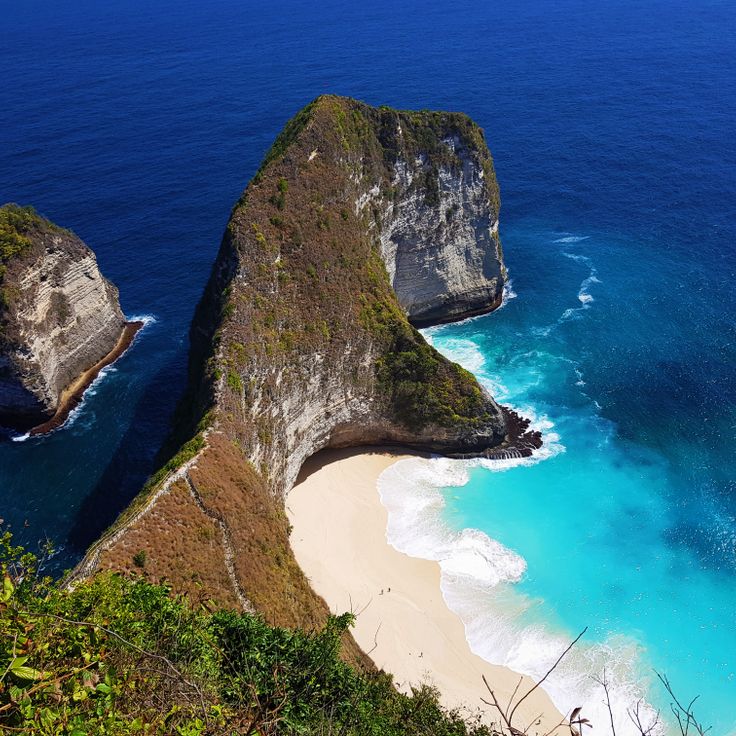
This clifftop trail on Nusa Penida descends steep steps to a 1,300-foot sand beach below a limestone formation. The rock wall resembles a dinosaur profile and serves as a natural landmark on the island's southwest coast. The descent involves roughly 300 steps through exposed terrain. Kelingking Beach connects Bali's coastal landscapes with volcanic geological formations and complements the walking routes through rice terraces and temple complexes on the main island with this coastal formation off the eastern shore.
Munduk Village sits at 2,625 feet (800 meters) elevation in the Buleleng region and offers walking trails that pass through coffee plantations and spice gardens. The routes in this mountain village connect several waterfalls with traditional cultivation areas and provide insight into local coffee farming. The paths run through forested terrain and lead to various natural water sources that form part of Bali's walking routes.
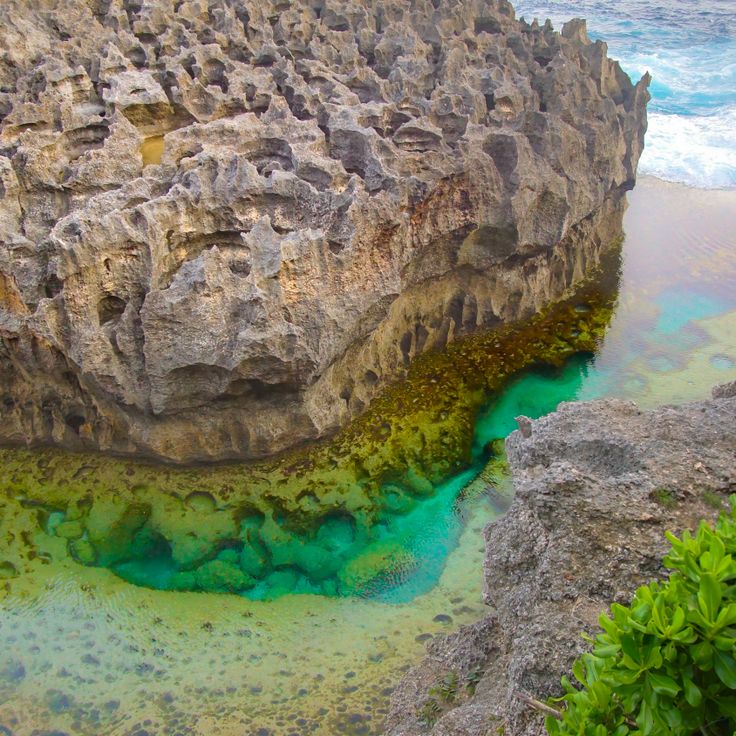
This natural tidal pool sits on the coast of Nusa Penida between limestone cliffs, where water from the Indian Ocean enters through rock openings. Angel's Billabong is accessible during low tide, when the sea is calm and water levels remain low enough to explore the pool. The formation developed through centuries of erosion on the coastal rock face. The pool connects to the open ocean through natural channels in the stone, so tidal cycles affect water levels and currents. The rock walls frame the clear water and provide views across the sea.
This remote forest complex presents seven waterfalls distributed across different elevations, with natural pools between dense tropical trees. The walking paths of Sambangan Secret Garden connect individual cascades through steep sections and constructed staircases. The route passes through vegetation with ferns and bamboo while water flows over rock formations into pools. The site sits in Buleleng district and extends Bali's walking options beyond the established rice terrace and temple routes, with a focus on water courses through forested terrain.
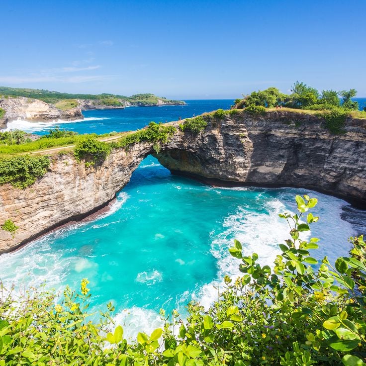
This stone arch on Nusa Penida's southwest coast spans a circular bay where seawater enters through a natural tunnel. The formation sits below clifftop paths that loop around the perimeter and offer views across the archway opening to the ocean beyond. Cliffs here rise roughly 160 feet (50 meters) above sea level. The site lies several miles from inhabited areas and requires travel along unpaved roads. Walking routes on the island frequently link this coastal point with other formations and temple sites across Nusa Penida.
This 65-foot (20-meter) waterfall in the rainforest of Bangli forms part of the natural attractions along Bali's walking routes. Water drops into a natural pool where visitors can swim. Tibumana Waterfall sits away from main routes between rice terraces and temples, connecting the volcanic landscapes with traditional villages in the region. The surroundings consist of dense rainforest with paths leading to other waterfalls in the area.
This 200-meter sandy stretch on the west coast of Nusa Penida provides access to coral reefs suitable for snorkeling and diving. The beach sits away from the main walking routes across Bali but serves as a starting point for coastal walks along the cliffs. The reefs off Crystal Bay Beach attract manta rays and ocean sunfish, particularly between July and October. The beach combines water activities with walking options to nearby temples and viewpoints. From here, paths lead north to traditional villages and south to the western coastline cliffs.
This temple from the 11th century sits in a deep river valley and contains ten shrines carved into rock. The complex was built during the reign of King Udayana and his son Airlangga. Gunung Kawi demonstrates early Balinese stone carving techniques. Access requires descending 315 steps through rice terraces and tropical vegetation. The shrines rise over 23 feet (7 meters) from the cliff face. Located along the Pakerisan River, this site connects the walking routes through rice fields and temple complexes across the island.
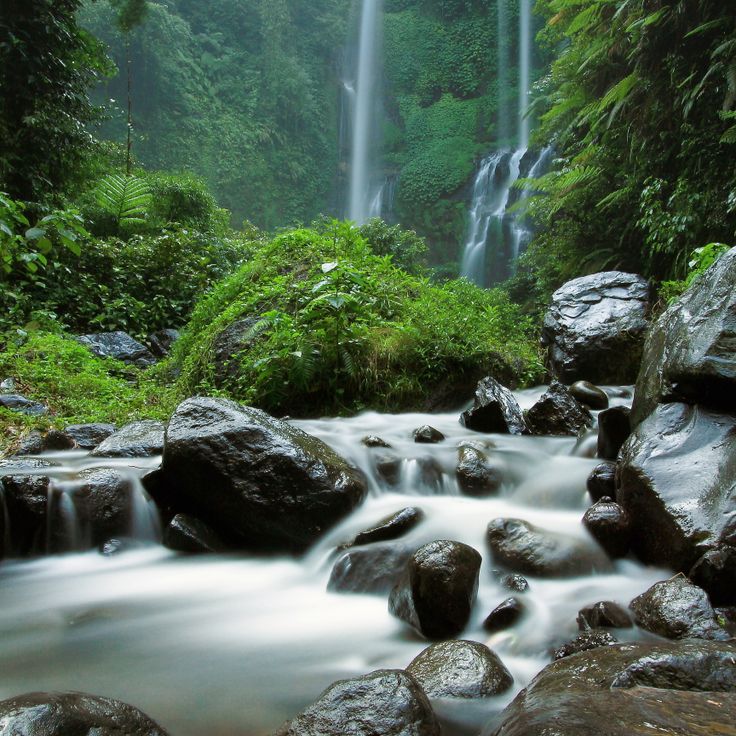
These twin waterfalls in northern Bali drop 30 meters (98 feet) into several natural pools at the base of the cascades. A hiking trail descends through dense rainforest to the bottom of the falls, where both streams flow side by side into turquoise pools. The route connects the falls to the collection's walking paths that lead through Bali's rice fields and temples. The trail requires approximately 20 minutes of descent on stepped paths and offers views of the surrounding highlands. The waterfalls are located in Buleleng regency, away from the island's main tourist routes.
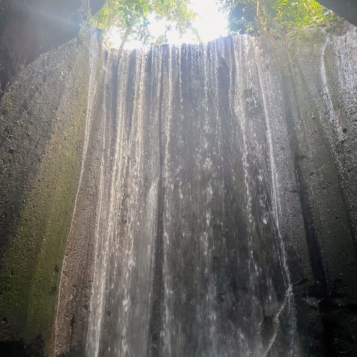
This waterfall in Tembuku sits inside a cave with a natural opening in the ceiling. Water drops about 50 feet (15 meters) through the opening and creates light reflections on the rock walls when sunlight enters. Access requires walking through a narrow canyon with a stream. The route through the gorge takes about 15 minutes from the parking area. This waterfall connects to walking routes that link rice fields and temples across the region, forming part of the trails that cross Bali's volcanic landscape.
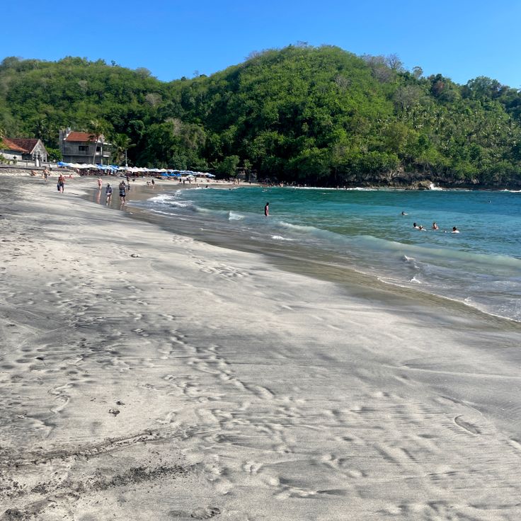
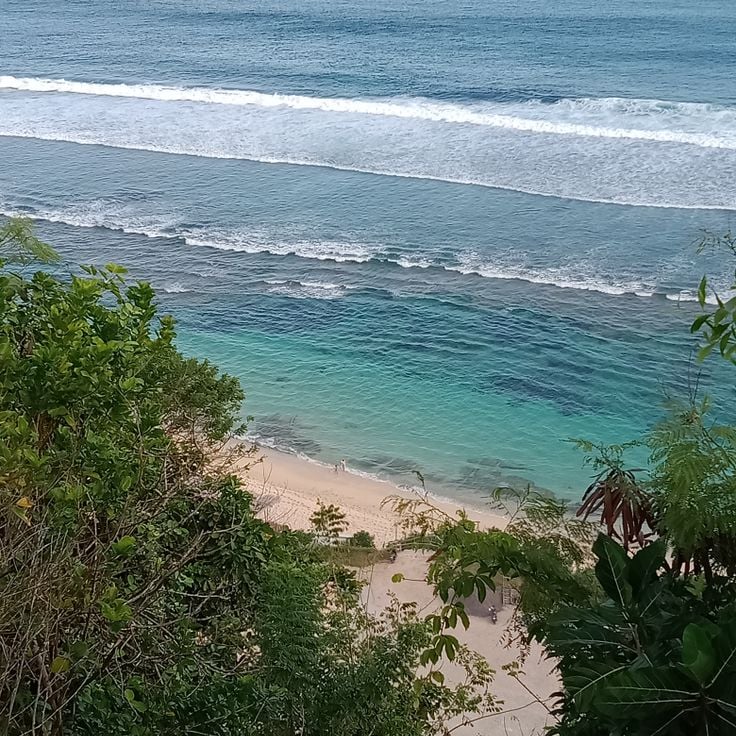
This sand beach stretches 1,500 feet (450 meters) along Bali's southern coast and provides a natural setting for walks from the Uluwatu area. Nyang Nyang Beach sits below high cliffs and features two remaining steel shipwrecks at the shore. Access requires descending staircases from the clifftop. The paths through this area connect coastal sections with the elevated cliffsides where temples and viewpoints stand. The beach remains less visited than other Bukit Peninsula stretches due to the steep approach.
This natural limestone cave in Uluwatu leads through rock crevices to the beach and connects with the walking routes across Bali that run from rice terraces to coastal cliffs. The passage is only accessible at low tide, when the water recedes enough to allow safe passage. The rock formation developed over thousands of years of erosion, as waves and wind shaped the porous limestone. Visitors climb down through the narrow opening to reach a small stretch of beach surrounded by high cliffs. The cave serves as a natural starting point for nearby coastal trails that lead toward the Uluwatu clifftops.
Melasti Beach sits at the base of 100-meter (330-foot) limestone cliffs in Ungasan and features fine white sand. This beach is accessible via a winding road and marks one of the southern access points for walking routes along Bali's coast. The cliffs frame the beach and create a sheltered cove that connects with the surrounding rice terraces and temple routes. The path down leads through limestone formations typical of this region.
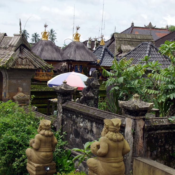
This village preserves traditional Balinese building methods and sits near a bamboo forest. Penglipuran provides insights into local customs and the daily life of residents who maintain their inherited practices. The route through the village connects cultural sites with natural landscapes, showing the relationship between rice fields, temples and traditional settlements in Bali. The houses follow construction techniques passed down through generations and the layout reflects principles of Balinese spatial organization.
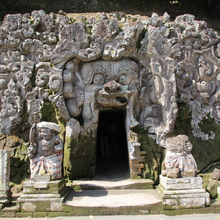
This 9th-century cave temple in Gianyar combines Hindu and Buddhist elements within a compound featuring water gardens. Goa Gajah fits into Bali's walking routes that connect rice terraces, temples and traditional villages. The carved entrance leads into the cave, where reliefs and stonework document the region's religious history. The water gardens with their pools and fountains complement the sacred ensemble, creating a site that reflects the island's layered spiritual traditions.
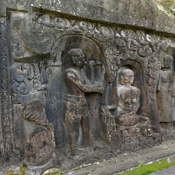
These stone reliefs from the 14th century stretch 82 feet (25 meters) along a rock face near Ubud. The carvings depict scenes from daily Balinese life: rice farmers at work, hunters with their dogs, and people engaged in ritual bathing. The narrow path to the reliefs passes through rice paddies and palm groves, alongside water sources that irrigate the surrounding farmland. Yeh Pulu offers direct insight into the historical everyday culture of Bali and connects well with walks to the nearby Tegallalang rice terraces and other cultural sites in the area.
This viewpoint integrates into Bali's walking routes and provides a direct view of the Indian Ocean and the beach below. The cliffs rise approximately 164 feet (50 meters) above the water, creating an elevated vantage point from which visitors can survey the coastline. Balangan Viewpoint connects the natural landscapes with the walking paths that lead through rice terraces, waterfalls and temples, allowing for a pause with ocean views along the route.
These rice terraces in western Bali are farmed using methods passed down through generations. The fields lie in Tabanan regency, away from the main tourist circuits, and are maintained by village communities. The path to the Belimbing terraces passes through working agricultural land where farmers use the traditional subak irrigation system. The route connects these rice fields with other natural and cultural sites across the island, showing the continued practice of Balinese agriculture.
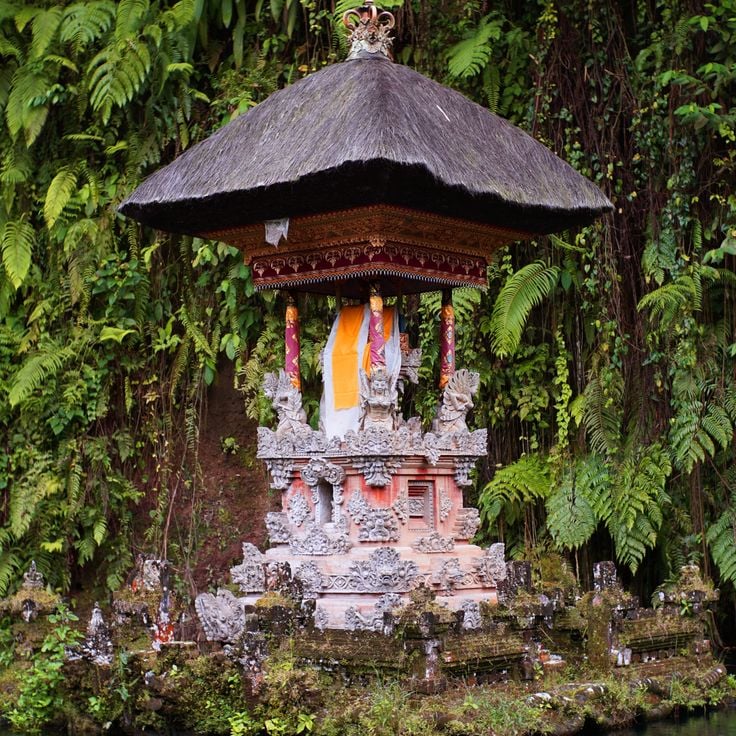
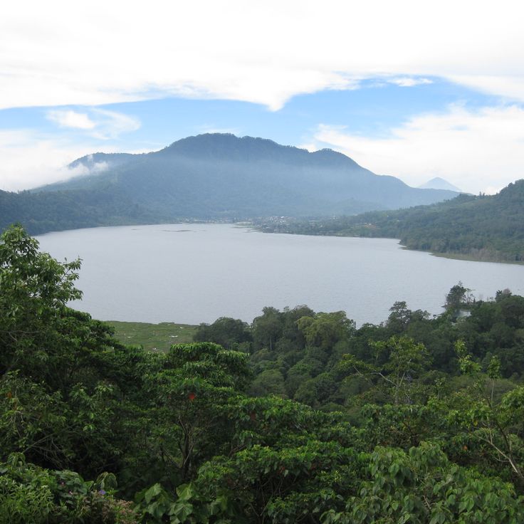
This lake sits at 3,300 feet (1,000 meters) elevation in the Buleleng highlands, surrounded by dense rainforest. Walking trails around Lake Tamblingan pass through old growth forest sections to reach several Hindu temples along the shoreline. The path connects natural landscapes with religious sites and provides views across the water and surrounding mountains. The route suits walkers seeking remote areas and historic temple compounds away from the more traveled paths in Bali.
This waterfall near Gianyar flows over gray rock formations in several levels, forming a pool at the base. Kanto Lampo sits in an area known for its natural waterways and rice paddies, making it a stop along the walking routes through central Bali. The rock structure allows for different viewing points along the tiers. The waterfall is accessible via a short walk from the main road and is often visited in combination with other natural sites in the area.
Lempuyang Temple is a historical temple complex in the mountains of Karangasem, known for its stone gate that frames a direct view of Mount Agung. The walking path to this temple climbs several hundred steps through tropical vegetation, passing multiple smaller shrines along the way. The complex stands as one of Bali's spiritual centers, combining religious architecture with views of the surrounding landscape. The ascent takes approximately one hour and provides insights into Balinese temple architecture along the route through rice fields and villages.
The Tegallalang Rice Terraces follow the traditional Subak irrigation system that distributes water across the terraced rice paddies. These agricultural steps stretch across several hillsides near Ubud and connect with the walking paths that lead through Bali's rice farming areas. The terraces demonstrate centuries-old cultivation methods where water cooperatives coordinate irrigation between farmers. Visitors can walk along the paths between the individual levels while observing farmers working the fields and harvesting crops.
This walking route follows forested hills north of Ubud, connecting two river valleys through tropical vegetation. The Campuhan Ridge Walk extends 1.2 miles (2 kilometers) along a narrow ridge line, offering views across palm groves and rice fields in the surrounding valleys. The path begins at Gunung Lebah Temple and continues through grassy stretches and shaded sections that contrast with the more densely settled areas of Ubud. The route works well for early morning or late afternoon walks and connects with additional trails leading to traditional villages and rice terraces across the region.
This valley displays terraced rice fields and traditional mountain villages beneath the Agung volcano. The walking paths through Sidemen Valley lead through bamboo groves and agricultural areas that represent the rural structure of East Bali. The route connects natural landscapes with local settlements and provides insights into traditional farming methods and village life. The trail through this valley complements the collection of walking routes in Bali through its focus on agricultural terraces and mountain scenery.
This 5,633-foot (1,717-meter) volcano in the Bangli district offers hikers a steep ascent through volcanic terrain to the summit. Mount Batur combines physical exertion with geological insights, and the trail passes through cooled lava fields and active steam vents. From the highest point, views extend across the crater lake within the caldera and the surrounding valleys toward Gunung Agung to the east. This route complements Bali's walking paths that connect rice fields, waterfalls and temples with an alpine volcanic trail through one of the island's most geologically active areas.
This Hindu temple rises from a 230-foot (70-meter) cliff above the Indian Ocean and stands as one of the defining waypoints among Bali's walking routes. Pura Luhur Uluwatu occupies the southwestern tip of the Bukit Peninsula, combining spiritual significance with dramatic coastal positioning. Stone pathways follow the cliff edge and provide access to different sections of the temple compound. The clifftop setting makes this site one that pairs temple architecture with ocean views. Access follows paved trails that trace the cliff rim.
These waterfalls in northern Bali comprise seven individual cascades that drop through dense tropical forest at heights between 165 and 260 feet (50 and 80 meters). Sekumpul Waterfalls sit in a remote valley within Buleleng regency and are reached through a combination of paved paths and steep stairways. Access requires a descent through cacao and spice plantations, past rice paddies, before trails meet the falls. The route connects natural landscapes with views into local agriculture and provides perspectives on multiple waterfalls simultaneously from the valley floor.
These rice terraces cover 600 hectares along the slopes of Mount Batukaru, using the traditional subak irrigation system practiced in Tabanan for centuries. The terraces at Jatiluwih combine rice cultivation with volcanic terrain, offering walking paths through multiple levels of rice fields. The route passes through the agricultural plots where farmers work using ancient methods, showing the irrigation techniques passed down through generations. The path follows the terraces with views of the surrounding mountains and rice cultivation in different growth stages.
This 190-square-kilometer national park in northwestern Bali combines monsoon forest, savanna, mangrove and coral reef ecosystems across different elevations and coastal zones. The walking routes in West Bali National Park lead through dry forest and wetlands to coves and viewpoints that provide access to both marine and terrestrial environments. The park protects the critically endangered Bali starling, a bird found only on this island, along with macaques, deer and reptile species. The trails connect natural landscapes with cultural sites and demonstrate Bali's ecological range from rice terraces to temple compounds.
This 115-foot (35-meter) waterfall descends in three tiers through dense rainforest in Buleleng district. The walking trail to Gitgit Waterfall passes through fields and tropical vegetation typical of Bali's walking routes. The marked path connects natural landscapes with local villages. The route provides access to this waterfall, which offers a break between rice terrace visits and temple sites in northeastern Bali.
This water garden from 1946 spans several terraces in eastern Bali and contains stone pathways that wind between spring-fed pools and sculptures. The trails pass through pond systems with lotus flowers and traditional Balinese figures. Tirta Gangga serves as a starting point for walking routes through rice fields and villages in the Karangasem area. The site sits 0.9 miles from the main town at the slopes of Mount Agung.
This temple dedicated to the Hindu goddess Saraswati sits in central Ubud and combines red brick construction with detailed stone carving work. The compound features ornate reliefs depicting deities and floral patterns across its walls and gates. A pond filled with lotus plants surrounds the prayer pavilions, creating a calm foreground to the main structures. The architecture follows Balinese temple conventions with tiered towers and open courtyards. Saraswati Temple remains an active place of worship with daily ceremonies, while also welcoming visitors who want to understand the religious artistry and the maintained water gardens that define the site.
This clifftop trail on Nusa Penida descends steep steps to a 1,300-foot sand beach below a limestone formation. The rock wall resembles a dinosaur profile and serves as a natural landmark on the island's southwest coast. The descent involves roughly 300 steps through exposed terrain. Kelingking Beach connects Bali's coastal landscapes with volcanic geological formations and complements the walking routes through rice terraces and temple complexes on the main island with this coastal formation off the eastern shore.
Munduk Village sits at 2,625 feet (800 meters) elevation in the Buleleng region and offers walking trails that pass through coffee plantations and spice gardens. The routes in this mountain village connect several waterfalls with traditional cultivation areas and provide insight into local coffee farming. The paths run through forested terrain and lead to various natural water sources that form part of Bali's walking routes.
This natural tidal pool sits on the coast of Nusa Penida between limestone cliffs, where water from the Indian Ocean enters through rock openings. Angel's Billabong is accessible during low tide, when the sea is calm and water levels remain low enough to explore the pool. The formation developed through centuries of erosion on the coastal rock face. The pool connects to the open ocean through natural channels in the stone, so tidal cycles affect water levels and currents. The rock walls frame the clear water and provide views across the sea.
This remote forest complex presents seven waterfalls distributed across different elevations, with natural pools between dense tropical trees. The walking paths of Sambangan Secret Garden connect individual cascades through steep sections and constructed staircases. The route passes through vegetation with ferns and bamboo while water flows over rock formations into pools. The site sits in Buleleng district and extends Bali's walking options beyond the established rice terrace and temple routes, with a focus on water courses through forested terrain.
This stone arch on Nusa Penida's southwest coast spans a circular bay where seawater enters through a natural tunnel. The formation sits below clifftop paths that loop around the perimeter and offer views across the archway opening to the ocean beyond. Cliffs here rise roughly 160 feet (50 meters) above sea level. The site lies several miles from inhabited areas and requires travel along unpaved roads. Walking routes on the island frequently link this coastal point with other formations and temple sites across Nusa Penida.
This 65-foot (20-meter) waterfall in the rainforest of Bangli forms part of the natural attractions along Bali's walking routes. Water drops into a natural pool where visitors can swim. Tibumana Waterfall sits away from main routes between rice terraces and temples, connecting the volcanic landscapes with traditional villages in the region. The surroundings consist of dense rainforest with paths leading to other waterfalls in the area.
This 200-meter sandy stretch on the west coast of Nusa Penida provides access to coral reefs suitable for snorkeling and diving. The beach sits away from the main walking routes across Bali but serves as a starting point for coastal walks along the cliffs. The reefs off Crystal Bay Beach attract manta rays and ocean sunfish, particularly between July and October. The beach combines water activities with walking options to nearby temples and viewpoints. From here, paths lead north to traditional villages and south to the western coastline cliffs.
This temple from the 11th century sits in a deep river valley and contains ten shrines carved into rock. The complex was built during the reign of King Udayana and his son Airlangga. Gunung Kawi demonstrates early Balinese stone carving techniques. Access requires descending 315 steps through rice terraces and tropical vegetation. The shrines rise over 23 feet (7 meters) from the cliff face. Located along the Pakerisan River, this site connects the walking routes through rice fields and temple complexes across the island.
These twin waterfalls in northern Bali drop 30 meters (98 feet) into several natural pools at the base of the cascades. A hiking trail descends through dense rainforest to the bottom of the falls, where both streams flow side by side into turquoise pools. The route connects the falls to the collection's walking paths that lead through Bali's rice fields and temples. The trail requires approximately 20 minutes of descent on stepped paths and offers views of the surrounding highlands. The waterfalls are located in Buleleng regency, away from the island's main tourist routes.
This waterfall in Tembuku sits inside a cave with a natural opening in the ceiling. Water drops about 50 feet (15 meters) through the opening and creates light reflections on the rock walls when sunlight enters. Access requires walking through a narrow canyon with a stream. The route through the gorge takes about 15 minutes from the parking area. This waterfall connects to walking routes that link rice fields and temples across the region, forming part of the trails that cross Bali's volcanic landscape.
This sand beach stretches 1,500 feet (450 meters) along Bali's southern coast and provides a natural setting for walks from the Uluwatu area. Nyang Nyang Beach sits below high cliffs and features two remaining steel shipwrecks at the shore. Access requires descending staircases from the clifftop. The paths through this area connect coastal sections with the elevated cliffsides where temples and viewpoints stand. The beach remains less visited than other Bukit Peninsula stretches due to the steep approach.
This natural limestone cave in Uluwatu leads through rock crevices to the beach and connects with the walking routes across Bali that run from rice terraces to coastal cliffs. The passage is only accessible at low tide, when the water recedes enough to allow safe passage. The rock formation developed over thousands of years of erosion, as waves and wind shaped the porous limestone. Visitors climb down through the narrow opening to reach a small stretch of beach surrounded by high cliffs. The cave serves as a natural starting point for nearby coastal trails that lead toward the Uluwatu clifftops.
Melasti Beach sits at the base of 100-meter (330-foot) limestone cliffs in Ungasan and features fine white sand. This beach is accessible via a winding road and marks one of the southern access points for walking routes along Bali's coast. The cliffs frame the beach and create a sheltered cove that connects with the surrounding rice terraces and temple routes. The path down leads through limestone formations typical of this region.
This village preserves traditional Balinese building methods and sits near a bamboo forest. Penglipuran provides insights into local customs and the daily life of residents who maintain their inherited practices. The route through the village connects cultural sites with natural landscapes, showing the relationship between rice fields, temples and traditional settlements in Bali. The houses follow construction techniques passed down through generations and the layout reflects principles of Balinese spatial organization.
This 9th-century cave temple in Gianyar combines Hindu and Buddhist elements within a compound featuring water gardens. Goa Gajah fits into Bali's walking routes that connect rice terraces, temples and traditional villages. The carved entrance leads into the cave, where reliefs and stonework document the region's religious history. The water gardens with their pools and fountains complement the sacred ensemble, creating a site that reflects the island's layered spiritual traditions.
These stone reliefs from the 14th century stretch 82 feet (25 meters) along a rock face near Ubud. The carvings depict scenes from daily Balinese life: rice farmers at work, hunters with their dogs, and people engaged in ritual bathing. The narrow path to the reliefs passes through rice paddies and palm groves, alongside water sources that irrigate the surrounding farmland. Yeh Pulu offers direct insight into the historical everyday culture of Bali and connects well with walks to the nearby Tegallalang rice terraces and other cultural sites in the area.
This viewpoint integrates into Bali's walking routes and provides a direct view of the Indian Ocean and the beach below. The cliffs rise approximately 164 feet (50 meters) above the water, creating an elevated vantage point from which visitors can survey the coastline. Balangan Viewpoint connects the natural landscapes with the walking paths that lead through rice terraces, waterfalls and temples, allowing for a pause with ocean views along the route.
These rice terraces in western Bali are farmed using methods passed down through generations. The fields lie in Tabanan regency, away from the main tourist circuits, and are maintained by village communities. The path to the Belimbing terraces passes through working agricultural land where farmers use the traditional subak irrigation system. The route connects these rice fields with other natural and cultural sites across the island, showing the continued practice of Balinese agriculture.
This lake sits at 3,300 feet (1,000 meters) elevation in the Buleleng highlands, surrounded by dense rainforest. Walking trails around Lake Tamblingan pass through old growth forest sections to reach several Hindu temples along the shoreline. The path connects natural landscapes with religious sites and provides views across the water and surrounding mountains. The route suits walkers seeking remote areas and historic temple compounds away from the more traveled paths in Bali.
This waterfall near Gianyar flows over gray rock formations in several levels, forming a pool at the base. Kanto Lampo sits in an area known for its natural waterways and rice paddies, making it a stop along the walking routes through central Bali. The rock structure allows for different viewing points along the tiers. The waterfall is accessible via a short walk from the main road and is often visited in combination with other natural sites in the area.
Lempuyang Temple is a historical temple complex in the mountains of Karangasem, known for its stone gate that frames a direct view of Mount Agung. The walking path to this temple climbs several hundred steps through tropical vegetation, passing multiple smaller shrines along the way. The complex stands as one of Bali's spiritual centers, combining religious architecture with views of the surrounding landscape. The ascent takes approximately one hour and provides insights into Balinese temple architecture along the route through rice fields and villages.