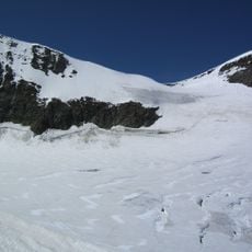
Kinhorn, Mountain summit in Valais, Switzerland
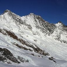
Kinhorn is a mountain of the Swiss Pennine Alps in the canton of Valais, overlooking Täsch. It stands on the ridge west of the Täschhorn and reaches 3,597 metres above sea level. The area receives about 1,585 mm of precipitation per year.
The Kinhorn lies on the ridge west of the Täschhorn in the Mischabel group of the Pennine Alps, above Täsch in Valais. Its elevation is 3,597 m, not 3,750 m. The summit is listed on Hikr, the Swiss climbing route database, which records ascent routes for the peak.
The Kinhorn lies on the ridge west of the Täschhorn, above Täsch in the Pennine Alps. Its name is recorded in several languages, including the Chinese form 金峰, used in reference works on Swiss peaks. The bilingual Wikipedia entries and the Hikr climbing database are the main published records of the mountain.
The Kinhorn stands on the ridge west of the Täschhorn, above Täsch in the Valais. It is a 3,597 m summit in the Pennine Alps, so approach it as high alpine terrain rather than a marked hiking peak. The nearest base is Täsch, from which the mountain is seen to the west.
The Kinhorn lies on the ridge west of the Täschhorn, above Täsch in the Pennine Alps. The Chinese Wikipedia entry gives its elevation as 3,597 metres and an average annual rainfall of 1,585 mm, and it links to the summit's page on Hikr, a hiking route database.
The community of curious travelers
AroundUs brings together thousands of curated places, local tips, and hidden gems, enriched daily by 94,474 contributors worldwide.