Hong Kong Flight Information Region, Flight information region in Hong Kong.
The Hong Kong Flight Information Region is an airspace control area that monitors aircraft movements over southeastern China and adjacent waters. The center manages a large flight corridor and coordinates traffic of various types, from commercial aircraft to helicopters.
The center was established to manage growing air traffic demand in southeastern Asia and has coordinated with control sectors like Manila, Shanghai, and Guangzhou ever since. These regional connections were built to enable safe and efficient flight movements across borders.
Pilots from around the world rely on the constant communication provided by Hongkong's air traffic controllers, who work seamlessly with nearby control centers. This cross-border collaboration shapes how the control center functions as a hub connecting different aviation regions.
The control area operates around the clock and provides pilots with information on weather, navigation, and emergencies. Aircraft receive continuous monitoring and support throughout their entire passage through the region.
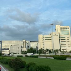
The region manages helicopter landing zones throughout the territory, including specialized sites at hospitals for emergency transport. These medical heliports are monitored continuously and play a critical role in rapid response operations.
The community of curious travelers
AroundUs brings together thousands of curated places, local tips, and hidden gems, enriched daily by 60,000 contributors worldwide.