Gwanggyosan, Mountain summit in Gyeonggi-do, South Korea
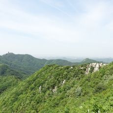
Gwanggyosan is a 582-meter peak located across Suwon and Yongin cities in Gyeonggi Province. The mountain features multiple summits connected by a system of hiking routes that span around 10.2 kilometers and link different access points.
The mountain served as a military observation point during the Qing invasion of Joseon in the 17th century. A monument and tomb dedicated to General Kim Joon Ryong mark this period of defense.
Gwanggyosan is Suwon's jinsan, or guardian mountain, in Korean pungsu thought: it stands north of the city, blocks winter winds and marks Suwon's position for travellers. Its old names include Gwangaksan and Gwangoksan; according to the Goryeo yasa, King Taejo Wang Geon renamed it in 928 after seeing a light rise from the mountain and called it the mountain of the Buddha's teaching. The mountain was also the site of a victory by General Kim Jun-ryong during the 1636 Qing invasion.
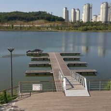
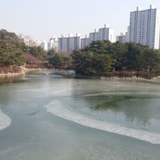
The main trailhead is at Gwanggyo Reservoir in Suwon, near the firefly restroom by the Kyonggi University entrance. From there, the ridge to Baengnyeonsu summit takes about an hour. A one-way route to Sirusan via Hyeongjebong and the communication tower takes about 1 hour 30 minutes; a family route to the summit via Biribong and Ttokki Pass takes about 3 hours 20 minutes.
Gwanggyosan is a large earthen mountain (yuksan) with almost no exposed rock, unusual for its height; nearby Baegunsan is similar. Its ridgelines are lined with pine forest, while the valleys hold broadleaf trees. From the summit, Suwon, Yongin and Bundang are visible, and the ridge path alone runs over 10 km.
The community of curious travelers
AroundUs brings together thousands of curated places, local tips, and hidden gems, enriched daily by 93,468 contributors worldwide.