Enable Location

We need your location to show you interesting places around you

Discover nearby places

Find interesting locations and hidden gems around you

Precise directions

Get accurate directions and distances to places

Your location is never shared with other users. It's only used when you tap the location button.

Taz

Log in to your account

Start exploring — it's free

Trusted by 66,998 travelers worldwide

Continue with Google
Continue with Apple
or

We will send you a code to connect

By continuing, you accept our Terms and Conditions and our Privacy Policy

Check your inbox

We've sent a pincode in your inbox. Please enter the code below.

Taz
Discussion Reviews 1 Photos
12.9k Popularity

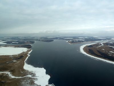
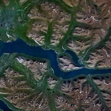
Taz, Siberian river in Krasnoyarsk Krai and Yamalo-Nenets Autonomous Okrug, Russia

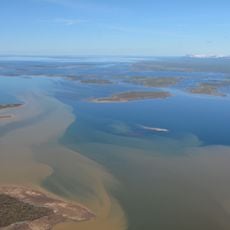
The Taz River flows through western Siberia for about 1,400 kilometers, moving northwest from its source until it reaches the Gulf of Ob. The waterway connects several neighboring river systems and shapes the sparsely settled landscape between forest and tundra regions.

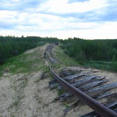
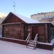
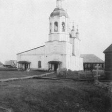
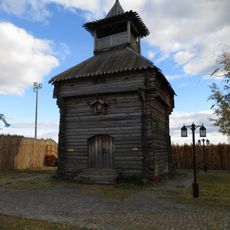
The river played a role in early Russian expansion into Siberia, particularly with the founding of Mangazeya in the 16th century, an important trading center in the region. This trading outpost was later abandoned but shaped the colonial history of the north.

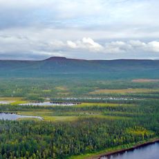
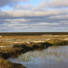
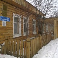
The river flows through lands where indigenous communities continue their traditional hunting and gathering practices today, relying on the water for daily activities.

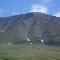
The river basin is difficult to access and ranks among Russia's most remote regions, with harsh climate and lengthy winter months. Visitors should prepare for basic conditions and limited infrastructure when exploring the area.

The river system's drainage basin spans several hundred thousand square kilometers with numerous lakes and tributaries forming a complex hydrological network. This hidden water abundance makes the region an overlooked geographic feature of northern Siberia.

The community of curious travelers

AroundUs brings together thousands of curated places, local tips, and hidden gems, enriched daily by 60,000 contributors worldwide.

Start exploring
Location
GPS coordinates
67.56670,78.85000
Latest update
December 7, 2025 20:42
Around this place
Putorana Plateau
Russian Federation

Putorana Plateau

602.8 km
Sabetta
Russian Federation

Sabetta

487.1 km
Salekhard–Igarka Railway
Russian Federation

Salekhard–Igarka Railway

447.9 km
Mangazeya
Russian Federation

Mangazeya

176.7 km
Polar Ural
Russian Federation

Polar Ural

620.8 km
Obskaya–Bovanenkovo Line
Russian Federation

Obskaya–Bovanenkovo Line

511.9 km
Lake Lama
Russian Federation

Lake Lama

497.5 km
Новопортовский мерзлотник
Russian Federation

Новопортовский мерзлотник

252.4 km
Nord Kamal Mosque
Russian Federation

Nord Kamal Mosque

429.7 km
Zapovednik Gydansky
Russian Federation

Zapovednik Gydansky

534.5 km
Upper Taz Nature Reserve
Russian Federation

Upper Taz Nature Reserve

511.6 km
Krasnye Kamny
Russian Federation

Krasnye Kamny

447.7 km
First house Norilsk
Russian Federation

First house Norilsk

430.2 km
Russian Federation

Музей Сталина (Курейка)

377.9 km
Permafrost Museum
Russian Federation

Permafrost Museum

330.3 km
Turukhansk Holy Trinity Monastery
Russian Federation

Turukhansk Holy Trinity Monastery

447.6 km
Peter and Paul Church
Russian Federation

Peter and Paul Church

543.7 km
Харнаурды-Кеу
Russian Federation

Харнаурды-Кеу

545.3 km
Khantayka Reservoir
Russian Federation

Khantayka Reservoir

379 km
Russian Federation

Brekhovskie Islands

378.9 km
Здание инородческих управ, в котором была провозглашена советская власть в Обдорске (Салехард)
Russian Federation

Здание инородческих управ, в котором была провозглашена советская власть в Обдорске (Салехард)

543.8 km
Polar circle monument
Russian Federation

Polar circle monument

541.4 km
Здание начальной школы 501-й стройки (Салехард)
Russian Federation

Здание начальной школы 501-й стройки (Салехард)

541.2 km
Здание театра 501-й стройки (Салехард)
Russian Federation

Здание театра 501-й стройки (Салехард)

541.5 km
Торговый дом купца И.Н. Корнилова (Салехард)
Russian Federation

Торговый дом купца И.Н. Корнилова (Салехард)

543.7 km
Obdorsky ostrog
Russian Federation

Obdorsky ostrog

543.9 km
Obdorskoye Cemetery
Russian Federation

Obdorskoye Cemetery

542.2 km
Дом купца И.А. Рочева-Моторова (Салехард)
Russian Federation

Дом купца И.А. Рочева-Моторова (Салехард)

543.5 km
Show the full map
Reviews
Share your experience

No review yet

Discussions
Start a discussion...

No discussion yet

« Taz - Siberian river in Krasnoyarsk Krai and Yamalo-Nenets Autonomous Okrug, Russia » is provided by Around Us (aroundus.com). Images and texts are derived from Wikimedia project under a Creative Commons license. You are allowed to copy, distribute, and modify copies of this page, under the conditions set by the license, as long as this note is clearly visible.

Discover hidden gems everywhere you go!

From secret cafés to breathtaking viewpoints, skip the crowded tourist spots and find places that match your style. Our app makes it easy with voice search, smart filtering, route optimization, and insider tips from travelers worldwide. Download now for the complete mobile experience.

Around Us App Screenshot

A unique approach to discovering new places

Le Figaro

All the places worth exploring

France Info

A tailor-made excursion in just a few clicks

20 Minutes

Around Us
Travel Guide & Maps
Download

Send to your phone

QR Code
1

Open the camera app on your mobile.

2

Point at the QR code with your camera. A notification will appear.

3

Tap the notification to open the link.