Kolyma

Log in to your account

AroundUs is a community-driven map of interesting places, built by curious explorers like you. It grows with every review, story, and photo you share.
Connect to save your favorite spots, contribute locations, and create personalized routes.
By continuing, you accept our Terms and Conditions and our Privacy Policy
Add to collection
Map
Suggest a change
Share

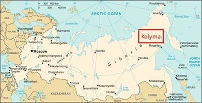
Kolyma, Geographic region in northeastern Siberia, Russia

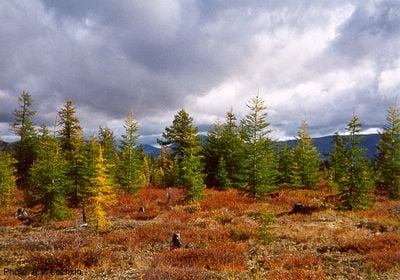
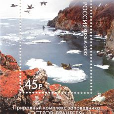
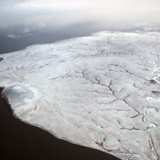
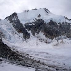
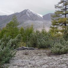
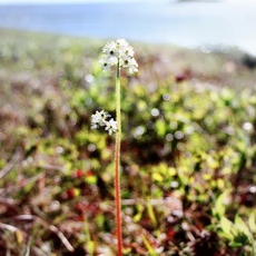
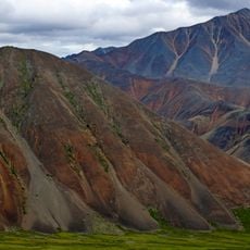
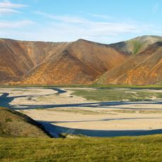
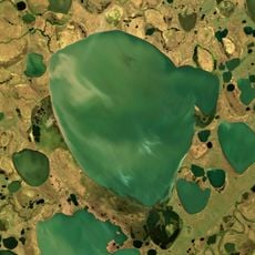
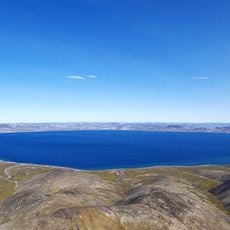
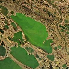
Kolyma is a sprawling region in northeastern Siberia, lying between the East Siberian Sea and the Sea of Okhotsk, with high mountain ranges, deep valleys, and expansive lowland zones. Rivers cut through the terrain and shape the landscape, while wide areas are covered by tundra and sparse stands of trees.

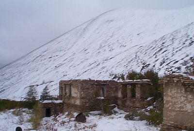
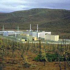
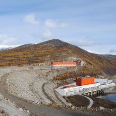
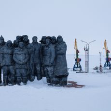
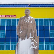
Between 1932 and 1954, parts of the region served as sites for labor camps where prisoners worked in gold mines under extreme conditions. After these camps closed, the focus shifted to mining and infrastructure development on a smaller scale.

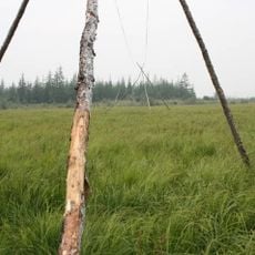
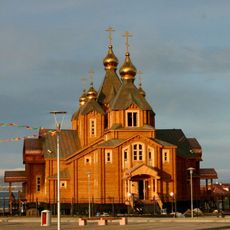
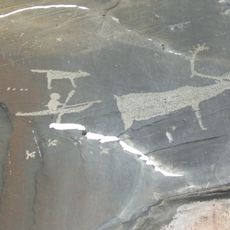
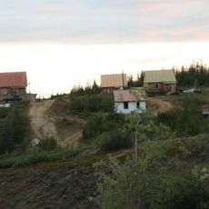
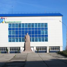
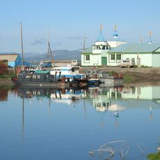
Indigenous communities in the northern areas maintain their connection to reindeer herding and hunting, while small settlements show a mix of modern elements and older wooden houses. The name Kolyma probably derives from a word meaning "river" in a native language.

Access is mainly by air or via the Kolyma Highway, with road conditions more reliable during winter when the ground freezes. Travelers should prepare for long distances between settlements and limited services.

In some areas, remnants of old camp structures remain visible, testifying to the harsh past of the region. Temperatures can briefly turn mild in summer, while the ground freezes so hard in winter that heavy vehicles can drive over it without difficulty.

Location: Magadan Oblast

Location: Chukotka Autonomous Okrug

Part of: Siberia, Russian Far East

GPS coordinates: 68.76877,161.69495

Latest update: December 13, 2025 16:16

Photos
Around this place
Akademik Lomonosov
Russian Federation

Akademik Lomonosov

355.4 km
Pleistocene Park
Russian Federation

Pleistocene Park

29.3 km
Bilibino Nuclear Power Plant
Russian Federation

Bilibino Nuclear Power Plant

213.8 km
Zapovednik Wrangel Island
Russian Federation

Zapovednik Wrangel Island

724.4 km
Peak Pobeda, Sakha
Russian Federation

Peak Pobeda, Sakha

788.1 km
Herald Island
Russian Federation

Herald Island

900.4 km
Bolshoy Lyakhovsky Island
Russian Federation

Bolshoy Lyakhovsky Island

887.2 km
Kolyma Mountains
Russian Federation

Kolyma Mountains

782.1 km
Trinity Cathedral
Russian Federation

Trinity Cathedral

824.2 km
Pegtymel Petroglyphs
Russian Federation

Pegtymel Petroglyphs

510.8 km
Kytalyk National Park
Russian Federation

Kytalyk National Park

578.5 km
Momsky nature park
Russian Federation

Momsky nature park

750.3 km
Khatyrka meteorite
Russian Federation

Khatyrka meteorite

895 km
Lake Ozhogino
Russian Federation

Lake Ozhogino

600.8 km
Routan Islands
Russian Federation

Routan Islands

349.8 km
Bolschaja-Momskaja-Aufeis
Russian Federation

Bolschaja-Momskaja-Aufeis

758.1 km
Kolyma Reservoir
Russian Federation

Kolyma Reservoir

919.3 km
Palyavaam River
Russian Federation

Palyavaam River

660.3 km
Lake Bolshoye Morskoye
Russian Federation

Lake Bolshoye Morskoye

185.2 km
Northeast Science Station
Russian Federation

Northeast Science Station

12.3 km
Elgygytgyn Lake
Russian Federation

Elgygytgyn Lake

453.3 km
Taygonos
Russian Federation

Taygonos

896.7 km
Chukochye Lake
Russian Federation

Chukochye Lake

94.3 km
Дворец Пионеров (Анадырь)
Russian Federation

Дворец Пионеров (Анадырь)

824.5 km
Историко-этнографический памятник «Коса Святого Александра» (Анадырь)
Russian Federation

Историко-этнографический памятник «Коса Святого Александра» (Анадырь)

824.5 km
Мемориальный комплекс «Памятник первым Ревкомовцам» (Анадырь)
Russian Federation

Мемориальный комплекс «Памятник первым Ревкомовцам» (Анадырь)

823.6 km
Памятник В. И. Ленину (Анадырь)
Russian Federation

Памятник В. И. Ленину (Анадырь)

824.4 km
Памятник «Авиаторам — первопроходцам и защитникам неба Чукотки» (Угольные Копи)
Russian Federation

Памятник «Авиаторам — первопроходцам и защитникам неба Чукотки» (Угольные Копи)

829.5 km
Show the full map
Reviews

Visited this place? Tap the stars to rate it and share your experience / photos with the community! Try now! You can cancel it anytime.

« Kolyma - Geographic region in northeastern Siberia, Russia » is provided by Around Us (aroundus.com). Images and texts are derived from Wikimedia project under a Creative Commons license. You are allowed to copy, distribute, and modify copies of this page, under the conditions set by the license, as long as this note is clearly visible.

Discover hidden gems everywhere you go!

From secret cafés to breathtaking viewpoints, skip the crowded tourist spots and find places that match your style. Our app makes it easy with voice search, smart filtering, route optimization, and insider tips from travelers worldwide. Download now for the complete mobile experience.

Around Us App Screenshot

A unique approach to discovering new places

Le Figaro

All the places worth exploring

France Info

A tailor-made excursion in just a few clicks

20 Minutes