Bayuda Volcanic Field, Volcanic field and mountain region in northeastern Sudan.
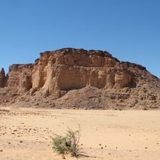
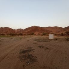
The Bayuda Volcanic Field is an elongated volcanic field in Sudan's Bayuda Desert, within the great bend of the Nile, covering about 11 by 48 kilometres in a northwesterly direction. It consists of roughly one hundred cinder cones, usually over 400 metres high and built of ash, lapilli, lava bombs and scoria, plus maars and explosion craters. 'A'ā lava flows reach lengths of 10 kilometres and thicknesses of 30 metres, often covered by ridges and hillocks.
Volcanism at Bayuda began 1.7 to 0.9 million years ago, starting with isolated volcanoes before newer edifices were built on older ones. The field was first identified through aerial photography in 1920. Radiocarbon dating of the most recent lava flow gives an age of 1,102 ± 48 years before present, and the uneroded state of Hosh ed Salam suggests activity continued after the last wet period some 5,000 years ago.
The crater El Muweilih holds a salt lake that gave the site its name and was worked as a salt source. Hosh ed Salam means "dark enclosure", a name describing its 500 m deep, 1,300 m wide basin. Middle Stone Age and Paleolithic sites lie within the field, and wells at Abu Khorit and Sani serve the area north of the lava.
The location is very remote with minimal services, so careful preparation and adequate supplies are essential before heading out. Temperature swings between day and night are extreme, requiring proper equipment suited to these harsh conditions.
Hosh ed Salam, whose name means "dark enclosure", is a crater 1,300 metres wide and 500 metres deep. Its uneroded state suggests activity after the last wet period ended about 5,000 years ago. The field was first identified from aerial photographs taken in 1920.
The community of curious travelers
AroundUs brings together thousands of curated places, local tips, and hidden gems, enriched daily by 93,541 contributors worldwide.