Chest opened
+${chestReward.xp} XP
Explorer
NOUVEAU ×${chestReward.collectible.quantity}
tapez pour fermer
Chest locked

Open chests in the app

Around Us is built for your phone — chests unlock when you walk, explore and capture nearby places.

Enable Location

We need your location to show you interesting places around you

Discover nearby places

Find interesting locations and hidden gems around you

Precise directions

Get accurate directions and distances to places

Your location is never shared with other users. It's only used when you tap the location button.

Door Peninsula

Log in to your account

Start exploring — it's free

Trusted by 72,879 travelers worldwide

Continue with Google
Continue with Apple
or

We will send you a code to connect

By continuing, you accept our Terms and Conditions and our Privacy Policy

Check your inbox

We've sent a pincode in your inbox. Please enter the code below.

Door Peninsula
Discussion Reviews 1 Photos
17k Popularity

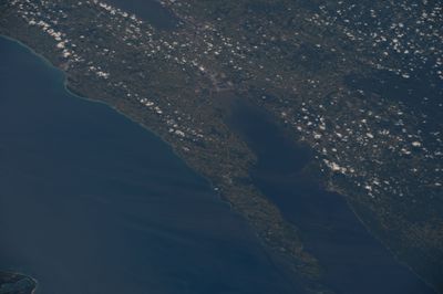
Door Peninsula, Peninsula between Green Bay and Lake Michigan in Wisconsin, United States.

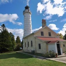
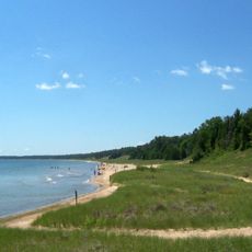
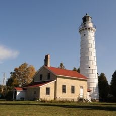
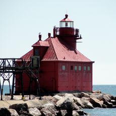
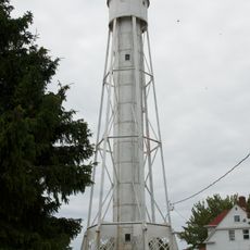
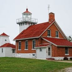
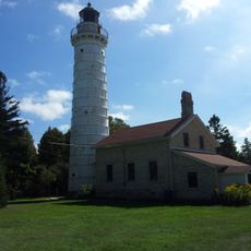
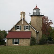
Door Peninsula extends northeastward and features a varied landscape with orchards, beaches, caves, lighthouses, and dense forests along its coastline. The Sturgeon Bay Ship Canal cuts through the peninsula and connects Green Bay with Lake Michigan.

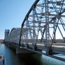
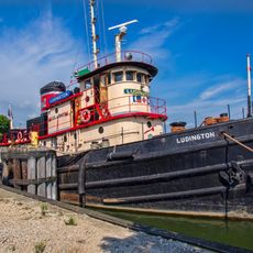
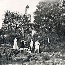
French explorers encountered local tribes during 17th-century expeditions in the region. The ship canal was completed in 1881 and marked a turning point for trade and connection between the two water bodies.

Local restaurants keep alive the tradition of fish boils, where whitefish from Lake Michigan is cooked outdoors with potatoes and onions over open flames. This way of eating is deeply rooted in the local identity and visitors enjoy experiencing it firsthand.

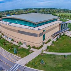
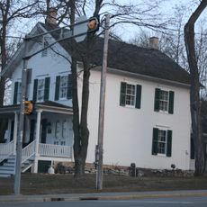
This place is best explored by car, as attractions are spread across the peninsula. Plan enough time to visit the coastal villages, beaches, and museums at your own pace.

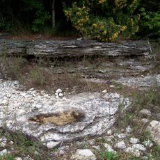
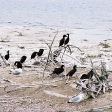
The region is home to an unusually high number of snail species that scientists have documented there. This diverse wildlife is often a surprising discovery for nature enthusiasts visiting the area.

The community of curious travelers

AroundUs brings together thousands of curated places, local tips, and hidden gems, enriched daily by 60,000 contributors worldwide.

Start exploring
Location
GPS coordinates
44.81343,-87.49328
Latest update
December 7, 2025 19:25
Around this place
Shrine of Our Lady of Good Help
United States of America

Shrine of Our Lady of Good Help

33.3 km
Peninsula State Park
United States of America

Peninsula State Park

43.4 km
Cana Island
United States of America

Cana Island

46.5 km
Whitefish Dunes State Park
United States of America

Whitefish Dunes State Park

25.7 km
Cana Island Light
United States of America

Cana Island Light

46.6 km
Copper Culture State Park
United States of America

Copper Culture State Park

33.2 km
Newport State Park
United States of America

Newport State Park

61.2 km
United States of America

Potawatomi State Park

8.4 km
SS Lakeland
United States of America

SS Lakeland

24.2 km
Green Island Light
United States of America

Green Island Light

27.1 km
Sturgeon Bay Bridge
United States of America

Sturgeon Bay Bridge

9.1 km
Interstate Bridge
United States of America

Interstate Bridge

33.9 km
Kress Events Center
United States of America

Kress Events Center

46 km
Tug Ludington
United States of America

Tug Ludington

39.3 km
Baileys Harbor Range Lights
United States of America

Baileys Harbor Range Lights

41.1 km
St. Lawrence Catholic Church
United States of America

St. Lawrence Catholic Church

48.5 km
Sturgeon Bay Canal North Pierhead Light
United States of America

Sturgeon Bay Canal North Pierhead Light

14.7 km
The Clearing Folk School
United States of America

The Clearing Folk School

59.8 km
The Ridges Sanctuary
United States of America

The Ridges Sanctuary

41.3 km
Weidner Center for the Performing Art
United States of America

Weidner Center for the Performing Art

46.2 km
Sturgeon Bay Canal Light
United States of America

Sturgeon Bay Canal Light

14.4 km
Sherwood Point Light
United States of America

Sherwood Point Light

10.1 km
Door County Maritime Museum
United States of America

Door County Maritime Museum

8.9 km
Eagle Bluff Light
United States of America

Eagle Bluff Light

44.4 km
United States of America

Mero Site

50.4 km
Gravel Island National Wildlife Refuge
United States of America

Gravel Island National Wildlife Refuge

58.9 km
Baileys Harbor Light
United States of America

Baileys Harbor Light

41.3 km
Alexander Noble House
United States of America

Alexander Noble House

40 km
Show the full map
Reviews
Share your experience

No review yet

Discussions
Start a discussion...

No discussion yet

« Door Peninsula - Peninsula between Green Bay and Lake Michigan in Wisconsin, United States » is provided by Around Us (aroundus.com). Images and texts are derived from Wikimedia project under a Creative Commons license. You are allowed to copy, distribute, and modify copies of this page, under the conditions set by the license, as long as this note is clearly visible.

Discover hidden gems everywhere you go!

From secret cafés to breathtaking viewpoints, skip the crowded tourist spots and find places that match your style. Our app makes it easy with voice search, smart filtering, route optimization, and insider tips from travelers worldwide. Download now for the complete mobile experience.

Around Us App Screenshot

A unique approach to discovering new places

Le Figaro

All the places worth exploring

France Info

A tailor-made excursion in just a few clicks

20 Minutes

Around Us
Travel Guide & Maps
Download

Send to your phone

QR Code
1

Open the camera app on your mobile.

2

Point at the QR code with your camera. A notification will appear.

3

Tap the notification to open the link.