Enable Location

We need your location to show you interesting places around you

Discover nearby places

Find interesting locations and hidden gems around you

Precise directions

Get accurate directions and distances to places

Your location is never shared with other users. It's only used when you tap the location button.

Streetsboro

Log in to your account

Start exploring — it's free

Trusted by 64,536 travelers worldwide

Continue with Google
Continue with Apple
or

We will send you a code to connect

By continuing, you accept our Terms and Conditions and our Privacy Policy

Check your inbox

We've sent a pincode in your inbox. Please enter the code below.

Discussion Reviews 1 Photos
18k Popularity

Streetsboro, city in Portage County, Ohio, United States

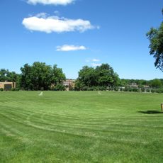
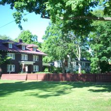
Streetsboro is a city in Portage County, Ohio, situated between Cleveland and Akron along the Interstate 480 corridor. It consists mainly of residential neighborhoods, retail areas along the main roads, and several green spaces spread across the city.

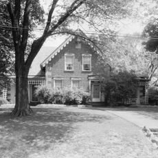
The area was settled in the early 1800s by the Street family, who gave the city its name. Growth accelerated in the second half of the 20th century as new highways made it easier for people to live here while working in Cleveland or Akron.

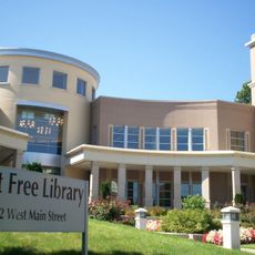
The name Streetsboro comes from the Street family, early settlers who shaped the area in the 19th century. Today, residents gather regularly in local parks and at community events, giving the city a neighborly feel that is easy to notice on any given day.

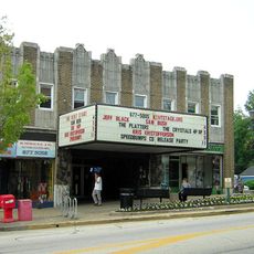
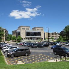
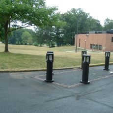
Streetsboro sits right off Interstate 480, making it easy to reach by car from both Cleveland and Akron. Most shops, restaurants, and services are concentrated along the main roads, so getting around is straightforward once you are in town.

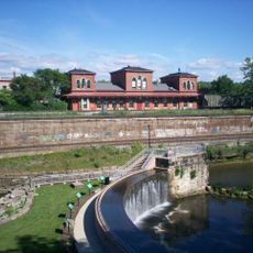
Streetsboro is one of the closest cities to Cuyahoga Valley National Park, which is one of the few national parks in the United States set within an urban region rather than in a remote wilderness. This makes a day trip into old-growth forest and river trails accessible without a long drive.

The community of curious travelers

AroundUs brings together thousands of curated places, local tips, and hidden gems, enriched daily by 60,000 contributors worldwide.

Start exploring
Location
Inception
1822
Elevation above the sea
345 m
Shares border with
Aurora
GPS coordinates
41.24250,-81.34917
Latest update
March 3, 2026 10:14
Around this place
Geauga Lake
United States of America

Geauga Lake

11.9 km
SeaWorld Ohio
United States of America

SeaWorld Ohio

11.9 km
Big Dipper
United States of America

Big Dipper

12.1 km
Dix Stadium
United States of America

Dix Stadium

11.9 km
Raging Wolf Bobs
United States of America

Raging Wolf Bobs

12.4 km
Partially Buried Woodshed
United States of America

Partially Buried Woodshed

11 km
Shady Lake Park
United States of America

Shady Lake Park

930 m
Masonic Temple
United States of America

Masonic Temple

9.9 km
Kent Stage
United States of America

Kent Stage

9.9 km
Loomis Observatory
United States of America

Loomis Observatory

8.3 km
Memorial Stadium
United States of America

Memorial Stadium

10.5 km
Kent Industrial District
United States of America

Kent Industrial District

10 km
Wills Gymnasium
United States of America

Wills Gymnasium

10.2 km
Rockwell Field
United States of America

Rockwell Field

11.9 km
Kent Free Library
United States of America

Kent Free Library

10 km
John Davey House
United States of America

John Davey House

9.4 km
Charles Kent House
United States of America

Charles Kent House

9.9 km
Mantua Center School
United States of America

Mantua Center School

11.6 km
Franklin Township Hall
United States of America

Franklin Township Hall

9.8 km
Hudson Historic District
United States of America

Hudson Historic District

7.8 km
West Main Street District
United States of America

West Main Street District

10 km
Aurora Center Historic District
United States of America

Aurora Center Historic District

7.9 km
C.R. Howard House
United States of America

C.R. Howard House

8.5 km
Ohio State Normal College At Kent
United States of America

Ohio State Normal College At Kent

10.1 km
Kent State University Center for the Performing Arts
United States of America

Kent State University Center for the Performing Arts

10 km
May 4, 1970, Kent State Shootings Site
United States of America

May 4, 1970, Kent State Shootings Site

10.3 km
West Main Street Historic District
United States of America

West Main Street Historic District

9.9 km
Hudson Middle School
United States of America

Hudson Middle School

7 km
Show the full map
Reviews
Share your experience

No review yet

Discussions
Start a discussion...

No discussion yet

« Streetsboro - city in Portage County, Ohio, United States » is provided by Around Us (aroundus.com). Images and texts are derived from Wikimedia project under a Creative Commons license. You are allowed to copy, distribute, and modify copies of this page, under the conditions set by the license, as long as this note is clearly visible.

Discover hidden gems everywhere you go!

From secret cafés to breathtaking viewpoints, skip the crowded tourist spots and find places that match your style. Our app makes it easy with voice search, smart filtering, route optimization, and insider tips from travelers worldwide. Download now for the complete mobile experience.

Around Us App Screenshot

A unique approach to discovering new places

Le Figaro

All the places worth exploring

France Info

A tailor-made excursion in just a few clicks

20 Minutes

Around Us
Travel Guide & Maps
Download

Send to your phone

QR Code
1

Open the camera app on your mobile.

2

Point at the QR code with your camera. A notification will appear.

3

Tap the notification to open the link.