Enable Location

We need your location to show you interesting places around you

Discover nearby places

Find interesting locations and hidden gems around you

Precise directions

Get accurate directions and distances to places

Your location is never shared with other users. It's only used when you tap the location button.

Sandy Hook

Log in to your account

Start exploring — it's free

Trusted by 62,429 travelers worldwide

Continue with Google
Continue with Apple
or

We will send you a code to connect

By continuing, you accept our Terms and Conditions and our Privacy Policy

Check your inbox

We've sent a pincode in your inbox. Please enter the code below.

Sandy Hook

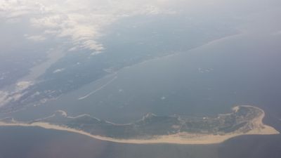
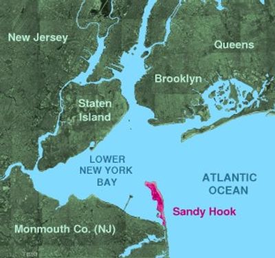
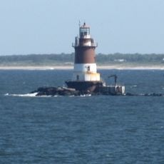
Sandy Hook, Peninsula and recreational area in New Jersey, United States

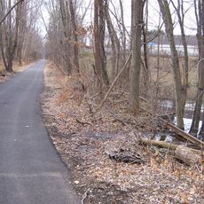
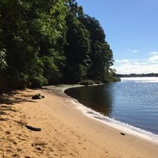
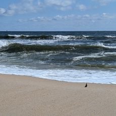
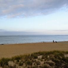
Sandy Hook is a peninsula and recreational area in Middletown Township, New Jersey, extending into the Lower New York Bay. The landform connects ocean beaches with bay shores, threading through salt marshes, dunes, and maritime forest throughout its length.

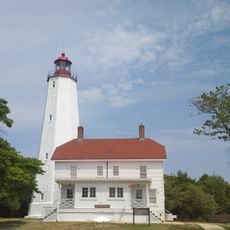
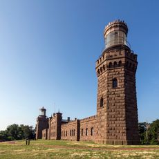
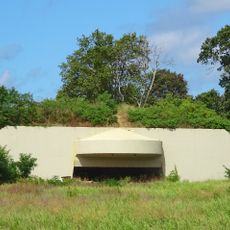
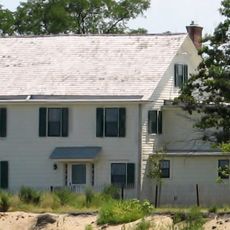
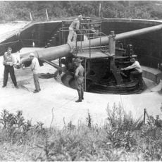
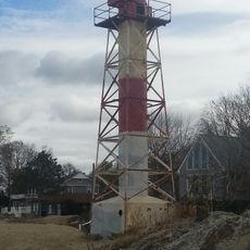
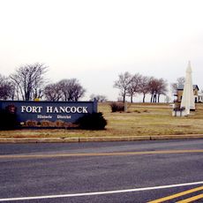
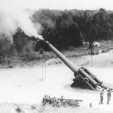
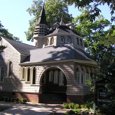
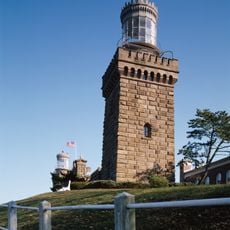
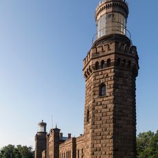
The peninsula served as military grounds from the late 19th century through 1974, with Fort Hancock guarding New York Harbor. After the base closed, the National Park Service took over in 1975 and opened it to the public.

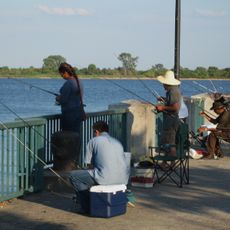
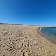
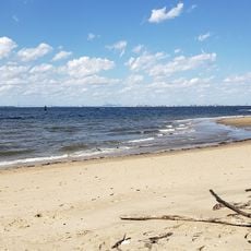
Dutch settlers named this sandy spit in the 17th century, describing its hooked shape jutting into the bay. Today locals and visitors use the beaches for swimming, fishing and walking along the dunes, while birdwatchers gather in the salt marshes during migration seasons.

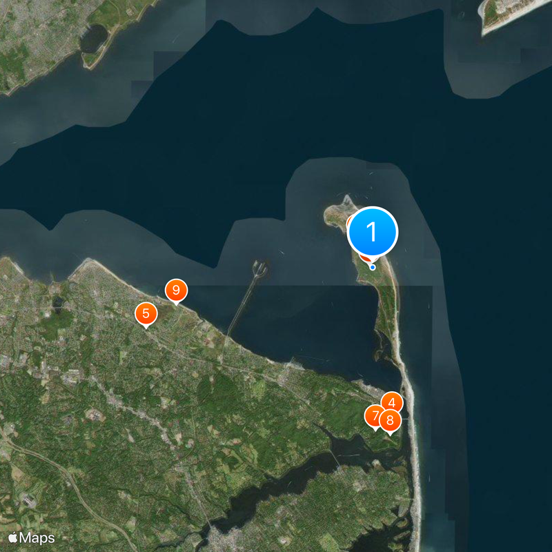
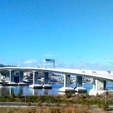
Beach parking fees apply from late May through early September, and visitors can pay with cards at toll booths operated during daylight hours. Access comes through a single road running north to south through the grounds, ending at several beach sections and walking trails.

One beach section here is the only place in a federal park on the East Coast where clothing is optional. This policy draws a devoted group of visitors who value the remote stretch of shore for its peaceful setting.

The community of curious travelers

AroundUs brings together thousands of curated places, local tips, and hidden gems, enriched daily by 60,000 contributors worldwide.

Start exploring
GPS coordinates
40.45289,-73.99524
Latest update
December 13, 2025 15:44
Around this place
Fort Hancock
United States of America

Fort Hancock

1.4 km
Sandy Hook Light
United States of America

Sandy Hook Light

1.1 km
Navesink Twin Lights
United States of America

Navesink Twin Lights

6.4 km
Henry Hudson Trail
United States of America

Henry Hudson Trail

9.9 km
Gateway National Recreation Area
United States of America

Gateway National Recreation Area

194 m
Highlands Air Force Station
United States of America

Highlands Air Force Station

6.8 km
Hartshorne Woods Park
United States of America

Hartshorne Woods Park

7.1 km
Seabrook-Wilson House
United States of America

Seabrook-Wilson House

8.4 km
Battery Gunnison
United States of America

Battery Gunnison

792 m
West Bank Light
United States of America

West Bank Light

10.3 km
Romer Shoal Light
United States of America

Romer Shoal Light

6.9 km
Seabright Lawn Tennis and Cricket Club
United States of America

Seabright Lawn Tennis and Cricket Club

9.7 km
Water Witch Club Casino
United States of America

Water Witch Club Casino

5.9 km
Conover Beacon
United States of America

Conover Beacon

6.2 km
Fort Hancock and the Sandy Hook Proving Ground Historic District
United States of America

Fort Hancock and the Sandy Hook Proving Ground Historic District

912 m
St. George's-by-the-River Episcopal Church
United States of America

St. George's-by-the-River Episcopal Church

10.1 km
Water Witch Club Historic District
United States of America

Water Witch Club Historic District

5.8 km
Fort Hancock, U.S. Life Saving Station
United States of America

Fort Hancock, U.S. Life Saving Station

3.1 km
Battery Kingman
United States of America

Battery Kingman

1.7 km
First Presbyterian Church of Rumson
United States of America

First Presbyterian Church of Rumson

8.6 km
Highlands–Sea Bright Bridge
United States of America

Highlands–Sea Bright Bridge

6.5 km
Beach C
United States of America

Beach C

4.3 km
North Beach
United States of America

North Beach

2.1 km
Beach E
United States of America

Beach E

2.9 km
Ideal Beach
United States of America

Ideal Beach

9.5 km
Navesink south lighthouse
United States of America

Navesink south lighthouse

6.4 km
Navesink north lighthouse
United States of America

Navesink north lighthouse

6.4 km
Victory Park
United States of America

Victory Park

8.6 km
Show the full map
« Sandy Hook - Peninsula and recreational area in New Jersey, United States » is provided by Around Us (aroundus.com). Images and texts are derived from Wikimedia project under a Creative Commons license. You are allowed to copy, distribute, and modify copies of this page, under the conditions set by the license, as long as this note is clearly visible.

Discover hidden gems everywhere you go!

From secret cafés to breathtaking viewpoints, skip the crowded tourist spots and find places that match your style. Our app makes it easy with voice search, smart filtering, route optimization, and insider tips from travelers worldwide. Download now for the complete mobile experience.

Around Us App Screenshot

A unique approach to discovering new places

Le Figaro

All the places worth exploring

France Info

A tailor-made excursion in just a few clicks

20 Minutes

Around Us
Travel Guide & Maps
Download

Send to your phone

QR Code
1

Open the camera app on your mobile.

2

Point at the QR code with your camera. A notification will appear.

3

Tap the notification to open the link.