Chest opened
+${chestReward.xp} XP
Explorer
NOUVEAU ×${chestReward.collectible.quantity}
tapez pour fermer
Chest locked

Open chests in the app

Around Us is built for your phone — chests unlock when you walk, explore and capture nearby places.

Enable Location

We need your location to show you interesting places around you

Discover nearby places

Find interesting locations and hidden gems around you

Precise directions

Get accurate directions and distances to places

Your location is never shared with other users. It's only used when you tap the location button.

Dumbo

Log in to your account

Start exploring — it's free

Trusted by 72,886 travelers worldwide

Continue with Google
Continue with Apple
or

We will send you a code to connect

By continuing, you accept our Terms and Conditions and our Privacy Policy

Check your inbox

We've sent a pincode in your inbox. Please enter the code below.

Discussion Reviews 1 Photos
14.1k Popularity

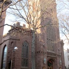
Dumbo, Industrial neighborhood in Brooklyn, US

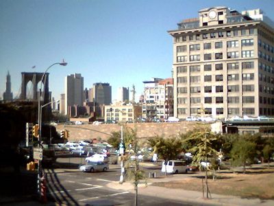
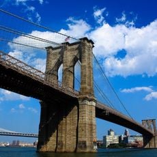
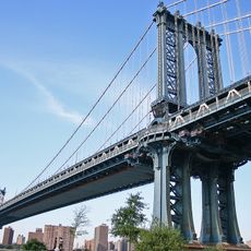
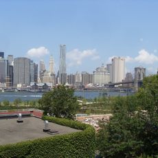
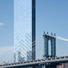
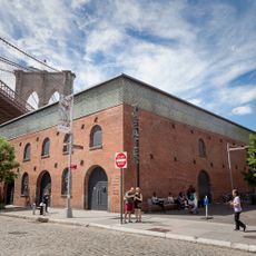
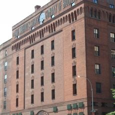
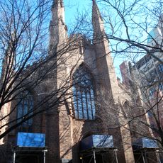
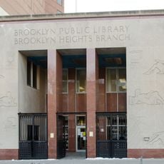
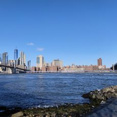
Dumbo is a neighborhood in Brooklyn featuring cobblestone streets and converted warehouses situated between the Manhattan and Brooklyn Bridges overlooking the East River. These former industrial buildings have been transformed into residential units, offices, and commercial spaces that define the area's character today.

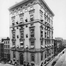
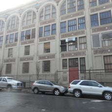
The area emerged in the 19th century as a manufacturing district with factories and warehouses that processed and distributed goods along the river. Starting in the 1970s, major renovation projects transformed it into a residential neighborhood with offices and retail spaces.

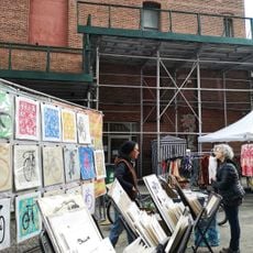
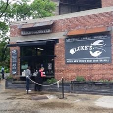
Art galleries, design studios, and creative businesses now fill the converted factory spaces that shape the neighborhood's character. Artists and workers use these rooms as workshops and studios, bringing the district to life with their daily work.

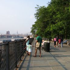
The neighborhood is connected to Manhattan by several subway lines and accessible via Brooklyn Bridge Park, which has ferry services. You can reach it on foot across both landmark bridges, which gives you a good sense of the area as you arrive.

Residents chose the name themselves in 1978, standing for "Down Under the Manhattan Bridge Overpass," to prevent commercial development. This naming strategy was an unusual move at the time to preserve the neighborhood's identity.

The community of curious travelers

AroundUs brings together thousands of curated places, local tips, and hidden gems, enriched daily by 60,000 contributors worldwide.

Start exploring
Location
GPS coordinates
40.70306,-73.98944
Latest update
May 9, 2026 15:08
Around this place
Brooklyn Bridge
United States of America

Brooklyn Bridge

650 m
Manhattan Bridge
United States of America

Manhattan Bridge

478 m
Brooklyn Bridge Park
United States of America

Brooklyn Bridge Park

953 m
One Manhattan Square
United States of America

One Manhattan Square

839 m
Brooklyn Heights Promenade
United States of America

Brooklyn Heights Promenade

907 m
Jane's Carousel
United States of America

Jane's Carousel

291 m
Cadman Plaza
United States of America

Cadman Plaza

556 m
St. Ann's Warehouse
United States of America

St. Ann's Warehouse

233 m
Squibb Park Bridge
United States of America

Squibb Park Bridge

625 m
Cathedral Basilica of St. James
United States of America

Cathedral Basilica of St. James

708 m
Quarters A, Brooklyn Navy Yard
United States of America

Quarters A, Brooklyn Navy Yard

773 m
1 Clinton Street
United States of America

1 Clinton Street

836 m
Theodore Roosevelt Federal Courthouse
United States of America

Theodore Roosevelt Federal Courthouse

668 m
Herman Behr Mansion
United States of America

Herman Behr Mansion

942 m
Federal Building and Post Office
United States of America

Federal Building and Post Office

826 m
Eagle Warehouse & Storage Company
United States of America

Eagle Warehouse & Storage Company

372 m
Henry Ward Beecher Monument
United States of America

Henry Ward Beecher Monument

913 m
Brooklyn War Memorial
United States of America

Brooklyn War Memorial

509 m
Crescent Athletic Club House
United States of America

Crescent Athletic Club House

917 m
First Unitarian Congregational Society
United States of America

First Unitarian Congregational Society

909 m
60 Water Street
United States of America

60 Water Street

192 m
Brooklyn Savings Bank
United States of America

Brooklyn Savings Bank

469 m
Brooklyn Flea
United States of America

Brooklyn Flea

147 m
First Presbyterian Church
United States of America

First Presbyterian Church

738 m
Business & Career Library
United States of America

Business & Career Library

834 m
Public School 7
United States of America

Public School 7

342 m
Pebble Beach
United States of America

Pebble Beach

176 m
Brooklyn Bridge
United States of America

Brooklyn Bridge

730 m
Show the full map
Reviews
Share your experience

No review yet

Discussions
Start a discussion...

No discussion yet

« Dumbo - Industrial neighborhood in Brooklyn, US » is provided by Around Us (aroundus.com). Images and texts are derived from Wikimedia project under a Creative Commons license. You are allowed to copy, distribute, and modify copies of this page, under the conditions set by the license, as long as this note is clearly visible.

Discover hidden gems everywhere you go!

From secret cafés to breathtaking viewpoints, skip the crowded tourist spots and find places that match your style. Our app makes it easy with voice search, smart filtering, route optimization, and insider tips from travelers worldwide. Download now for the complete mobile experience.

Around Us App Screenshot

A unique approach to discovering new places

Le Figaro

All the places worth exploring

France Info

A tailor-made excursion in just a few clicks

20 Minutes

Around Us
Travel Guide & Maps
Download

Send to your phone

QR Code
1

Open the camera app on your mobile.

2

Point at the QR code with your camera. A notification will appear.

3

Tap the notification to open the link.