Brewster Islands Military Reservation
Brewster Islands Military Reservation, Military coastal defense fort in Boston Harbor, Massachusetts.
Description
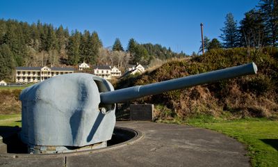
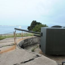
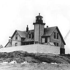
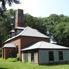
The Brewster Islands Military Reservation occupies Great Brewster Island and Outer Brewster Island, featuring concrete gun emplacements, reinforced shelters, and observation posts scattered across the terrain. These installations face the Atlantic Ocean and show visible damage from decades of exposure to coastal weather.
History
The reservation was built in 1941 during World War II to defend Boston Harbor from attack. It served as a coastal defense system with artillery batteries and underwater mine fields controlled from the islands.
Culture
The military structures across both islands show how the United States protected its harbor during wartime. Visitors can still observe where soldiers would have stationed themselves to watch the ocean from elevated positions.
Practical
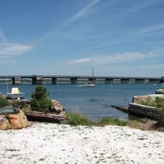
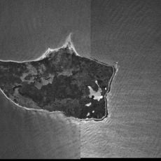
You need a boat to reach the islands, as there is no bridge or causeway from the mainland. Wear sturdy shoes and expect uneven, weathered ground when exploring the structures.
Did you know?
Battery Jewell on Outer Brewster Island was armed with 6-inch guns aimed at the Atlantic. Great Brewster Island housed a mine control station where operators directed underwater mines without seeing them directly.
AroundUs brings together thousands of curated places, local tips, and hidden gems, enriched daily by 60,000 contributors worldwide. Discover all places nearby (United States of America).
Gay Head Light
4.6 km
Nobska Light
27.7 km
Woods Hole Science Aquarium
27.5 km
Demarest Lloyd State Park
22.5 km
Coast Guard Station Woods Hole
27.5 km
Buzzards Bay Entrance Light
13.9 km
Barn House
13 kmLambert's Cove Beach
22 km
Slocum's River Reserve
25.9 kmPolly Hill Arboretum
18.5 km
Tarpaulin Cove Light
18.2 km
Paul Cuffe Farm
27.9 km
Normand Edward Fontaine Bridge
25 km
Barneys Joy Point Military Reservation
20.8 km
Edwin DeVries Vanderhoop Homestead
4.4 km
Woods Hole School
27.7 km
Cuttyhunk Light
10 km
Ritter House
27.1 km
Calf Island Military Reservation
793 m
Westport Point Historic District
25.9 km
Dumpling Rocks Light
22.5 km
Tashmoo Springs Pumping Station
25.4 km
William Street Historic District
27 km
Gay Head-Aquinnah Town Center Historic District
6.2 km
Allens Pond Wildlife Sanctuary
22 km
Martha's Vineyard Museum
27.1 km
Nomans Land Island National Wildlife Refuge
11 km
Dumpling Rocks Light
22.5 kmDiscover hidden gems everywhere you go!
From secret cafés to breathtaking viewpoints, skip the crowded tourist spots and find places that match your style. Our app makes it easy with voice search, smart filtering, route optimization, and insider tips from travelers worldwide. Download now for the complete mobile experience.
A unique approach to discovering new places❞
— Le Figaro
All the places worth exploring❞
— France Info
A tailor-made excursion in just a few clicks❞
— 20 Minutes