Chest opened
+${chestReward.xp} XP
Explorer
NOUVEAU ×${chestReward.collectible.quantity}
tapez pour fermer
Chest locked

Open chests in the app

Around Us is built for your phone — chests unlock when you walk, explore and capture nearby places.

Enable Location

We need your location to show you interesting places around you

Discover nearby places

Find interesting locations and hidden gems around you

Precise directions

Get accurate directions and distances to places

Your location is never shared with other users. It's only used when you tap the location button.

Log in to your account

Start exploring — it's free

Trusted by 72,899 travelers worldwide

Continue with Google
Continue with Apple
or

We will send you a code to connect

By continuing, you accept our Terms and Conditions and our Privacy Policy

Check your inbox

We've sent a pincode in your inbox. Please enter the code below.

Chesapeake Bay Gateways Network
Discussion Reviews Photo
2.5k Popularity

Chesapeake Bay Gateways Network, Ecological network in Chesapeake Bay region, United States.

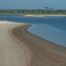
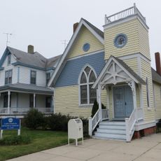
The Chesapeake Bay Gateways Network is a collection of over 150 parks, museums, historic sites, and water trails spread across the bay's surrounding region. It extends from New York down to Virginia and includes nature preserves, trails, and recreational waterways that provide access to the bay and its shores.

The network was established in 1998 to provide public access to the bay's natural and cultural areas. This initiative grew from a need to protect and share the bay's resources for education and recreation.

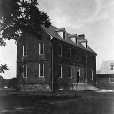
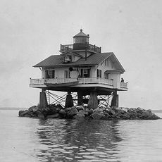
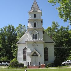
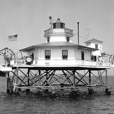
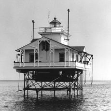
The network showcases Native American heritage, maritime traditions, and historic communities that shaped the region's identity over time. These places show how people have lived with and used the bay for generations.

The network sites have signage and information boards to help visitors navigate and learn about local areas. Checking the network's website before visiting helps you find the activities and locations that match your interests.

Some locations in the network are home to rare cypress trees that recall when Native Americans harvested them for boat building. These trees are a botanical rarity at such northern latitudes, making them notable to encounter during a visit.

The community of curious travelers

AroundUs brings together thousands of curated places, local tips, and hidden gems, enriched daily by 60,000 contributors worldwide.

Start exploring
Inception
1998
GPS coordinates
37.32212,-76.25336
Latest update
December 12, 2025 17:40
Around this place
Moore House
United States of America

Moore House

23.4 km
Wolf Trap Light
United States of America

Wolf Trap Light

9.4 km
Warner Hall
United States of America

Warner Hall

19.9 km
Plum Tree Island National Wildlife Refuge
United States of America

Plum Tree Island National Wildlife Refuge

21.3 km
New Point Comfort Light
United States of America

New Point Comfort Light

3.2 km
Savage Neck Dunes Natural Area Preserve
United States of America

Savage Neck Dunes Natural Area Preserve

21.4 km
Bethel Beach Natural Area Preserve
United States of America

Bethel Beach Natural Area Preserve

9.7 km
Little England
United States of America

Little England

21.2 km
Toddsbury
United States of America

Toddsbury

21.5 km
Old Plantation Flats Light
United States of America

Old Plantation Flats Light

21 km
Zion Poplars Baptist Church
United States of America

Zion Poplars Baptist Church

24 km
Cape Charles Historic District
United States of America

Cape Charles Historic District

21.8 km
Airville
United States of America

Airville

23.3 km
Burgh Westra
United States of America

Burgh Westra

20.8 km
York Spit Light
United States of America

York Spit Light

12.5 km
Lowland Cottage
United States of America

Lowland Cottage

21 km
Lands End
United States of America

Lands End

15.3 km
Poplar Grove Mill and House
United States of America

Poplar Grove Mill and House

11 km
Tue Marshes Light
United States of America

Tue Marshes Light

15.2 km
Cherrystone Bar Light
United States of America

Cherrystone Bar Light

20.9 km
Sibley's and James Store Historic District
United States of America

Sibley's and James Store Historic District

13.9 km
Billups House
United States of America

Billups House

13.6 km
Woodville School
United States of America

Woodville School

23.2 km
Mathews County Courthouse Square
United States of America

Mathews County Courthouse Square

13.8 km
Springdale
United States of America

Springdale

13 km
Fort Cricket Hill
United States of America

Fort Cricket Hill

19 km
Riverlawn
United States of America

Riverlawn

12.5 km
Mathews Downtown Historic District
United States of America

Mathews Downtown Historic District

13.8 km
Show the full map
Reviews
Share your experience

No review yet

Discussions
Start a discussion...

No discussion yet

« Chesapeake Bay Gateways Network - Ecological network in Chesapeake Bay region, United States » is provided by Around Us (aroundus.com). Images and texts are derived from Wikimedia project under a Creative Commons license. You are allowed to copy, distribute, and modify copies of this page, under the conditions set by the license, as long as this note is clearly visible.

Discover hidden gems everywhere you go!

From secret cafés to breathtaking viewpoints, skip the crowded tourist spots and find places that match your style. Our app makes it easy with voice search, smart filtering, route optimization, and insider tips from travelers worldwide. Download now for the complete mobile experience.

Around Us App Screenshot

A unique approach to discovering new places

Le Figaro

All the places worth exploring

France Info

A tailor-made excursion in just a few clicks

20 Minutes

Around Us
Travel Guide & Maps
Download

Send to your phone

QR Code
1

Open the camera app on your mobile.

2

Point at the QR code with your camera. A notification will appear.

3

Tap the notification to open the link.