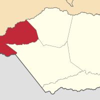
Apure, Venezuelan administrative division in southwestern Venezuela, bordering Colombia.
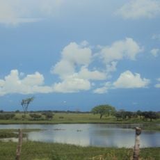
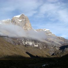
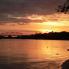
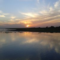
Apure is an administrative region in southwestern Venezuela that borders Colombia. The territory lies in a wide plain that reaches the Orinoco River and is crossed by scattered waterways.
The region separated from Barinas province in 1856. It later joined Guayana temporarily before receiving its final self-governance in 1899.
People here call themselves llaneros and live close to the grasslands. Their music and riding traditions shape daily life and celebrations in the smaller towns.
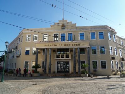
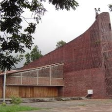
The capital San Fernando de Apure can be reached by road during the dry season. Many routes become impassable or flooded during the rains, so plan your travel timing carefully.
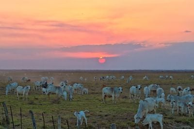
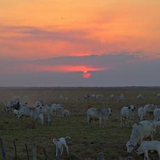
The yearly flooding forces cattle farmers to move their animals. They drive the herds toward higher pastures that remain dry while the plain fills with water.
Location: Venezuela
Inception: 1909
Capital city: San Fernando de Apure
Elevation above the sea: 74 m
Reference: AP
Shares border with: Táchira, Barinas State, Guárico, Bolívar, Vichada Department, Arauca Department, Boyacá Department, Norte de Santander Department
Website: http://apure.gob.ve
GPS coordinates: 7.13333,-69.00000
Latest update: December 13, 2025 16:23
El Cocuy National Park
371.2 km
Basilica of the National Shrine of Our Lady of Coromoto
215.9 km
Santos Luzardo National Park
164.1 km
Estadio Polideportivo de Pueblo Nuevo
360.4 km
Chorro El Indio National Park
356.6 km
Potosí
306.8 km
Estadio Agustín Tovar
212.8 km
El Tamá National Park
354.8 km
Ritacuba Blanco
371.2 km
Hato El Cedral
48.7 km
General Juan Pablo Peñaloza National Park
339 kmHospital Central de San Cristóbal
362.8 kmTamá National Natural Park
356 km
Tapo-Caparo National Park
325 km
José Antonio Páez International Bridget
192.3 km
Basilica of Our Lady of Consolation, Táriba
364.2 km
Cathedral of St. Christopher
364 km
Puente Libertador
364.6 kmRío Viejo San Camilo National Park
341 km
Cathedral of Our Lady of the Pillar
213.5 km
Hato El Frío
81.7 km
Isidore the Laborer Church, Potosí
306.6 kmAbra de Río Frío Natural Monument
362 km
El Cocuy National Park
352 kmUnellez Botanical Garden
216.6 km
Cathedral of Our Lady of Mount Carmel
188.3 km
Iglesia del Divino Redentor
362.4 kmMuseo Alberto Arvelo Torrealba
213.8 kmVisited this place? Tap the stars to rate it and share your experience / photos with the community! Try now! You can cancel it anytime.
Discover hidden gems everywhere you go!
From secret cafés to breathtaking viewpoints, skip the crowded tourist spots and find places that match your style. Our app makes it easy with voice search, smart filtering, route optimization, and insider tips from travelers worldwide. Download now for the complete mobile experience.
A unique approach to discovering new places❞
— Le Figaro
All the places worth exploring❞
— France Info
A tailor-made excursion in just a few clicks❞
— 20 Minutes