Cerro El Ávila, Mountain range in northern Venezuela
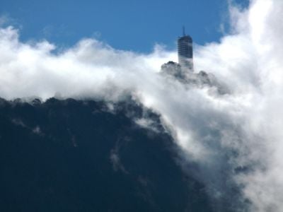
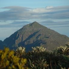
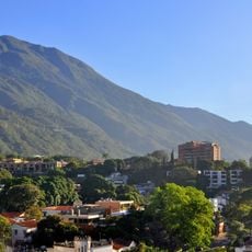
Cerro El Ávila is a mountain range in north-central Venezuela that stretches between Caracas and the Caribbean Sea, rising to about 2,740 meters (9,000 feet) at its highest point. The massif is covered with dense forest vegetation that changes character at different elevations.
The mountain was declared a national park in 1958 to protect the forested slopes that had served as a natural boundary since the 19th century. This decision marked the beginning of organized conservation for this important natural space.
People in Caracas call this mountain the city's lungs because it stands as a natural green barrier above the capital. It serves as a shared landmark that connects residents to the landscape around them.
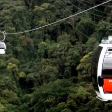
A cable car system connects Caracas to the summit and offers multiple trails suited to different fitness levels. Visitors should expect wind and cooler temperatures at higher elevations compared to the city below.
The mountain contains distinct ecosystems ranging from dry forests at lower elevations to cloud forests high above. This variety allows the slopes to support over 500 bird species and around 120 mammal species.
The community of curious travelers
AroundUs brings together thousands of curated places, local tips, and hidden gems, enriched daily by 60,000 contributors worldwide.