See the monuments around you in AROpen chests in the app
Around Us is built for your phone — point your camera at the streets and discover the monuments and places around you in augmented reality.Around Us is built for your phone — chests unlock when you walk, explore and capture nearby places.
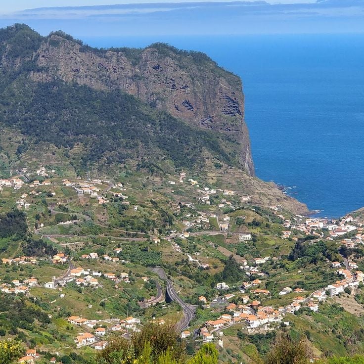
This collection covers the main natural areas and cultural sites across Madeira, a Portuguese island of volcanic origin in the Atlantic Ocean. The route connects coastal regions with highland areas, showcasing the diverse vegetation that results from the subtropical climate and varied elevation levels.
Included locations feature Pico Ruivo, the island's highest peak at 1,861 meters, the sea cliffs at Cabo Girão, the botanical gardens of Funchal with plant collections from multiple continents, and several coastal and mountain viewpoints. The route also incorporates examples of traditional levada irrigation channels, which have distributed water across the island for centuries.
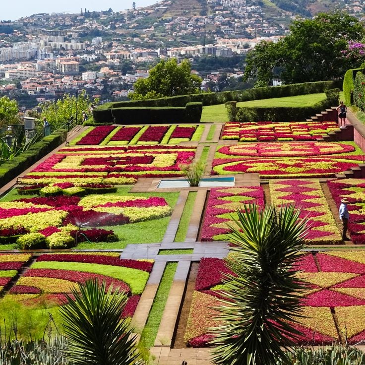
The Madeira Botanical Garden covers 8 hectares in Funchal and contains over 2000 native and exotic plant species. This garden is divided into thematic sections, including areas for Madeiran endemic flora, tropical and subtropical species, and an extensive collection of cacti and succulents. Founded in 1960 on the site of a former private estate, the garden allows visitors to explore the botanical diversity of the island and its historical trade connections.
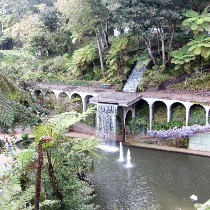
The Monte Palace Gardens occupy 70,000 square meters of terraced slopes in the mountain village of Monte above Funchal. These botanical grounds combine plant species from multiple continents, including South African proteas, New Zealand ferns, and camellia collections. The garden design incorporates Asian elements such as Chinese pagodas, Japanese stone lanterns, and ceramic panels depicting historical scenes. Water features, koi ponds, and sculpture groups divide the different garden sections. The attached museum displays mineral collections and historical Portuguese azulejos tiles.
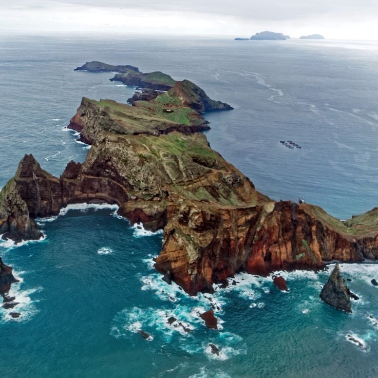
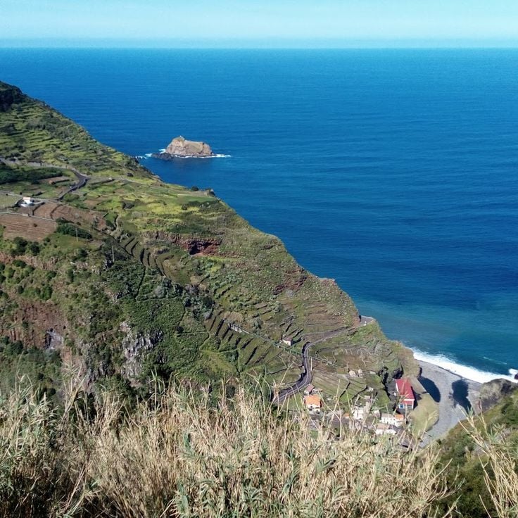
Ponta de São Lourenço forms the easternmost point of Madeira and differs markedly from the rest of the island through its barren, wind-swept landscape. This peninsula of volcanic origin displays rock layers in various shades of red and ochre, exposed through erosion. A marked hiking trail of approximately 8 kilometers leads across the narrow promontory between steep cliffs that drop directly into the sea. From viewpoints along the path, visitors can observe the offshore rock islands of Ilhéu do Farol and Ilhéu da Cevada, as well as the north coast of Madeira.
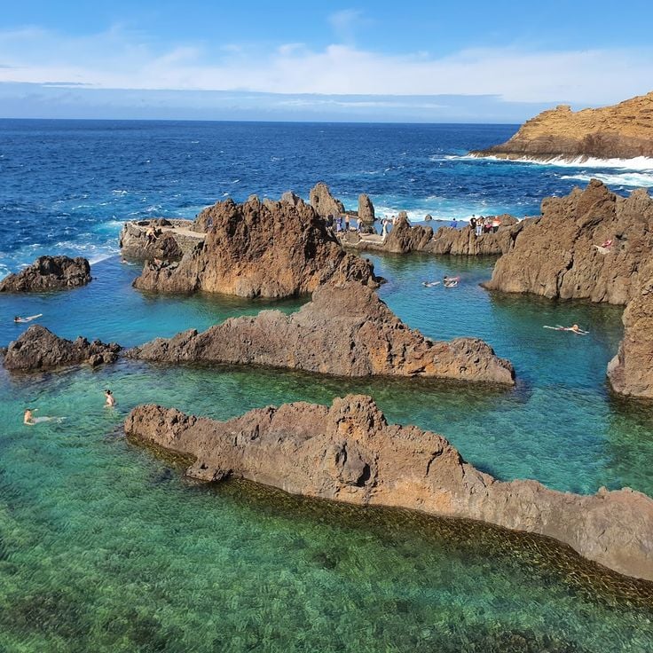
The Natural Pools of Porto Moniz were formed by volcanic lava that cooled when it met the Atlantic Ocean. These pools fill with fresh seawater during high tide and provide safe swimming areas protected from ocean currents. The facility includes changing rooms, showers, and access stairs. The dark lava rock contrasts with the turquoise water. Located on the northwest coast of Madeira, these pools are accessible year-round and attract swimmers and families seeking ocean bathing in a controlled environment.
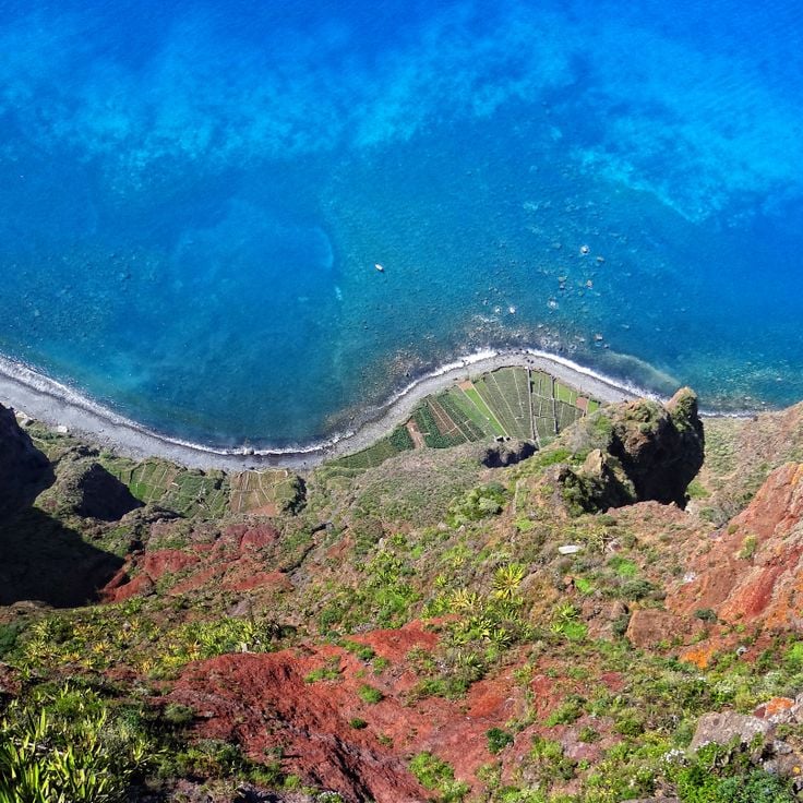
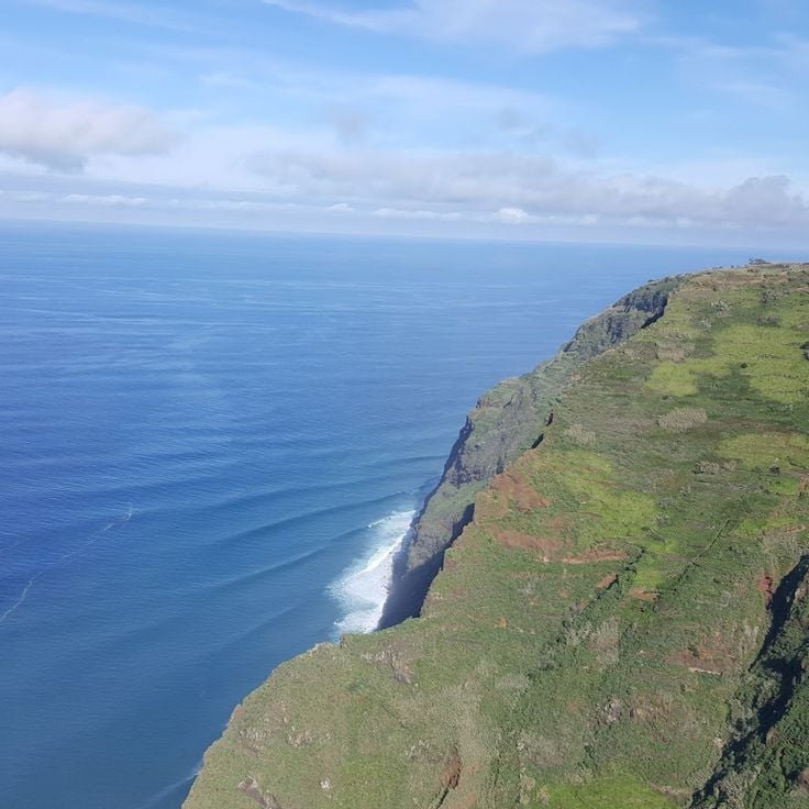
Cabo Girão rises 580 meters above the Atlantic Ocean and belongs to Europe's highest sea cliffs. The glass observation platform extends beyond the precipice and offers views of the terraced fields at the cliff base and Madeira's southern coast. Fishermen work the narrow coastal strips below the cliff, cultivating vegetables and grapevines.
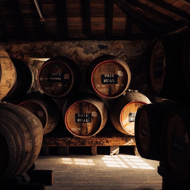
Blandy's Wine Lodge is a historic winery in Funchal, operating since the 17th century. The cellars house large wooden barrels where Madeira wine ages according to traditional methods. Visitors can learn about the production process through guided tours and sample different wine varieties during tastings. The establishment represents the long winemaking tradition of Madeira island.
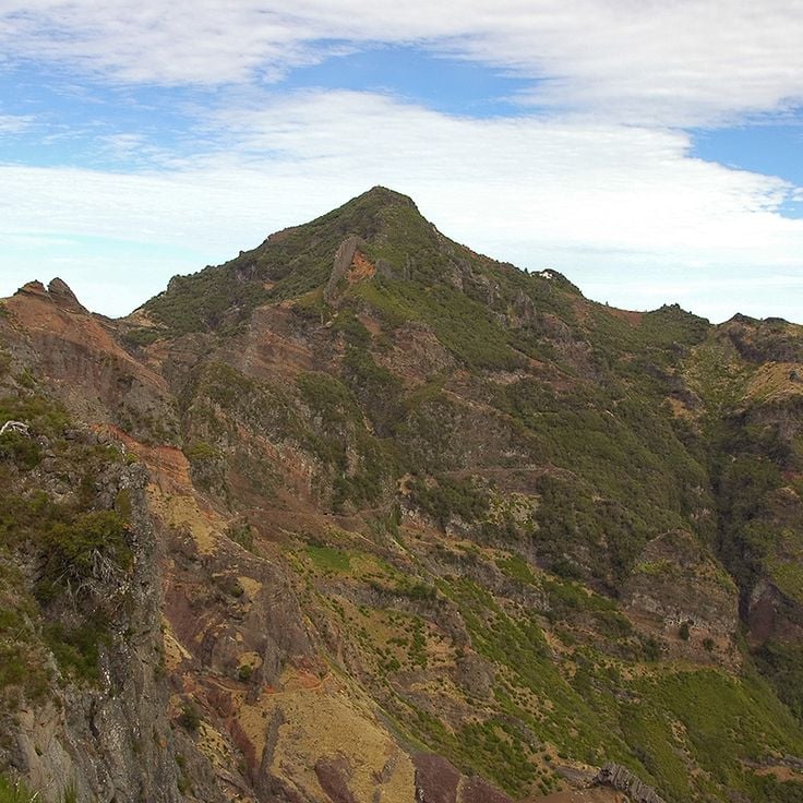
Pico Ruivo stands as Madeira's highest peak at 1862 meters above sea level. The hiking trail winds through laurel forests and volcanic rock formations to reach the summit, where panoramic views extend across the island's mountain ranges and the Atlantic Ocean. The route connects several mountain shelters and on clear days offers visibility to the neighboring island of Porto Santo.
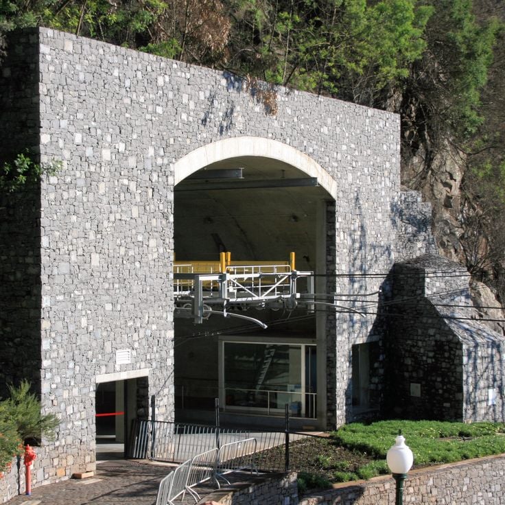
The Madeira Cable Car connects downtown Funchal with the historic Monte neighbourhood, climbing 560 meters in elevation. The journey takes approximately 15 minutes and covers 3.2 kilometers through the island's vegetation. From the gondolas, passengers can observe the houses of Funchal, the harbour, and the surrounding mountains. The cable car opened in 2000 and transports thousands of visitors annually to the pilgrimage church of Nossa Senhora do Monte.
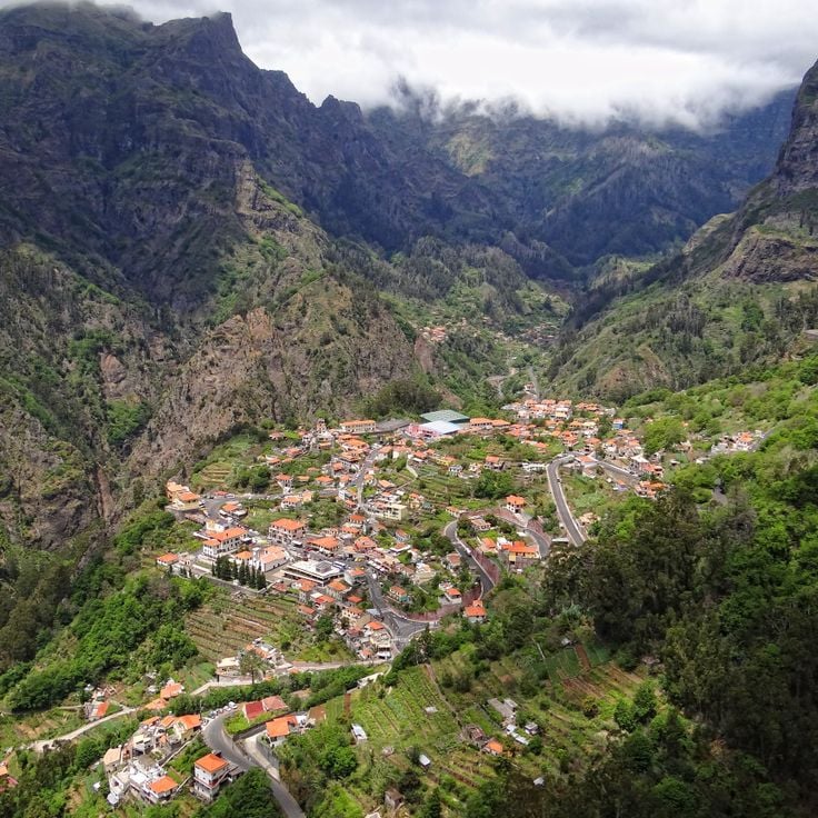
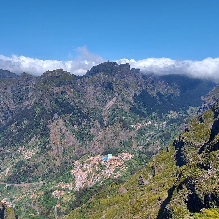
Curral das Freiras occupies a deep valley surrounded by high mountains. The village was accessible only by steep mountain paths until recent decades. Today a cable car connects the settlement with the surrounding area and provides views of the terraces where chestnuts and other crops are cultivated. The mountain slopes rise up to 700 meters above the valley floor. Residents maintain traditional agricultural methods. Several viewpoints allow observation of the valley's geology and the settlement patterns of the region.
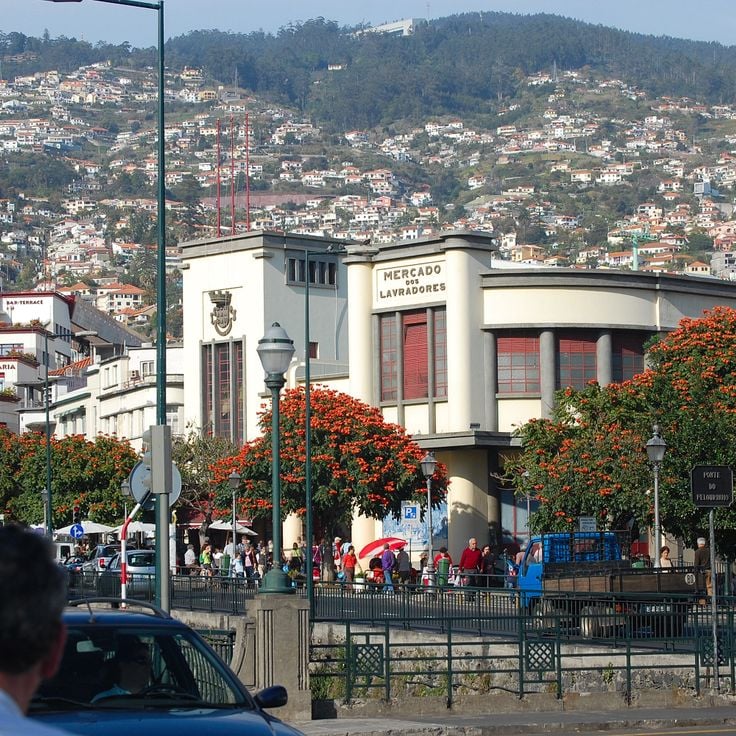
The Mercado dos Lavradores is a two-story covered market hall located in central Funchal. The ground floor hosts fish vendors, while the upper level features fresh fruits, vegetables, and flowers. Sellers dressed in traditional Madeiran costumes offer local produce including tropical fruits, bird-of-paradise flowers, and regional specialties. This market has operated as a central trading place for locals and visitors since 1940.
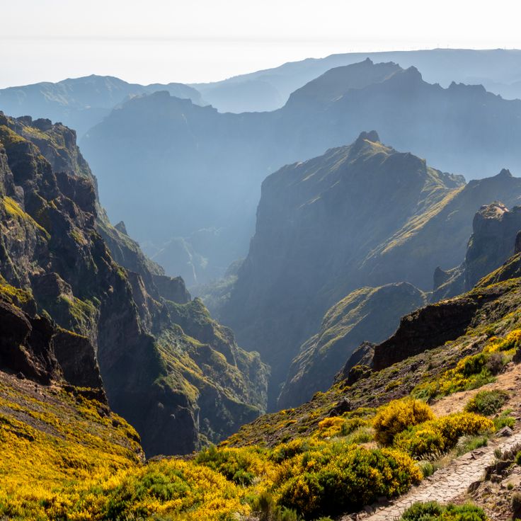
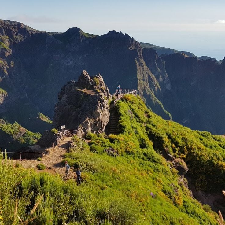
Pico do Arieiro stands at 1818 meters above sea level, making it the third highest peak in Madeira, located in the central mountain range of the island. This mountain offers views across the volcanic mountain chains that characterize the interior of Madeira. The access road reaches close to the summit, where a weather station and viewing platforms are situated. On clear days, visibility extends to the highest summit plateau of the island, Pico Ruivo. The PR1 hiking trail connecting these two peaks is among the most traveled mountain paths in Madeira, crossing various vegetation zones and geological formations along the way.
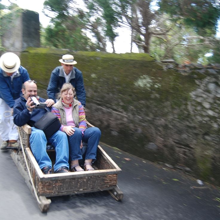
The Monte toboggan ride is a traditional form of transport that has been carrying visitors since 1850. Two experienced drivers steer the woven wicker baskets down the paved roads toward Funchal. The 2-kilometer route passes through residential neighborhoods and offers views of the city and the Atlantic Ocean. This method of travel was originally developed by locals as a practical means of transportation on the steep slopes. The ride takes approximately 10 minutes and reaches speeds of up to 48 kilometers per hour.
Miradouro do Paredão is an observation platform situated at high altitude above Curral das Freiras. From this viewpoint, visitors can observe the steep mountain walls surrounding the valley and the surrounding peaks of Madeira's central mountain range. On clear days, the view extends to the southern coast and the Atlantic Ocean. The platform is accessible via a paved road and provides a complete panoramic view of the island's volcanic topography.
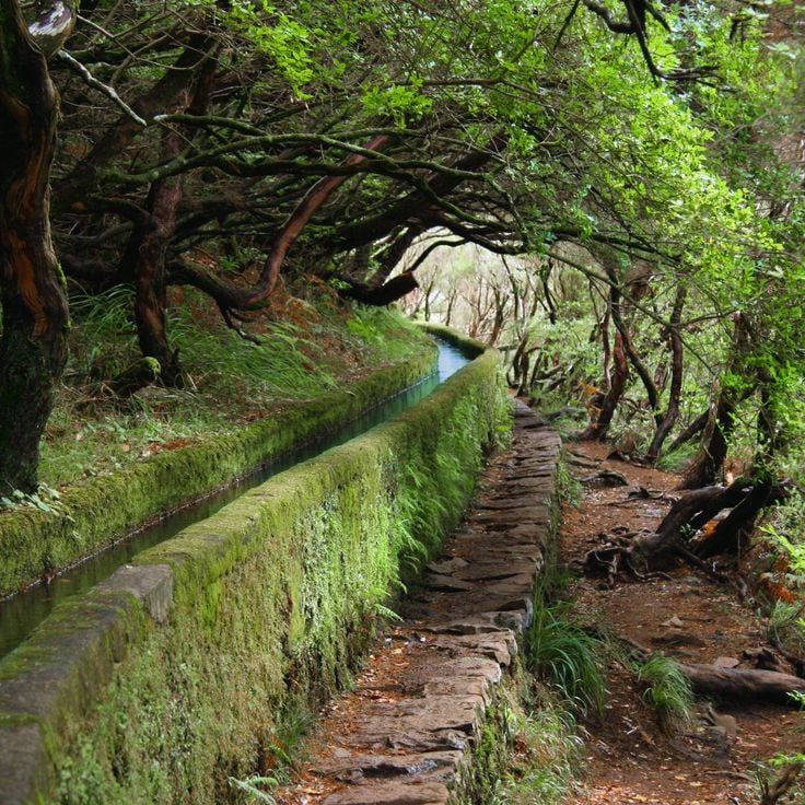
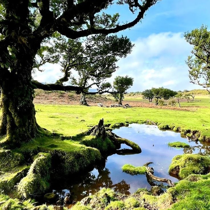
The Levada do Rabaçal is a historic stone irrigation system extending 25 kilometers through the mountains of Madeira. These water channels were constructed to transport water from high-rainfall areas to agricultural lands. The walking path along this levada passes through dense laurel forests, alongside multiple waterfalls, and provides insight into the island's endemic flora. The route connects various elevations and allows observation of different vegetation zones of the highlands.
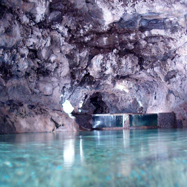
The São Vicente Caves formed 890,000 years ago through volcanic activity in northern Madeira. The lava tunnels extend over 700 meters and display various geological formations including stalactites, lava tongues, and layered rock structures. The attached Volcanism Centre presents the geological formation of Madeira through multimedia exhibitions, documenting the volcanic processes that led to the island's creation.
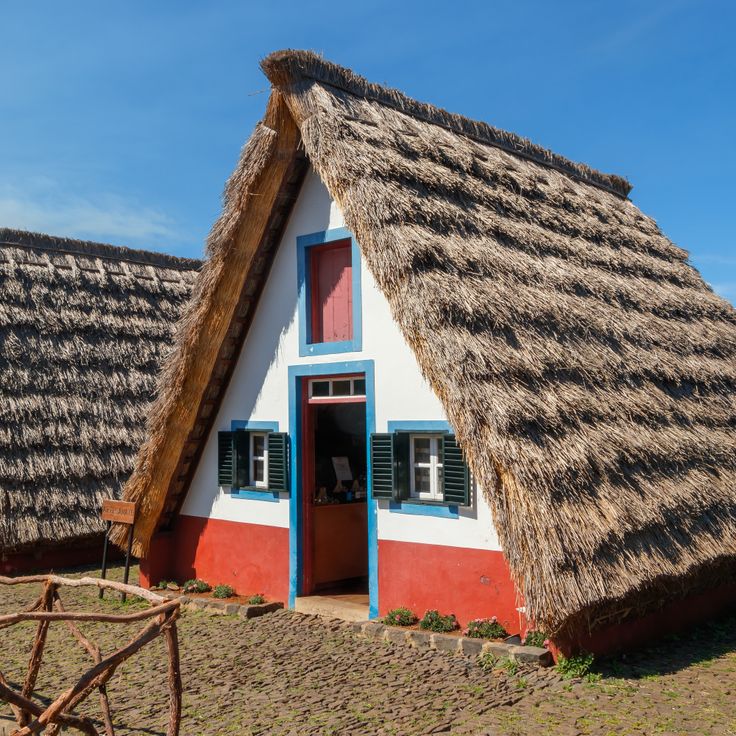
The Santana Houses are traditional wooden structures with thatched roofs extending to the ground. These triangular buildings are painted white and blue, representing the typical construction method of the region. The houses originally provided shelter for farmers and today stand as symbols of Madeiran architecture. Several structures have been restored and are open to visitors. They are situated primarily in the northern part of the island and illustrate the historical lifestyle of the rural community.
Queimadas Forest is located in the northern part of Madeira and consists primarily of laurel trees and tree heathers, which form part of the island's laurel forest. Several hiking trails traverse this forested area, passing through dense vegetation that includes numerous endemic plant species native to Madeira. The paths connect different points within the area and allow exploration of the natural environment. The forest serves as a starting point for hikes to other parts of the island.
Balcões Viewpoint is located within the Ribeiro Frio Nature Reserve and provides views over the Ribeira da Metade valley. This observation platform can be reached after a short walk through the laurel forest. From here, visitors can see the forested slopes and mountain peaks of Madeira's central mountain range. The site is frequently visited by hikers exploring the levada trails in the area.
The Miradouro do Ninho da Manta is located at Pico do Arieiro, the third highest peak in Madeira at 1,818 meters above sea level. This viewpoint offers a direct view of the Fajã da Nogueira valley, which extends deep below. From here, visitors can observe the mountain formation of the island's central mountain range. The location sits along the hiking route that connects Pico do Arieiro with Pico Ruivo.
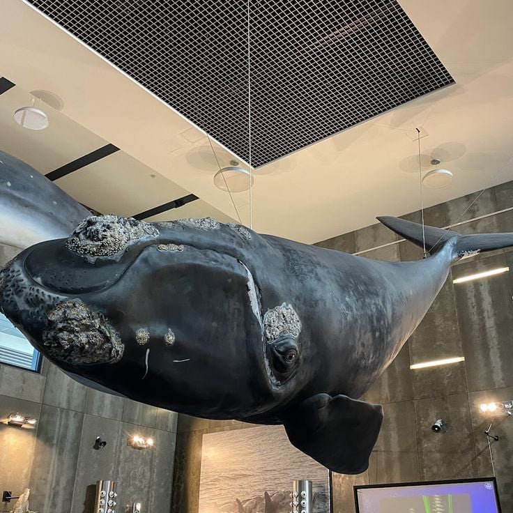
The Whale Museum in Calheta documents the history of whaling in Madeira. The exhibition displays historical tools, photographs, and equipment used by whalers. Visitors learn about the economic importance of whaling for the island and the development of this industry from the 19th century until its end in the 1980s. The museum also presents information about whale species found in the waters around Madeira and current conservation efforts for these marine mammals.
Fanal Forest sits on the Paul da Serra plateau at approximately 1,100 meters elevation. This ancient laurel woodland forms part of the UNESCO-listed Laurisilva of Madeira and consists primarily of Madeira laurel trees, whose twisted trunks and branches are frequently enveloped in fog. The trees are often covered with lichens and mosses, giving the forest a characteristic appearance. The area serves as an important water reservoir for the island and offers several hiking trails through the vegetation.
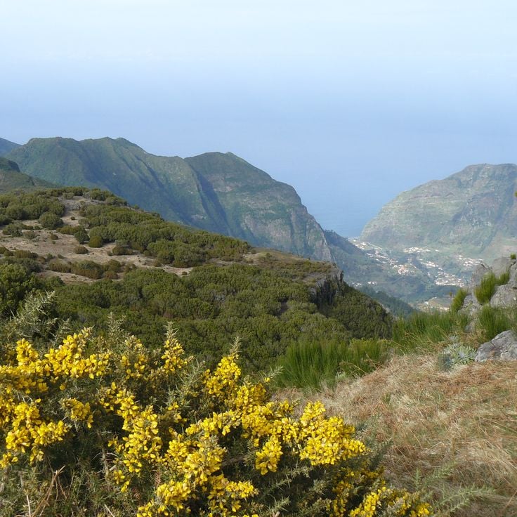
Miradouro do Espigão is an observation point located in Ribeira Brava municipality, offering expansive views over the Ribeira da Água valley. The steep slopes are covered with dense vegetation characteristic of Madeira's mountain regions. From this vantage point, visitors can observe the geological formations and natural plant cover favored by the humid climate of higher elevations. The viewpoint serves as a stopping point on hiking routes that traverse the central mountainous interior of the island.
The Miradouro da Bica da Cana is positioned at 1560 meters elevation on the Paul da Serra plateau. This viewpoint provides views over the surrounding mountain ranges and valleys of Madeira. The location on the island's largest plateau offers wide perspectives across the central region.
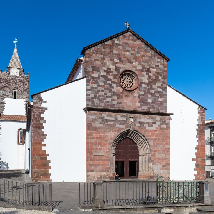
The Sé Cathedral of Funchal was constructed in the 15th century in Manueline style and serves as the main church of the city. The building is characterized by its cedar wood ceiling and traditional Portuguese azulejo tiles. The cathedral combines Gothic and Manueline architectural elements and stands in the historical center of Funchal. The interior houses several altars and religious artworks from different periods.
Miradouro Achadas da Cruz sits on a clifftop in northwestern Madeira and provides direct views of the Atlantic Ocean. From this observation point, visitors overlook the small settlement of Fajã das Achadas da Cruz, located approximately 450 meters below at sea level. A cable car connects the viewpoint to the village below, enabling access to the terraced fields and houses of the inhabitants. This location demonstrates the steep coastal formation of Madeira and the traditional agriculture practiced on difficult terrain.
The Madeira Theme Park in Santana is an open-air museum dedicated to the history, crafts, and traditions of the island. Visitors can explore the grounds and discover traditional Madeiran houses that showcase the region's typical architecture. The park features several thematic areas, including exhibitions on agricultural practices, traditional professions, and the daily life of island inhabitants. Local gardens with native plant species complement the historical buildings and provide insight into Madeira's natural environment.
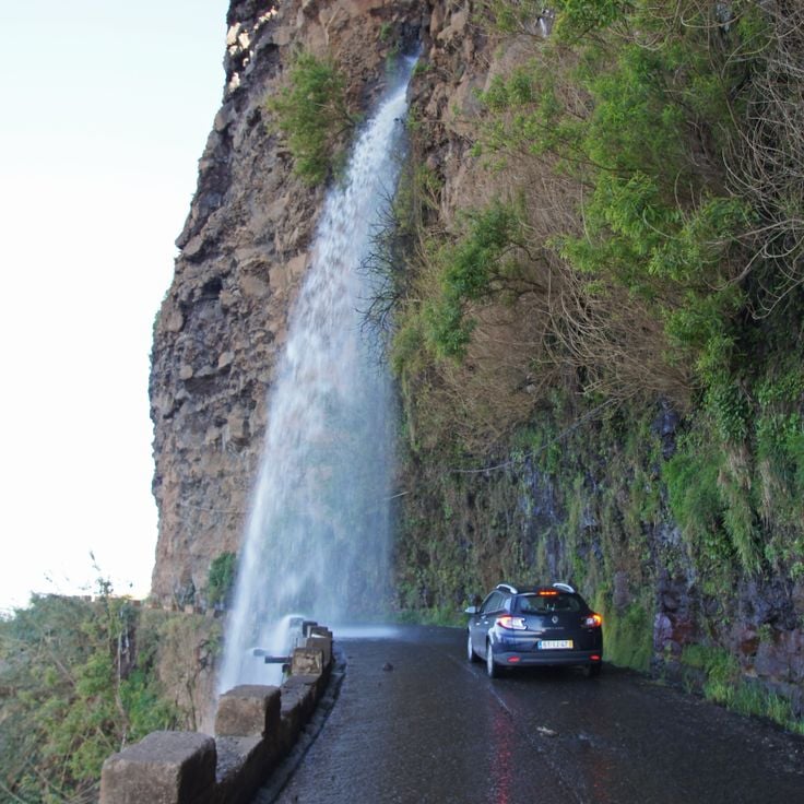
Cascata dos Anjos is a natural waterfall that flows directly onto the coastal road between Ponta do Sol and Madalena do Mar. The water descends from approximately 30 meters high down the cliff face, creating a curtain over the roadway. Vehicles drive through this wall of water as the freshwater splashes onto windshields. The waterfall originates from spring water coming from the mountains above the road.
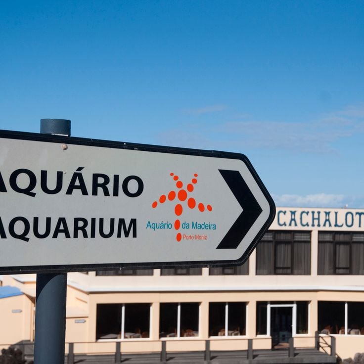
The Madeira Aquarium is located in Porto Moniz on the northwest coast of the island. This facility houses eleven tanks containing fish and invertebrates from the Atlantic Ocean. The exhibition focuses on marine fauna found in the waters surrounding Madeira, presenting species that inhabit different depths of the archipelago. Visitors can observe the diversity of local underwater life through educational displays.
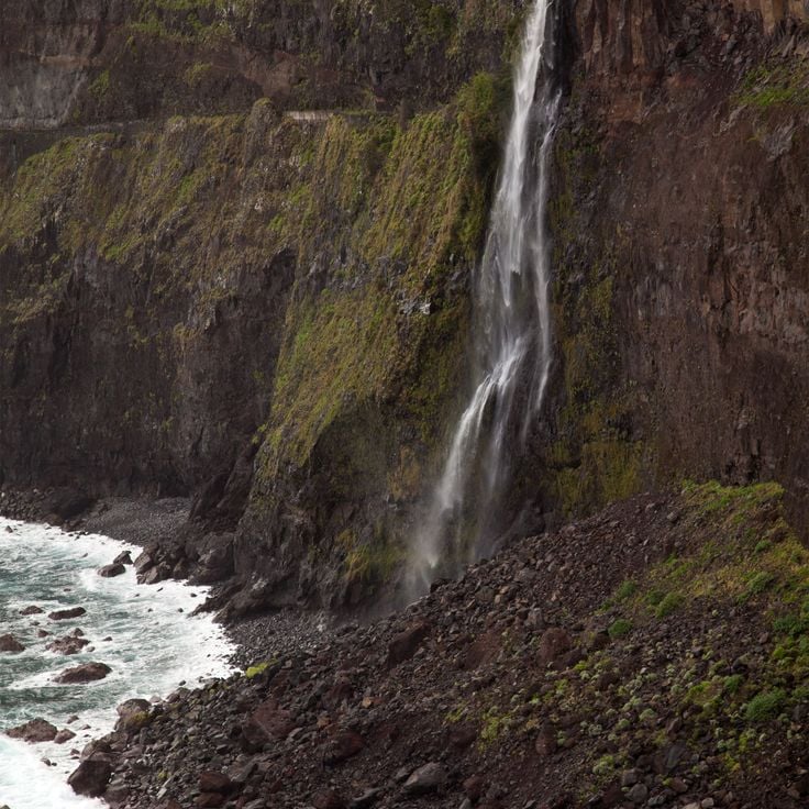
Cascata do Véu da Noiva is a waterfall that drops 120 meters down a rock face. The water flows directly from the island's mountains, forming a thin veil that gives the formation its name. The waterfall is located along the VE2 coastal road between São Vicente and Seixal and can be observed from several viewpoints along the route. Water volume varies depending on the season and rainfall.
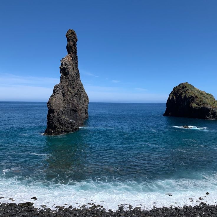
The Bridge of Ribeira da Janela is a geological formation created by marine erosion over thousands of years. This natural arch of volcanic rock rises 25 meters above the Atlantic Ocean, forming a distinctive coastal landmark. The rock formation stands in the water off the northwest coast of Madeira and can be viewed from the coastal road and surrounding cliffs.
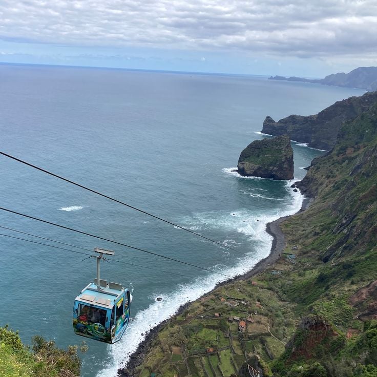
The Rocha do Navio Cable Car connects the plateau above with a pebble beach on Madeira's northern coast. The cabin descends 350 meters during a five-minute journey along the steep cliff face. This installation provides access to an isolated coastal area that was previously reachable only by a steep footpath. The beach serves as a mooring point for local fishing boats.
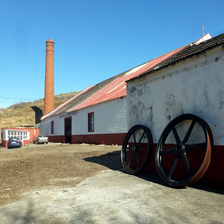
The Porto da Cruz Distillery is a 19th-century industrial complex that houses original functioning machinery for rum production. The facility produces traditional Madeiran sugarcane rum, known as aguardente. During guided tours, visitors can observe the historic steam engines, mills, and distillation apparatus. Guides explain each step of the manufacturing process, from sugarcane processing to distillation and aging of the rum.
Miradouro da Portela stands at 670 meters elevation along the ER110 regional road in northern Madeira. This viewpoint provides views over the village of Porto da Cruz, the terraced fields of the agricultural valley, and the Atlantic Ocean. The location allows observation of the coastline and surrounding mountain slopes used for sugarcane and vine cultivation.
The Madeira Botanical Garden covers 8 hectares in Funchal and contains over 2000 native and exotic plant species. This garden is divided into thematic sections, including areas for Madeiran endemic flora, tropical and subtropical species, and an extensive collection of cacti and succulents. Founded in 1960 on the site of a former private estate, the garden allows visitors to explore the botanical diversity of the island and its historical trade connections.
The Monte Palace Gardens occupy 70,000 square meters of terraced slopes in the mountain village of Monte above Funchal. These botanical grounds combine plant species from multiple continents, including South African proteas, New Zealand ferns, and camellia collections. The garden design incorporates Asian elements such as Chinese pagodas, Japanese stone lanterns, and ceramic panels depicting historical scenes. Water features, koi ponds, and sculpture groups divide the different garden sections. The attached museum displays mineral collections and historical Portuguese azulejos tiles.
Ponta de São Lourenço forms the easternmost point of Madeira and differs markedly from the rest of the island through its barren, wind-swept landscape. This peninsula of volcanic origin displays rock layers in various shades of red and ochre, exposed through erosion. A marked hiking trail of approximately 8 kilometers leads across the narrow promontory between steep cliffs that drop directly into the sea. From viewpoints along the path, visitors can observe the offshore rock islands of Ilhéu do Farol and Ilhéu da Cevada, as well as the north coast of Madeira.
The Natural Pools of Porto Moniz were formed by volcanic lava that cooled when it met the Atlantic Ocean. These pools fill with fresh seawater during high tide and provide safe swimming areas protected from ocean currents. The facility includes changing rooms, showers, and access stairs. The dark lava rock contrasts with the turquoise water. Located on the northwest coast of Madeira, these pools are accessible year-round and attract swimmers and families seeking ocean bathing in a controlled environment.
Cabo Girão rises 580 meters above the Atlantic Ocean and belongs to Europe's highest sea cliffs. The glass observation platform extends beyond the precipice and offers views of the terraced fields at the cliff base and Madeira's southern coast. Fishermen work the narrow coastal strips below the cliff, cultivating vegetables and grapevines.
Blandy's Wine Lodge is a historic winery in Funchal, operating since the 17th century. The cellars house large wooden barrels where Madeira wine ages according to traditional methods. Visitors can learn about the production process through guided tours and sample different wine varieties during tastings. The establishment represents the long winemaking tradition of Madeira island.
Pico Ruivo stands as Madeira's highest peak at 1862 meters above sea level. The hiking trail winds through laurel forests and volcanic rock formations to reach the summit, where panoramic views extend across the island's mountain ranges and the Atlantic Ocean. The route connects several mountain shelters and on clear days offers visibility to the neighboring island of Porto Santo.
The Madeira Cable Car connects downtown Funchal with the historic Monte neighbourhood, climbing 560 meters in elevation. The journey takes approximately 15 minutes and covers 3.2 kilometers through the island's vegetation. From the gondolas, passengers can observe the houses of Funchal, the harbour, and the surrounding mountains. The cable car opened in 2000 and transports thousands of visitors annually to the pilgrimage church of Nossa Senhora do Monte.
Curral das Freiras occupies a deep valley surrounded by high mountains. The village was accessible only by steep mountain paths until recent decades. Today a cable car connects the settlement with the surrounding area and provides views of the terraces where chestnuts and other crops are cultivated. The mountain slopes rise up to 700 meters above the valley floor. Residents maintain traditional agricultural methods. Several viewpoints allow observation of the valley's geology and the settlement patterns of the region.
The Mercado dos Lavradores is a two-story covered market hall located in central Funchal. The ground floor hosts fish vendors, while the upper level features fresh fruits, vegetables, and flowers. Sellers dressed in traditional Madeiran costumes offer local produce including tropical fruits, bird-of-paradise flowers, and regional specialties. This market has operated as a central trading place for locals and visitors since 1940.
Pico do Arieiro stands at 1818 meters above sea level, making it the third highest peak in Madeira, located in the central mountain range of the island. This mountain offers views across the volcanic mountain chains that characterize the interior of Madeira. The access road reaches close to the summit, where a weather station and viewing platforms are situated. On clear days, visibility extends to the highest summit plateau of the island, Pico Ruivo. The PR1 hiking trail connecting these two peaks is among the most traveled mountain paths in Madeira, crossing various vegetation zones and geological formations along the way.
The Monte toboggan ride is a traditional form of transport that has been carrying visitors since 1850. Two experienced drivers steer the woven wicker baskets down the paved roads toward Funchal. The 2-kilometer route passes through residential neighborhoods and offers views of the city and the Atlantic Ocean. This method of travel was originally developed by locals as a practical means of transportation on the steep slopes. The ride takes approximately 10 minutes and reaches speeds of up to 48 kilometers per hour.
Miradouro do Paredão is an observation platform situated at high altitude above Curral das Freiras. From this viewpoint, visitors can observe the steep mountain walls surrounding the valley and the surrounding peaks of Madeira's central mountain range. On clear days, the view extends to the southern coast and the Atlantic Ocean. The platform is accessible via a paved road and provides a complete panoramic view of the island's volcanic topography.
The Levada do Rabaçal is a historic stone irrigation system extending 25 kilometers through the mountains of Madeira. These water channels were constructed to transport water from high-rainfall areas to agricultural lands. The walking path along this levada passes through dense laurel forests, alongside multiple waterfalls, and provides insight into the island's endemic flora. The route connects various elevations and allows observation of different vegetation zones of the highlands.
The São Vicente Caves formed 890,000 years ago through volcanic activity in northern Madeira. The lava tunnels extend over 700 meters and display various geological formations including stalactites, lava tongues, and layered rock structures. The attached Volcanism Centre presents the geological formation of Madeira through multimedia exhibitions, documenting the volcanic processes that led to the island's creation.
The Santana Houses are traditional wooden structures with thatched roofs extending to the ground. These triangular buildings are painted white and blue, representing the typical construction method of the region. The houses originally provided shelter for farmers and today stand as symbols of Madeiran architecture. Several structures have been restored and are open to visitors. They are situated primarily in the northern part of the island and illustrate the historical lifestyle of the rural community.
Queimadas Forest is located in the northern part of Madeira and consists primarily of laurel trees and tree heathers, which form part of the island's laurel forest. Several hiking trails traverse this forested area, passing through dense vegetation that includes numerous endemic plant species native to Madeira. The paths connect different points within the area and allow exploration of the natural environment. The forest serves as a starting point for hikes to other parts of the island.
Balcões Viewpoint is located within the Ribeiro Frio Nature Reserve and provides views over the Ribeira da Metade valley. This observation platform can be reached after a short walk through the laurel forest. From here, visitors can see the forested slopes and mountain peaks of Madeira's central mountain range. The site is frequently visited by hikers exploring the levada trails in the area.
The Miradouro do Ninho da Manta is located at Pico do Arieiro, the third highest peak in Madeira at 1,818 meters above sea level. This viewpoint offers a direct view of the Fajã da Nogueira valley, which extends deep below. From here, visitors can observe the mountain formation of the island's central mountain range. The location sits along the hiking route that connects Pico do Arieiro with Pico Ruivo.
The Whale Museum in Calheta documents the history of whaling in Madeira. The exhibition displays historical tools, photographs, and equipment used by whalers. Visitors learn about the economic importance of whaling for the island and the development of this industry from the 19th century until its end in the 1980s. The museum also presents information about whale species found in the waters around Madeira and current conservation efforts for these marine mammals.
Fanal Forest sits on the Paul da Serra plateau at approximately 1,100 meters elevation. This ancient laurel woodland forms part of the UNESCO-listed Laurisilva of Madeira and consists primarily of Madeira laurel trees, whose twisted trunks and branches are frequently enveloped in fog. The trees are often covered with lichens and mosses, giving the forest a characteristic appearance. The area serves as an important water reservoir for the island and offers several hiking trails through the vegetation.
Miradouro do Espigão is an observation point located in Ribeira Brava municipality, offering expansive views over the Ribeira da Água valley. The steep slopes are covered with dense vegetation characteristic of Madeira's mountain regions. From this vantage point, visitors can observe the geological formations and natural plant cover favored by the humid climate of higher elevations. The viewpoint serves as a stopping point on hiking routes that traverse the central mountainous interior of the island.
The Miradouro da Bica da Cana is positioned at 1560 meters elevation on the Paul da Serra plateau. This viewpoint provides views over the surrounding mountain ranges and valleys of Madeira. The location on the island's largest plateau offers wide perspectives across the central region.
The Sé Cathedral of Funchal was constructed in the 15th century in Manueline style and serves as the main church of the city. The building is characterized by its cedar wood ceiling and traditional Portuguese azulejo tiles. The cathedral combines Gothic and Manueline architectural elements and stands in the historical center of Funchal. The interior houses several altars and religious artworks from different periods.
Miradouro Achadas da Cruz sits on a clifftop in northwestern Madeira and provides direct views of the Atlantic Ocean. From this observation point, visitors overlook the small settlement of Fajã das Achadas da Cruz, located approximately 450 meters below at sea level. A cable car connects the viewpoint to the village below, enabling access to the terraced fields and houses of the inhabitants. This location demonstrates the steep coastal formation of Madeira and the traditional agriculture practiced on difficult terrain.
The Madeira Theme Park in Santana is an open-air museum dedicated to the history, crafts, and traditions of the island. Visitors can explore the grounds and discover traditional Madeiran houses that showcase the region's typical architecture. The park features several thematic areas, including exhibitions on agricultural practices, traditional professions, and the daily life of island inhabitants. Local gardens with native plant species complement the historical buildings and provide insight into Madeira's natural environment.
Cascata dos Anjos is a natural waterfall that flows directly onto the coastal road between Ponta do Sol and Madalena do Mar. The water descends from approximately 30 meters high down the cliff face, creating a curtain over the roadway. Vehicles drive through this wall of water as the freshwater splashes onto windshields. The waterfall originates from spring water coming from the mountains above the road.
The Madeira Aquarium is located in Porto Moniz on the northwest coast of the island. This facility houses eleven tanks containing fish and invertebrates from the Atlantic Ocean. The exhibition focuses on marine fauna found in the waters surrounding Madeira, presenting species that inhabit different depths of the archipelago. Visitors can observe the diversity of local underwater life through educational displays.
Cascata do Véu da Noiva is a waterfall that drops 120 meters down a rock face. The water flows directly from the island's mountains, forming a thin veil that gives the formation its name. The waterfall is located along the VE2 coastal road between São Vicente and Seixal and can be observed from several viewpoints along the route. Water volume varies depending on the season and rainfall.
The Bridge of Ribeira da Janela is a geological formation created by marine erosion over thousands of years. This natural arch of volcanic rock rises 25 meters above the Atlantic Ocean, forming a distinctive coastal landmark. The rock formation stands in the water off the northwest coast of Madeira and can be viewed from the coastal road and surrounding cliffs.
The Rocha do Navio Cable Car connects the plateau above with a pebble beach on Madeira's northern coast. The cabin descends 350 meters during a five-minute journey along the steep cliff face. This installation provides access to an isolated coastal area that was previously reachable only by a steep footpath. The beach serves as a mooring point for local fishing boats.
The Porto da Cruz Distillery is a 19th-century industrial complex that houses original functioning machinery for rum production. The facility produces traditional Madeiran sugarcane rum, known as aguardente. During guided tours, visitors can observe the historic steam engines, mills, and distillation apparatus. Guides explain each step of the manufacturing process, from sugarcane processing to distillation and aging of the rum.
Miradouro da Portela stands at 670 meters elevation along the ER110 regional road in northern Madeira. This viewpoint provides views over the village of Porto da Cruz, the terraced fields of the agricultural valley, and the Atlantic Ocean. The location allows observation of the coastline and surrounding mountain slopes used for sugarcane and vine cultivation.