Natural beauties and historical sites of Tajikistan
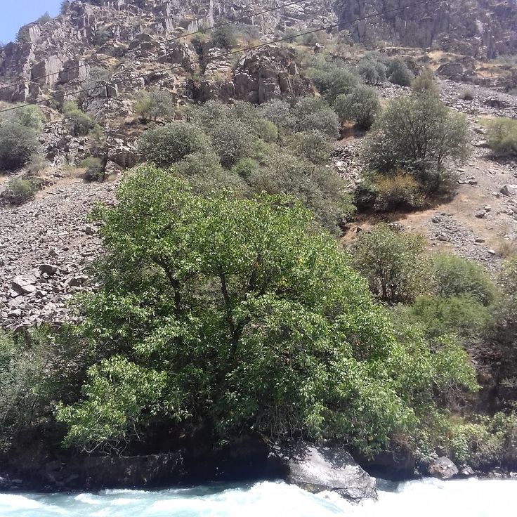
Tajikistan is a land of dramatic contrasts shaped by towering mountains and deep river valleys. The country sits at the crossroads of Central Asia, where ancient trade routes once connected empires and cultures. Today, visitors find themselves in a landscape dominated by peaks that reach beyond 5000 meters, alpine lakes fed by glacial waters, and hot springs that emerge from the earth in high mountain passes. Medieval fortresses still stand in remote valleys, telling stories of centuries past, while archaeological sites scattered across the country reveal traces of civilizations that flourished here long ago.
In the capital, Dushanbe, the pace of life feels different from the mountains. Museums house artifacts and objects that help explain the country's history, while theaters host performances and parks offer spaces where people gather. Just outside the city, the Varzob Valley and Hissar Fortress show how the past remains present in everyday landscapes. The nearby Fann Mountains and their Seven Lakes draw visitors who want to walk through high terrain and see water so clear it reflects the sky.
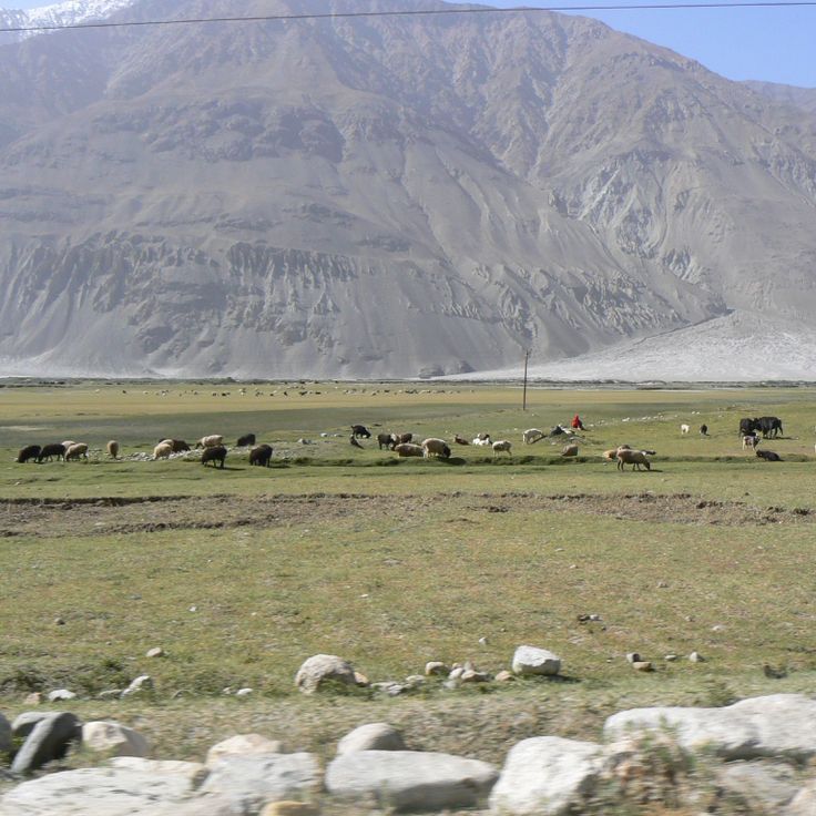
For those seeking adventure, the Pamir Highway cuts through some of the world's highest mountain terrain, linking small towns and settlements that seem to exist on the edge of the world. Iskanderkul Lake and Garm Chashma Spring sit along these routes, offering places to stop and rest. The road itself becomes part of the journey, passing through Wakhan Valley where Yamchun Fortress overlooks the landscape, a reminder that people have long found ways to live and thrive in these mountains. Each location tells a different story about what life looks like when you live surrounded by some of the earth's most imposing natural forms.
Natural beauties and historical sites of Tajikistan
Tajikistan is a land of dramatic contrasts shaped by towering mountains and deep river valleys. The country sits at the crossroads of Central Asia, where ancient trade routes once connected empires and cultures. Today, visitors find themselves in a landscape dominated by peaks that reach beyond 5000 meters, alpine lakes fed by glacial waters, and hot springs that emerge from the earth in high mountain passes. Medieval fortresses still stand in remote valleys, telling stories of centuries past, while archaeological sites scattered across the country reveal traces of civilizations that flourished here long ago.
In the capital, Dushanbe, the pace of life feels different from the mountains. Museums house artifacts and objects that help explain the country's history, while theaters host performances and parks offer spaces where people gather. Just outside the city, the Varzob Valley and Hissar Fortress show how the past remains present in everyday landscapes. The nearby Fann Mountains and their Seven Lakes draw visitors who want to walk through high terrain and see water so clear it reflects the sky.
For those seeking adventure, the Pamir Highway cuts through some of the world's highest mountain terrain, linking small towns and settlements that seem to exist on the edge of the world. Iskanderkul Lake and Garm Chashma Spring sit along these routes, offering places to stop and rest. The road itself becomes part of the journey, passing through Wakhan Valley where Yamchun Fortress overlooks the landscape, a reminder that people have long found ways to live and thrive in these mountains. Each location tells a different story about what life looks like when you live surrounded by some of the earth's most imposing natural forms.
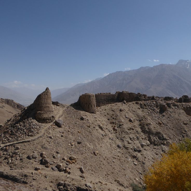
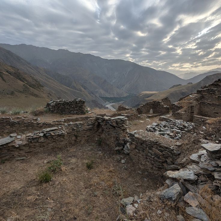
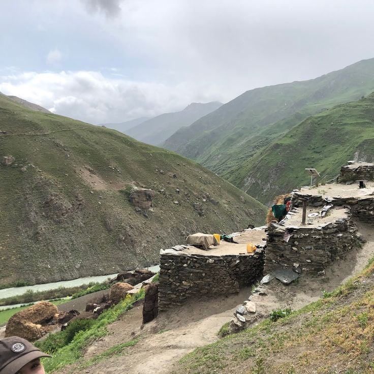
Yamchun Fortress is a military construction from the 3rd century that sits in a remote valley within the Pamir region. This fortress shows how people have lived in the highest mountains of the world across many centuries. The stone walls stretch across several levels along a mountain slope at 3000 meters altitude. As part of the natural beauties and historical sites of Tajikistan, Yamchun Fortress offers a view into the ancient past of the country.
The Pamir Highway is a high-altitude international road that spans 1200 km through the mountains of Tajikistan and plays a central role in the collection of the country's natural beauties and historical sites. This route connects small towns and settlements that seem to exist on the edge of the world, leading visitors through some of the earth's highest mountain terrain. Along the way, you pass places like Iskanderkul Lake and Garm Chashma Spring, where you can stop and rest. The road itself becomes part of the journey as it passes through Wakhan Valley, where Yamchun Fortress overlooks the landscape. At its highest point of 4655 meters at Ak-Baital Pass, the Pamir Highway shows how people have long found ways to live and thrive in these mountains.
The Fann Mountains are part of Tajikistan's natural beauties and historical sites, showcasing the dramatic contrasts of this mountain landscape. With more than ten peaks exceeding 5000 meters, this range shapes the Sughd Province region. Glaciers and deep valleys cut through the Fann Mountains, making it a key part of the Pamir system. Visitors who trek here experience the raw beauty of high peaks and encounter lakes whose waters mirror the sky above.
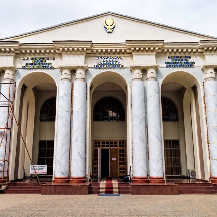
The National Museum of Tajikistan tells the story of the country through objects spanning from ancient times to today. Its collection spreads across three floors, showing archaeological finds, traditional crafts, and artworks that reveal how people have lived in this mountainous land. Walking through the museum, you see evidence of civilizations that flourished here centuries ago, connecting the modern nation to its past. The museum helps visitors understand that Tajikistan's story extends beyond its mountains and valleys to include the cultures and traditions of the people who call this place home.
The Varzob Valley is a natural corridor traversed by the Varzob River, bordered by mountains. This valley connects the capital Dushanbe to the northern mountainous regions and serves as a vital link between the city and the higher terrain of the country.
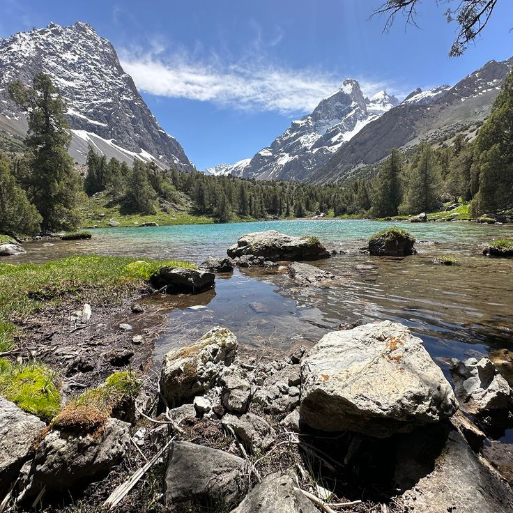
The Seven Lakes are a collection of alpine lakes in Sughd Province, part of Tajikistan's natural beauties and historical sites. These lakes connect to each other through natural waterfalls, and each lake displays a different color based on its depth and composition. This location offers visitors the chance to walk through high terrain and see water so clear it reflects the sky.
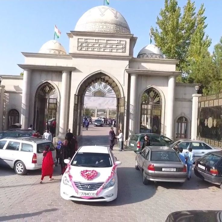
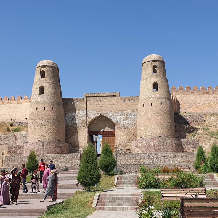
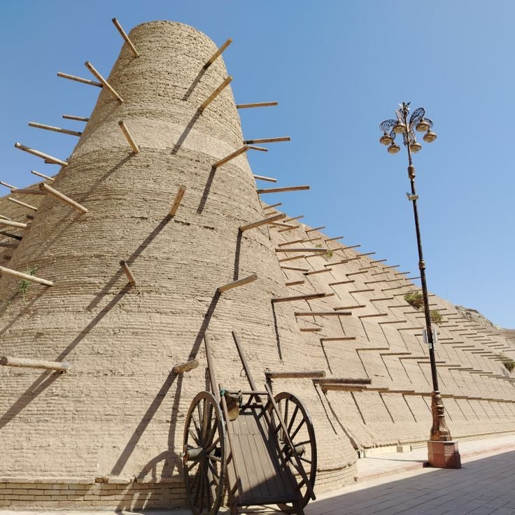
Hissar Fortress is a military structure from the 16th century and part of Tajikistan's natural beauties and historical sites. Located near the capital, Dushanbe, this fortress shows how the past remains present in everyday landscapes. The fortress features two entrance towers and is accompanied by an old madrasa and a mosque that sit adjacent to the main enclosure. The site tells of centuries when people built and lived in Tajikistan's valleys, shaping life in the shadow of surrounding mountains.
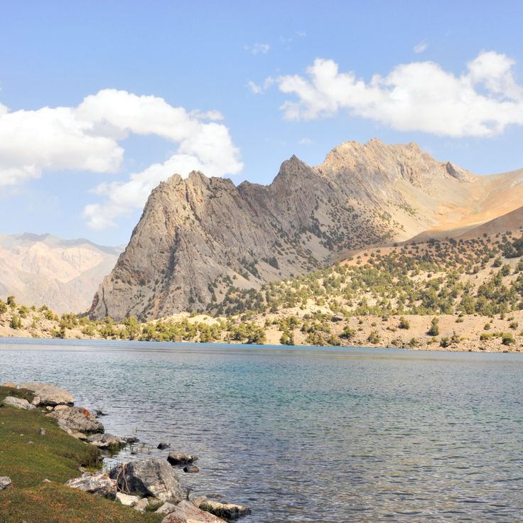
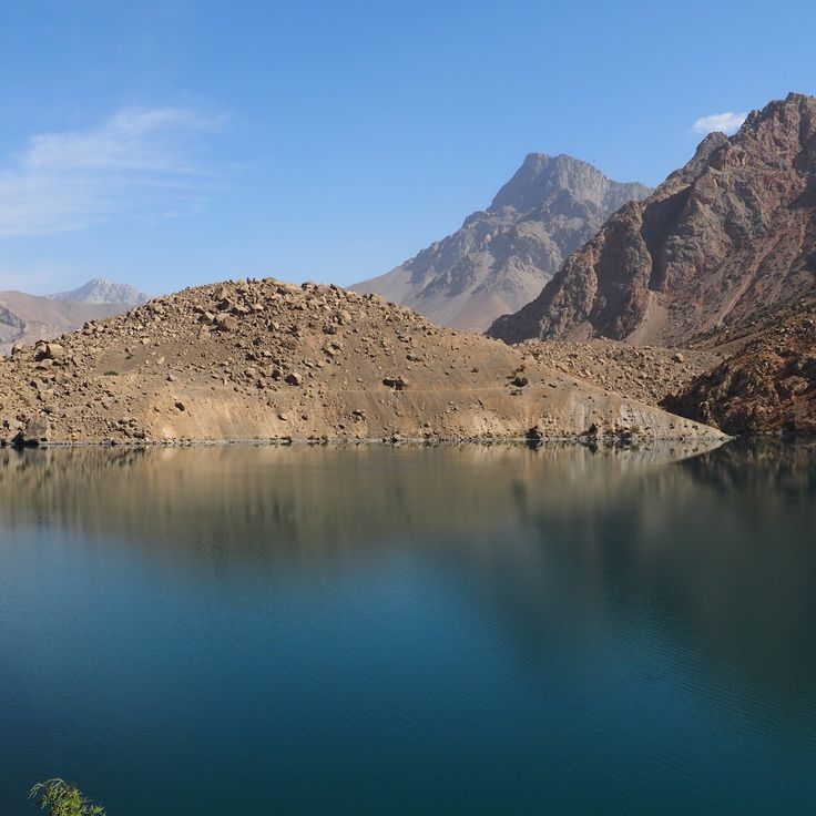
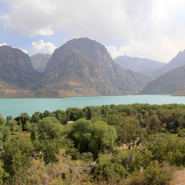
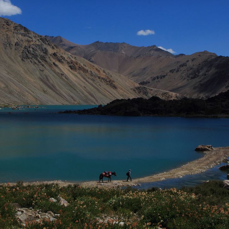
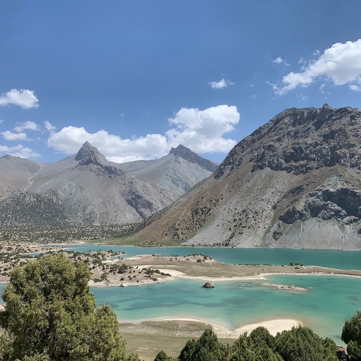
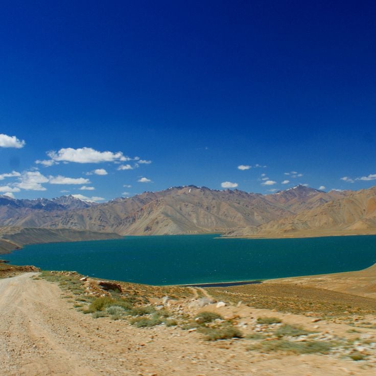
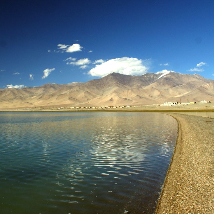
Iskanderkul Lake is a large alpine mountain lake in Sughd Province fed by glacial waters. Its blue waters reflect the surrounding peaks and draw hikers throughout the summer months. This lake represents the natural beauty that defines Tajikistan, where mountain peaks rise above 5000 meters and alpine waters sit nestled in high terrain. The lake shows how water and mountains combine to create spaces where visitors gather to walk and rest in the mountains.
The city of Karon represents a medieval settlement within this collection of natural beauties and historical sites of Tajikistan. Located at 2000 meters altitude in a mountain valley, it shows how communities once thrived in this remote terrain. Excavations have uncovered pottery and coins from the 7th century, revealing traces of daily life from centuries past. The remains speak to a settlement that served as a meeting point along ancient trade routes, where people adapted to the challenges of high-altitude living.
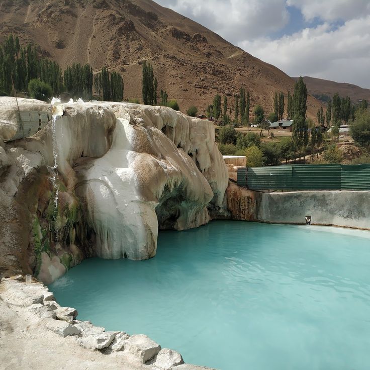
This hot spring emerges from the ground at 2800 meters altitude in Gorno-Badakhshan and is part of Tajikistan's natural heritage. The warm water reaches 63 degrees Celsius and attracts visitors traveling along the Pamir Highway. Locals have long valued the spring for its medicinal properties and use it to rest and restore themselves.
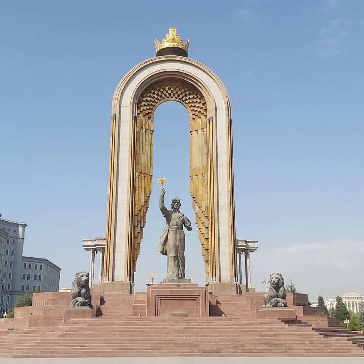
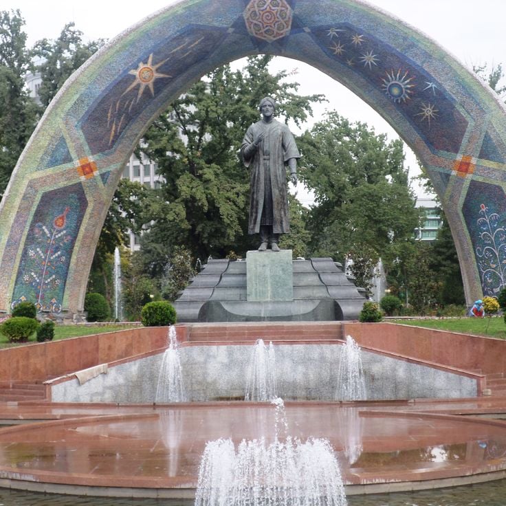
This statue of Ismoil Somoni rises 25 meters above the central square in Dushanbe and represents the first ruler of the Samanid dynasty. The bronze figure commemorates a leader whose empire shaped Central Asia more than 1000 years ago. This monument stands as a reminder of Tajikistan's deep past, when powerful dynasties controlled the region and trade routes brought people and goods across the mountains. For travelers exploring the country's history, the statue offers insight into the rulers and kingdoms that once flourished here.
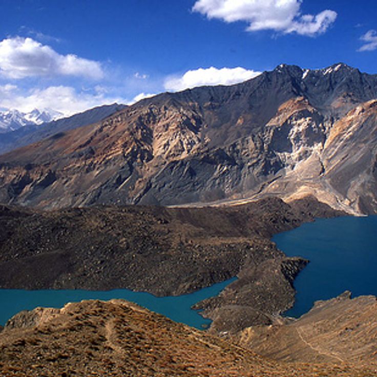
Karakul Lake is a saltwater body situated in the Pamir mountains and represents one of the natural wonders featured in this collection of Tajikistan's sites. With a maximum depth of 236 meters, this lake sits in one of the highest and most remote regions of the country. The lake remains frozen for eight months each year, demonstrating the extreme conditions that define life in these mountains. Its salty waters mirror the surrounding peaks, making it a remarkable place for those seeking to experience the raw beauty of the Pamir landscape.
Sarez Lake is a freshwater lake in Gorno-Badakhshan Province, formed by an earthquake in 1911. It stretches 55.8 kilometers long and holds 17 cubic kilometers of water. This lake is part of Tajikistan's natural features, where mountain peaks rise above 5000 meters and glacial water feeds alpine lakes. Sarez Lake shows how the forces of nature shape the landscape in this mountainous region, and how water from high elevations remains clear and pure.
Dushanbe is the administrative and economic center of Tajikistan, set in a mountainous landscape crossed by the Varzob River. The city displays the modern face of the country with museums housing objects from its history and theaters where performances take place. Parks provide spaces where people gather. The surrounding area, with Varzob Valley and Hissar Fortress, shows how the past remains visible in today's landscape. From here, you can easily reach the Fann Mountains with their lakes and clear waters.
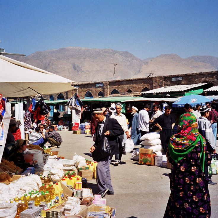
Khujand is a commercial hub on the Syr-Darya River in northern Sughd Province and serves as a gateway to understanding the natural beauty and historical sites that define Tajikistan. This city thrives along its waterfront with markets and shops that fill the central bazaar with activity and sound. The historic fortress that stands above the city tells of centuries when Khujand was an important stop on ancient trade routes that connected distant empires. The regional museum houses objects and artifacts that help visitors understand the region's past and its role in the civilizations that once flourished across Tajikistan.
Yagnob Valley is a mountainous region within Tajikistan's landscape of dramatic contrasts and historical depth. The valley is carved by the Yagnob River, which flows through steep terrain and alpine scenery. Local residents speak Yagnobi, an ancient language with roots in Sogdian culture. The valley demonstrates how communities have lived in these remote mountains for generations, maintaining their distinct heritage. The setting reveals the deep connection between the natural landscape and the people who have adapted to life at high altitude.
Kulikalon Lake is part of the natural beauties and historical sites of Tajikistan. This alpine body of water sits at 2800 meters elevation in the Fann Mountains, surrounded by peaks that exceed 5000 meters. The lake's clear waters reflect the surrounding mountains, offering a glimpse into the geological power that shapes this part of Central Asia.
Wakhan Valley is a narrow mountainous corridor that stretches between Tajikistan and Afghanistan. The valley follows the Piandj River as it cuts through deep gorges, connecting remote settlements in one of the world's highest mountain regions. This landscape shows how people have lived and worked at extreme elevation for centuries. The valley is part of Tajikistan's natural and historical treasures, offering visitors a glimpse into life at the border between two nations, where mountains shape the world around them.
Rudaki Park is a 14-hectare municipal park in the heart of Dushanbe and shows how the capital provides green spaces and gathering places for its residents. Named after the classical Persian poet Rudaki, the park reflects the cultural importance Tajikistan places on its literary and artistic heritage. With fountains, flower beds, and monuments, this park offers a space where people stroll, rest, and slow down from daily life. It demonstrates that the capital is more than just a gateway to mountain landscapes, but also a place where urban life unfolds and communities come together.
Alaudin Lake represents the high mountain lakes that define Tajikistan's landscape in this collection. The lake sits at 3300 meters elevation, ringed by snow-covered peaks that rise above the water. Hikers reach it after a 6-hour walk from the village of Zimtud. The water reflects the surrounding mountains, and the silence of this altitude makes it a special destination for those wanting to experience the country's mountain terrain.
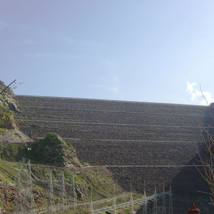
Nurek Dam is a monumental structure in Khatlon Province and plays a central role in Tajikistan's energy supply. Standing 300 meters high, it ranks among the world's tallest earthfill dams. The dam harnesses the waters of the Vakhsh River and generates about 70 percent of the country's electricity. The reservoir stretches for about 70 kilometers, offering a view of the scale of engineering in this mountainous region. This dam shows how people in Tajikistan have found ways to harness natural forces and provide power to communities across the land.
Geisev Valley is a remote mountain valley in the Bartang Canyon that represents the blend of human settlement and natural landscape found throughout Tajikistan. This valley contains three stone villages whose structures blend into the mountainside, alongside terraced fields shaped by generations of inhabitants. A glacier-fed lake provides water to this isolated location, while the people who live here continue to practice traditional forms of agriculture passed down through time.
The Kayrakkum Reservoir in Sughd holds an important place among Tajikistan's natural beauties and historical sites as a key structure on the Syr-Darya River. This 55-kilometer-long water retention system serves two essential purposes for the region: it supplies irrigation water to agricultural lands and generates electricity for the surrounding communities.
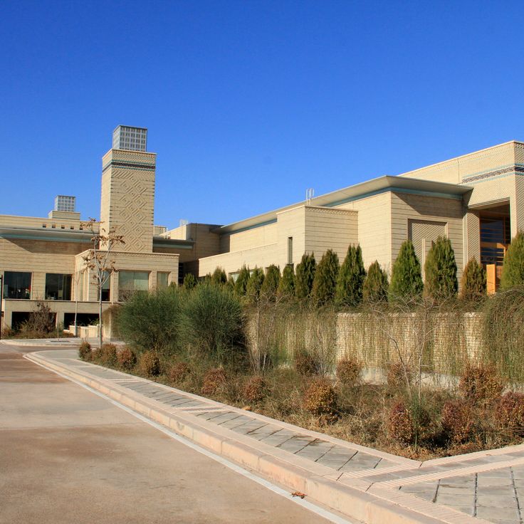
The Ismaili Centre stands as a modern building in Dushanbe, built in 2009 to serve the Ismaili Muslim community. It functions as a place for worship and community gatherings, reflecting how contemporary architecture fits into the city's fabric. The centre shows how religious spaces remain important to the rhythm of daily life in Tajikistan's capital.
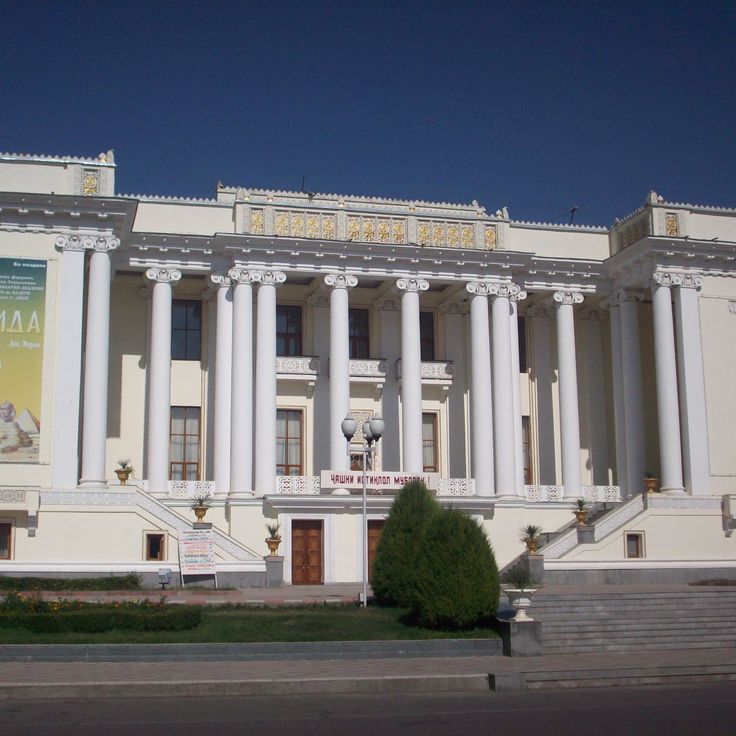
The Ayni Theater in Dushanbe serves as a cultural venue where the country's artistic traditions come to life. Built in 1946, this performance space seats about 1500 people and hosts national opera and ballet productions. The theater reflects how Tajikistan maintains its connection to the performing arts, offering a place where audiences gather to experience music, dance, and drama. Located in the capital, it stands as a reminder that cultural life thrives alongside the mountain landscapes that define the nation.
Penjikent is an archaeological site within this collection of natural beauties and historical sites of Tajikistan. This medieval city dates from the 5th century and reveals palaces, tombs, and remains of dwellings where people once lived. Murals and sculptures found here tell stories of the past and show how civilizations flourished in the mountain valleys. Penjikent stands as a window into how communities adapted to life in these high regions.
Bulunkul is a mountain village established at 3700 meters altitude on the Pamir plateau in Gorno-Badakhshan Province. The settlement sits beside a cold-water lake where winter temperatures plunge to minus 63 degrees Celsius. This village demonstrates how people have adapted to survive in one of the harshest environments on earth. Visitors to Bulunkul experience the reality of high-altitude living in the heart of Central Asia's most extreme terrain, where traditional ways persist in isolation.
Murghab is a regional center on the Pamir plateau and part of Tajikistan's natural beauties and historical sites. Located at 3650 meters, the town sits in harsh mountain terrain where temperatures drop below freezing for 8 months each year. The low buildings here are built to withstand the severe mountain climate, showing how people have adapted to life at extreme altitude. Murghab serves as an important stop for travelers crossing the Pamir Highway and exploring the high valleys and passes of the region.
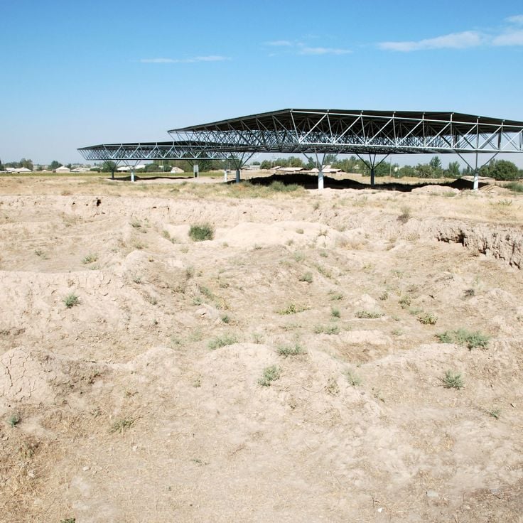
Sarazm is an archaeological site within the collection of natural beauties and historical sites of Tajikistan. Located in Panjakent District, it reveals the remains of palaces and religious buildings from a Bronze Age civilization that existed roughly 5500 years ago. The excavations show how people once lived together and built their communities in this region. Sarazm connects the history of this area with the landscape where ancient cultures developed and thrived.
Khulbuk Fortress was once the medieval capital of Khatlon province and today shows the remains of defensive walls and administrative buildings. This fortress tells the story of Tajikistan's past and belongs to the many historical sites that reveal how people lived and governed in this mountainous land. The ruins offer insight into medieval architecture and the importance of this region along ancient trade routes.
The Danghara Temple is a Hellenistic temple from the 3rd century BCE and an important witness to Tajikistan's ancient history. With its stone foundations and architectural elements showing Greek influence, this temple embodies the cultural connections that once linked the ancient world. The temple documents a time when Greek trade routes and cultural exchanges reached into the mountain regions of Central Asia and shaped local societies.
Yamchun Fortress is a military construction from the 3rd century that sits in a remote valley within the Pamir region. This fortress shows how people have lived in the highest mountains of the world across many centuries. The stone walls stretch across several levels along a mountain slope at 3000 meters altitude. As part of the natural beauties and historical sites of Tajikistan, Yamchun Fortress offers a view into the ancient past of the country.
The Pamir Highway is a high-altitude international road that spans 1200 km through the mountains of Tajikistan and plays a central role in the collection of the country's natural beauties and historical sites. This route connects small towns and settlements that seem to exist on the edge of the world, leading visitors through some of the earth's highest mountain terrain. Along the way, you pass places like Iskanderkul Lake and Garm Chashma Spring, where you can stop and rest. The road itself becomes part of the journey as it passes through Wakhan Valley, where Yamchun Fortress overlooks the landscape. At its highest point of 4655 meters at Ak-Baital Pass, the Pamir Highway shows how people have long found ways to live and thrive in these mountains.
The Fann Mountains are part of Tajikistan's natural beauties and historical sites, showcasing the dramatic contrasts of this mountain landscape. With more than ten peaks exceeding 5000 meters, this range shapes the Sughd Province region. Glaciers and deep valleys cut through the Fann Mountains, making it a key part of the Pamir system. Visitors who trek here experience the raw beauty of high peaks and encounter lakes whose waters mirror the sky above.
The National Museum of Tajikistan tells the story of the country through objects spanning from ancient times to today. Its collection spreads across three floors, showing archaeological finds, traditional crafts, and artworks that reveal how people have lived in this mountainous land. Walking through the museum, you see evidence of civilizations that flourished here centuries ago, connecting the modern nation to its past. The museum helps visitors understand that Tajikistan's story extends beyond its mountains and valleys to include the cultures and traditions of the people who call this place home.
The Varzob Valley is a natural corridor traversed by the Varzob River, bordered by mountains. This valley connects the capital Dushanbe to the northern mountainous regions and serves as a vital link between the city and the higher terrain of the country.
The Seven Lakes are a collection of alpine lakes in Sughd Province, part of Tajikistan's natural beauties and historical sites. These lakes connect to each other through natural waterfalls, and each lake displays a different color based on its depth and composition. This location offers visitors the chance to walk through high terrain and see water so clear it reflects the sky.
Hissar Fortress is a military structure from the 16th century and part of Tajikistan's natural beauties and historical sites. Located near the capital, Dushanbe, this fortress shows how the past remains present in everyday landscapes. The fortress features two entrance towers and is accompanied by an old madrasa and a mosque that sit adjacent to the main enclosure. The site tells of centuries when people built and lived in Tajikistan's valleys, shaping life in the shadow of surrounding mountains.
Iskanderkul Lake is a large alpine mountain lake in Sughd Province fed by glacial waters. Its blue waters reflect the surrounding peaks and draw hikers throughout the summer months. This lake represents the natural beauty that defines Tajikistan, where mountain peaks rise above 5000 meters and alpine waters sit nestled in high terrain. The lake shows how water and mountains combine to create spaces where visitors gather to walk and rest in the mountains.
The city of Karon represents a medieval settlement within this collection of natural beauties and historical sites of Tajikistan. Located at 2000 meters altitude in a mountain valley, it shows how communities once thrived in this remote terrain. Excavations have uncovered pottery and coins from the 7th century, revealing traces of daily life from centuries past. The remains speak to a settlement that served as a meeting point along ancient trade routes, where people adapted to the challenges of high-altitude living.
This hot spring emerges from the ground at 2800 meters altitude in Gorno-Badakhshan and is part of Tajikistan's natural heritage. The warm water reaches 63 degrees Celsius and attracts visitors traveling along the Pamir Highway. Locals have long valued the spring for its medicinal properties and use it to rest and restore themselves.
This statue of Ismoil Somoni rises 25 meters above the central square in Dushanbe and represents the first ruler of the Samanid dynasty. The bronze figure commemorates a leader whose empire shaped Central Asia more than 1000 years ago. This monument stands as a reminder of Tajikistan's deep past, when powerful dynasties controlled the region and trade routes brought people and goods across the mountains. For travelers exploring the country's history, the statue offers insight into the rulers and kingdoms that once flourished here.
Karakul Lake is a saltwater body situated in the Pamir mountains and represents one of the natural wonders featured in this collection of Tajikistan's sites. With a maximum depth of 236 meters, this lake sits in one of the highest and most remote regions of the country. The lake remains frozen for eight months each year, demonstrating the extreme conditions that define life in these mountains. Its salty waters mirror the surrounding peaks, making it a remarkable place for those seeking to experience the raw beauty of the Pamir landscape.
Sarez Lake is a freshwater lake in Gorno-Badakhshan Province, formed by an earthquake in 1911. It stretches 55.8 kilometers long and holds 17 cubic kilometers of water. This lake is part of Tajikistan's natural features, where mountain peaks rise above 5000 meters and glacial water feeds alpine lakes. Sarez Lake shows how the forces of nature shape the landscape in this mountainous region, and how water from high elevations remains clear and pure.
Dushanbe is the administrative and economic center of Tajikistan, set in a mountainous landscape crossed by the Varzob River. The city displays the modern face of the country with museums housing objects from its history and theaters where performances take place. Parks provide spaces where people gather. The surrounding area, with Varzob Valley and Hissar Fortress, shows how the past remains visible in today's landscape. From here, you can easily reach the Fann Mountains with their lakes and clear waters.
Khujand is a commercial hub on the Syr-Darya River in northern Sughd Province and serves as a gateway to understanding the natural beauty and historical sites that define Tajikistan. This city thrives along its waterfront with markets and shops that fill the central bazaar with activity and sound. The historic fortress that stands above the city tells of centuries when Khujand was an important stop on ancient trade routes that connected distant empires. The regional museum houses objects and artifacts that help visitors understand the region's past and its role in the civilizations that once flourished across Tajikistan.
Yagnob Valley is a mountainous region within Tajikistan's landscape of dramatic contrasts and historical depth. The valley is carved by the Yagnob River, which flows through steep terrain and alpine scenery. Local residents speak Yagnobi, an ancient language with roots in Sogdian culture. The valley demonstrates how communities have lived in these remote mountains for generations, maintaining their distinct heritage. The setting reveals the deep connection between the natural landscape and the people who have adapted to life at high altitude.
Kulikalon Lake is part of the natural beauties and historical sites of Tajikistan. This alpine body of water sits at 2800 meters elevation in the Fann Mountains, surrounded by peaks that exceed 5000 meters. The lake's clear waters reflect the surrounding mountains, offering a glimpse into the geological power that shapes this part of Central Asia.
Wakhan Valley is a narrow mountainous corridor that stretches between Tajikistan and Afghanistan. The valley follows the Piandj River as it cuts through deep gorges, connecting remote settlements in one of the world's highest mountain regions. This landscape shows how people have lived and worked at extreme elevation for centuries. The valley is part of Tajikistan's natural and historical treasures, offering visitors a glimpse into life at the border between two nations, where mountains shape the world around them.
Rudaki Park is a 14-hectare municipal park in the heart of Dushanbe and shows how the capital provides green spaces and gathering places for its residents. Named after the classical Persian poet Rudaki, the park reflects the cultural importance Tajikistan places on its literary and artistic heritage. With fountains, flower beds, and monuments, this park offers a space where people stroll, rest, and slow down from daily life. It demonstrates that the capital is more than just a gateway to mountain landscapes, but also a place where urban life unfolds and communities come together.
Alaudin Lake represents the high mountain lakes that define Tajikistan's landscape in this collection. The lake sits at 3300 meters elevation, ringed by snow-covered peaks that rise above the water. Hikers reach it after a 6-hour walk from the village of Zimtud. The water reflects the surrounding mountains, and the silence of this altitude makes it a special destination for those wanting to experience the country's mountain terrain.
Nurek Dam is a monumental structure in Khatlon Province and plays a central role in Tajikistan's energy supply. Standing 300 meters high, it ranks among the world's tallest earthfill dams. The dam harnesses the waters of the Vakhsh River and generates about 70 percent of the country's electricity. The reservoir stretches for about 70 kilometers, offering a view of the scale of engineering in this mountainous region. This dam shows how people in Tajikistan have found ways to harness natural forces and provide power to communities across the land.
Geisev Valley is a remote mountain valley in the Bartang Canyon that represents the blend of human settlement and natural landscape found throughout Tajikistan. This valley contains three stone villages whose structures blend into the mountainside, alongside terraced fields shaped by generations of inhabitants. A glacier-fed lake provides water to this isolated location, while the people who live here continue to practice traditional forms of agriculture passed down through time.
The Kayrakkum Reservoir in Sughd holds an important place among Tajikistan's natural beauties and historical sites as a key structure on the Syr-Darya River. This 55-kilometer-long water retention system serves two essential purposes for the region: it supplies irrigation water to agricultural lands and generates electricity for the surrounding communities.
The Ismaili Centre stands as a modern building in Dushanbe, built in 2009 to serve the Ismaili Muslim community. It functions as a place for worship and community gatherings, reflecting how contemporary architecture fits into the city's fabric. The centre shows how religious spaces remain important to the rhythm of daily life in Tajikistan's capital.
The Ayni Theater in Dushanbe serves as a cultural venue where the country's artistic traditions come to life. Built in 1946, this performance space seats about 1500 people and hosts national opera and ballet productions. The theater reflects how Tajikistan maintains its connection to the performing arts, offering a place where audiences gather to experience music, dance, and drama. Located in the capital, it stands as a reminder that cultural life thrives alongside the mountain landscapes that define the nation.
Penjikent is an archaeological site within this collection of natural beauties and historical sites of Tajikistan. This medieval city dates from the 5th century and reveals palaces, tombs, and remains of dwellings where people once lived. Murals and sculptures found here tell stories of the past and show how civilizations flourished in the mountain valleys. Penjikent stands as a window into how communities adapted to life in these high regions.
Bulunkul is a mountain village established at 3700 meters altitude on the Pamir plateau in Gorno-Badakhshan Province. The settlement sits beside a cold-water lake where winter temperatures plunge to minus 63 degrees Celsius. This village demonstrates how people have adapted to survive in one of the harshest environments on earth. Visitors to Bulunkul experience the reality of high-altitude living in the heart of Central Asia's most extreme terrain, where traditional ways persist in isolation.
Murghab is a regional center on the Pamir plateau and part of Tajikistan's natural beauties and historical sites. Located at 3650 meters, the town sits in harsh mountain terrain where temperatures drop below freezing for 8 months each year. The low buildings here are built to withstand the severe mountain climate, showing how people have adapted to life at extreme altitude. Murghab serves as an important stop for travelers crossing the Pamir Highway and exploring the high valleys and passes of the region.
Sarazm is an archaeological site within the collection of natural beauties and historical sites of Tajikistan. Located in Panjakent District, it reveals the remains of palaces and religious buildings from a Bronze Age civilization that existed roughly 5500 years ago. The excavations show how people once lived together and built their communities in this region. Sarazm connects the history of this area with the landscape where ancient cultures developed and thrived.
Khulbuk Fortress was once the medieval capital of Khatlon province and today shows the remains of defensive walls and administrative buildings. This fortress tells the story of Tajikistan's past and belongs to the many historical sites that reveal how people lived and governed in this mountainous land. The ruins offer insight into medieval architecture and the importance of this region along ancient trade routes.
The Danghara Temple is a Hellenistic temple from the 3rd century BCE and an important witness to Tajikistan's ancient history. With its stone foundations and architectural elements showing Greek influence, this temple embodies the cultural connections that once linked the ancient world. The temple documents a time when Greek trade routes and cultural exchanges reached into the mountain regions of Central Asia and shaped local societies.