Enable Location

We need your location to show you interesting places around you

Discover nearby places

Find interesting locations and hidden gems around you

Precise directions

Get accurate directions and distances to places

Your location is never shared with other users. It's only used when you tap the location button.

Jackson County

Log in to your account

Start exploring — it's free

Trusted by travelers worldwide

Continue with Google
Continue with Apple
or

We will send you a code to connect

By continuing, you accept our Terms and Conditions and our Privacy Policy

Check your inbox

We've sent a pincode in your inbox. Please enter the code below.

Jackson County, County in western Missouri, United States.

Description

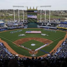
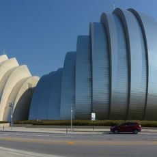
Jackson County is a county in western Missouri that stretches from the Missouri River in the north to rural areas in the south. The Kansas City metropolitan area occupies the western portion, while the Independence area sits in the east.

History

The county formed in 1826 and took its name from Andrew Jackson, a military hero of the War of 1812. During the following decades it became a hub for trade with the West and migration across the plains.

Culture

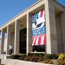
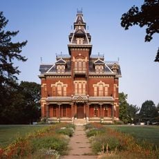
The eastern part of the county served as a departure point for thousands of settlers traveling west by wagon during the 19th century. Museums and reconstructed buildings now preserve the memory of this continental migration.

Practical

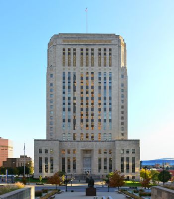
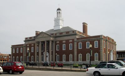
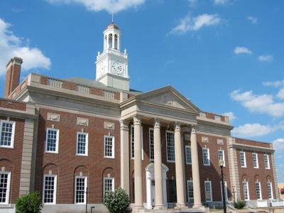
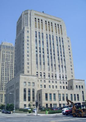
The administration splits across two sites: Independence in the east serves as the original seat, and Kansas City in the west houses additional offices. Roads connect both parts and pass through residential and commercial districts as well as farmland.

Did you know?

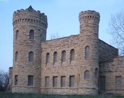
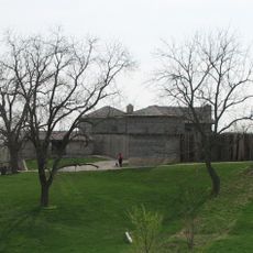
Fort Osage on the Missouri River was built in 1808 as one of the first military installations of the United States in this territory. The reconstructed fort now shows how soldiers and traders lived on the edge of settled land at that time.

Location
Inception
December 15, 1826
Capital city
Kansas City
Shares border with
Clay County, Cass County, Ray County, Lafayette County, Johnson County, Wyandotte County
GPS coordinates
39.01000,-94.34000
Latest update
December 13, 2025 16:57

AroundUs brings together thousands of curated places, local tips, and hidden gems, enriched daily by 60,000 contributors worldwide. Discover all places nearby (Missouri).

Around this place
Arrowhead Stadium
United States of America

Arrowhead Stadium

13.2 km
Kauffman Stadium
United States of America

Kauffman Stadium

13 km
Worlds of Fun
United States of America

Worlds of Fun

22.6 km
T-Mobile Center
United States of America

T-Mobile Center

22.9 km
Hy-Vee Arena
United States of America

Hy-Vee Arena

24.7 km
The Nelson-Atkins Museum of Art
United States of America

The Nelson-Atkins Museum of Art

21.2 km
Harry S. Truman Presidential Library and Museum
United States of America

Harry S. Truman Presidential Library and Museum

12.5 km
Municipal Stadium
United States of America

Municipal Stadium

20.6 km
National Collegiate Basketball Hall of Fame
United States of America

National Collegiate Basketball Hall of Fame

23 km
Independence Temple
United States of America

Independence Temple

11.7 km
Kauffman Center for the Performing Arts
United States of America

Kauffman Center for the Performing Arts

23.3 km
Temple Lot
United States of America

Temple Lot

11.7 km
Kansas City Zoo
United States of America

Kansas City Zoo

16.2 km
Negro Leagues Baseball Museum
United States of America

Negro Leagues Baseball Museum

21.3 km
Remnant Church of Jesus Christ of Latter Day Saints
United States of America

Remnant Church of Jesus Christ of Latter Day Saints

11.7 km
Worlds of Fun
United States of America

Worlds of Fun

22.2 km
Mamba
United States of America

Mamba

22.2 km
Kansas City Public Library
United States of America

Kansas City Public Library

23.5 km
Municipal Auditorium
United States of America

Municipal Auditorium

23.5 km
Oceans of Fun
United States of America

Oceans of Fun

21.7 km
Arabia Steamboat Museum
United States of America

Arabia Steamboat Museum

23.6 km
Linda Hall Library
United States of America

Linda Hall Library

20.8 km
Kansas City Power and Light Building
United States of America

Kansas City Power and Light Building

23.3 km
Vaile Mansion
United States of America

Vaile Mansion

12.8 km
City Market
United States of America

City Market

23.7 km
Timber Wolf
United States of America

Timber Wolf

22.2 km
Fort Osage
United States of America

Fort Osage

23.5 km
Hotel President
United States of America

Hotel President

23.2 km
Show the full map
« Jackson County - County in western Missouri, United States » is provided by Around Us (aroundus.com). Images and texts are derived from Wikimedia project under a Creative Commons license. You are allowed to copy, distribute, and modify copies of this page, under the conditions set by the license, as long as this note is clearly visible.

Discover hidden gems everywhere you go!

From secret cafés to breathtaking viewpoints, skip the crowded tourist spots and find places that match your style. Our app makes it easy with voice search, smart filtering, route optimization, and insider tips from travelers worldwide. Download now for the complete mobile experience.

Around Us App Screenshot

A unique approach to discovering new places

Le Figaro

All the places worth exploring

France Info

A tailor-made excursion in just a few clicks

20 Minutes

Around Us
Travel Guide & Maps
Download

Send to your phone

QR Code
1

Open the camera app on your mobile.

2

Point at the QR code with your camera. A notification will appear.

3

Tap the notification to open the link.