·

Enable Location

We need your location to show you interesting places around you

Discover nearby places

Find interesting locations and hidden gems around you

Precise directions

Get accurate directions and distances to places

Your location is never shared with other users. It's only used when you tap the location button.

Lechtal Alps

Log in to your account

Start exploring — it's free

Trusted by 62,658 travelers worldwide

Continue with Google
Continue with Apple
or

We will send you a code to connect

By continuing, you accept our Terms and Conditions and our Privacy Policy

Check your inbox

We've sent a pincode in your inbox. Please enter the code below.

Lechtal Alps

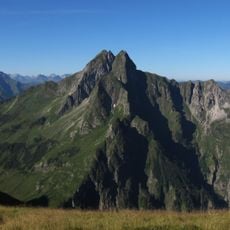
Lechtal Alps, Mountain range in western Tyrol and Vorarlberg, Austria

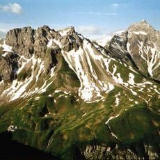
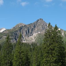
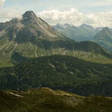
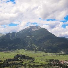
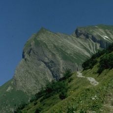
The Lechtal Alps form the largest mountain chain of the Northern Limestone Alps, stretching across Tyrol and Vorarlberg. The range contains numerous peaks and valleys that take hikers through different elevations and landscapes.

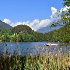
The range takes its name from the Lech River, which begins in Vorarlberg and flows northward through the mountains into Germany. This river has shaped the region's geography and historical connections for centuries.

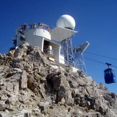
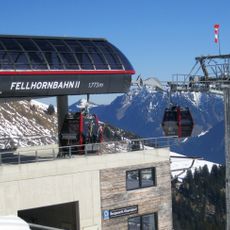
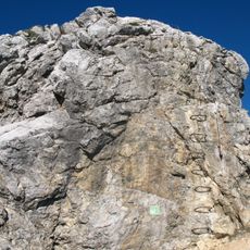
Mountaineers traveling through here rely on the twenty mountain huts run by the Alpine Association as stopping points. These shelters have become meeting places where visitors rest and share stories about their journeys.

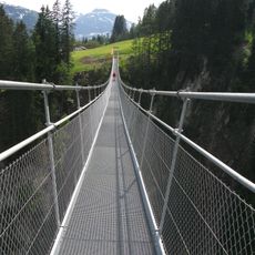
The European long-distance hiking trail E5 and two sections of the Via Alpina traverse the mountain range with clearly marked paths for multi-day treks. Visitors should prepare for changing mountain weather and bring appropriate gear.

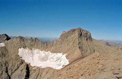
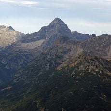
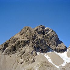
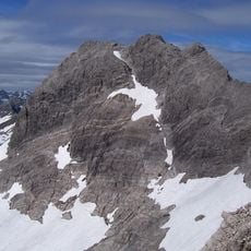
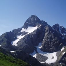
The Parseierspitze stands as the only peak above 3,000 meters in the Northern Limestone Alps, reaching 3,036 meters. This distinction makes it a special destination for mountaineers exploring the range.

The community of curious travelers

AroundUs brings together thousands of curated places, local tips, and hidden gems, enriched daily by 60,000 contributors worldwide.

Start exploring
Location
Location
Elevation above the sea
3,036 m
Made from material
sedimentary rock
Part of
North Tyrol Limestone Alps
Shares border with
Lechquellen Mountains, Allgäu Alps, Ammergau Alps, Ötztal Alps, Samnaun Alps, Verwall Alps, Wetterstein and Mieming Range
GPS coordinates
47.17440,10.47830
Latest update
December 7, 2025 10:08
« Lechtal Alps - Mountain range in western Tyrol and Vorarlberg, Austria » is provided by Around Us (aroundus.com). Images and texts are derived from Wikimedia project under a Creative Commons license. You are allowed to copy, distribute, and modify copies of this page, under the conditions set by the license, as long as this note is clearly visible.

Discover hidden gems everywhere you go!

From secret cafés to breathtaking viewpoints, skip the crowded tourist spots and find places that match your style. Our app makes it easy with voice search, smart filtering, route optimization, and insider tips from travelers worldwide. Download now for the complete mobile experience.

Around Us App Screenshot

A unique approach to discovering new places

Le Figaro

All the places worth exploring

France Info

A tailor-made excursion in just a few clicks

20 Minutes

Around Us
Travel Guide & Maps
Download

Send to your phone

QR Code
1

Open the camera app on your mobile.

2

Point at the QR code with your camera. A notification will appear.

3

Tap the notification to open the link.