Log in to your account

AroundUs is a community-driven map of interesting places, built by curious explorers like you. It grows with every review, story, and photo you share.
Connect to save your favorite spots, contribute locations, and create personalized routes.
Continue with Google
Continue with Apple
Continue with X
Continue with Facebook
Continue with email
By continuing, you accept our Terms and Conditions and our Privacy Policy
Create an account

West Jaintia Hills district

Add to collection
Map
Suggest a change
Share

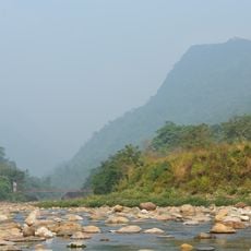
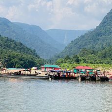
West Jaintia Hills district, Administrative district in Meghalaya, India

West Jaintia Hills is an administrative district in Meghalaya comprising three development blocks with Jowai serving as the main administrative center. The region connects to other areas through major national highways.

The district was created in 2012 when the original Jaintia Hills district split into two separate administrative regions. This division established a new governing structure for the western portion of the area.

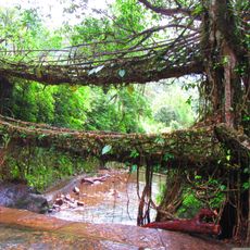
The people here speak Pnar and War languages and celebrate local festivals that keep their traditions alive. These celebrations shape daily life and show how communities maintain their identity.

The region is easily accessible via major national highways, and you will find banks, educational institutions, and healthcare facilities concentrated around Jowai. Most essential services are available in this central area.

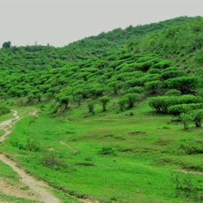
The region grows Lakadong Turmeric, a variety known for its unusually high curcumin content. This special crop is often overlooked by visitors, though it is one of the area's most valuable products.

Location: Meghalaya

Inception: July 31, 2012

Capital city: Jowai

Shares border with: East Jaintia Hills district, East Khasi Hills district, Ri-Bhoi district

Website: http://westjaintiahills.gov.in

GPS coordinates: 25.45000,92.20000

Latest update: December 8, 2025 13:44

Photos
Reviews

Visited this place? Tap the stars to rate it and share your experience / photos with the community! Try now! You can cancel it anytime.

« West Jaintia Hills district - Administrative district in Meghalaya, India » is provided by Around Us (aroundus.com). Images and texts are derived from Wikimedia project under a Creative Commons license. You are allowed to copy, distribute, and modify copies of this page, under the conditions set by the license, as long as this note is clearly visible.

Discover hidden gems everywhere you go!

From secret cafés to breathtaking viewpoints, skip the crowded tourist spots and find places that match your style. Our app makes it easy with voice search, smart filtering, route optimization, and insider tips from travelers worldwide. Download now for the complete mobile experience.

Around Us App Screenshot

A unique approach to discovering new places

Le Figaro

All the places worth exploring

France Info

A tailor-made excursion in just a few clicks

20 Minutes