Chest opened
+${chestReward.xp} XP
Explorer
NOUVEAU ×${chestReward.collectible.quantity}
tapez pour fermer
Chest locked

Open chests in the app

Around Us is built for your phone — chests unlock when you walk, explore and capture nearby places.

Enable Location

We need your location to show you interesting places around you

Discover nearby places

Find interesting locations and hidden gems around you

Precise directions

Get accurate directions and distances to places

Your location is never shared with other users. It's only used when you tap the location button.

Peer Ki Gali

Log in to your account

Start exploring — it's free

Trusted by 72,888 travelers worldwide

Continue with Google
Continue with Apple
or

We will send you a code to connect

By continuing, you accept our Terms and Conditions and our Privacy Policy

Check your inbox

We've sent a pincode in your inbox. Please enter the code below.

Peer Ki Gali
Discussion Reviews 1 Photos
14.4k Popularity

Peer Ki Gali, Mountain pass in Pir Panjal Range, Jammu and Kashmir, India

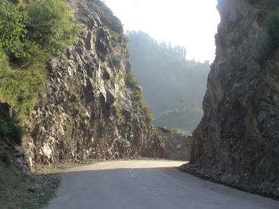
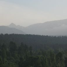
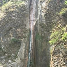
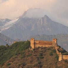
Peer Ki Gali is a mountain pass in the Pir Panjal Range at 3,485 meters elevation, connecting the Kashmir Valley with Rajouri and Poonch districts through steep terrain. The route traverses narrow gorges and exposed ridges with panoramic views across the surrounding peaks.

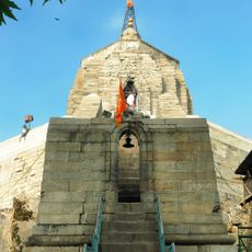
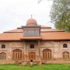
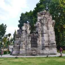
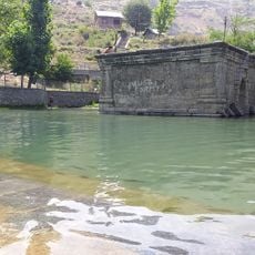
Emperor Jahangir built a rest house called Aliabad Sarai near the pass in the late 16th century as a stopping point along the Mughal Road. This outpost was part of a network of halting stations that supported travel across the mountains.

The pass takes its name from Saint Mir Sayyid Ali Hamadani, whose spiritual teachings shaped local traditions in the region. This religious connection remains visible in how people regard this place as a sacred crossing.

Heavy snowfall and temperatures dropping below -15°C in winter require careful preparation before traveling. Check current road conditions and gather information about local weather patterns before planning your visit.

The Pir Panjal stream runs through the pass and transforms into the Rambi Ara River as it descends toward Shopian district. Followers of this water course can trace the natural geography that defines the landscape.

The community of curious travelers

AroundUs brings together thousands of curated places, local tips, and hidden gems, enriched daily by 60,000 contributors worldwide.

Start exploring
Elevation above the sea
3,485 m
GPS coordinates
33.62993,74.51997
Latest update
December 7, 2025 20:21
Reviews
Share your experience

No review yet

Discussions
Start a discussion...

No discussion yet

« Peer Ki Gali - Mountain pass in Pir Panjal Range, Jammu and Kashmir, India » is provided by Around Us (aroundus.com). Images and texts are derived from Wikimedia project under a Creative Commons license. You are allowed to copy, distribute, and modify copies of this page, under the conditions set by the license, as long as this note is clearly visible.

Discover hidden gems everywhere you go!

From secret cafés to breathtaking viewpoints, skip the crowded tourist spots and find places that match your style. Our app makes it easy with voice search, smart filtering, route optimization, and insider tips from travelers worldwide. Download now for the complete mobile experience.

Around Us App Screenshot

A unique approach to discovering new places

Le Figaro

All the places worth exploring

France Info

A tailor-made excursion in just a few clicks

20 Minutes

Around Us
Travel Guide & Maps
Download

Send to your phone

QR Code
1

Open the camera app on your mobile.

2

Point at the QR code with your camera. A notification will appear.

3

Tap the notification to open the link.