El Malpais National Conservation Area

Log in to your account

AroundUs is a community-driven map of interesting places, built by curious explorers like you. It grows with every review, story, and photo you share.
Connect to save your favorite spots, contribute locations, and create personalized routes.
Continue with Google
Continue with Apple
Continue with X
Continue with Facebook
Continue with email
By continuing, you accept our Terms and Conditions and our Privacy Policy
Create an account

El Malpais National Conservation Area

Add to collection
Map
Suggest a change
Share

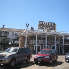
El Malpais National Conservation Area, Conservation area with volcanic fields in Cibola County, United States.

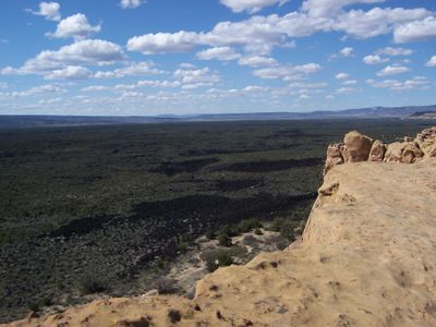
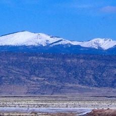
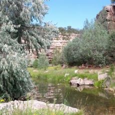
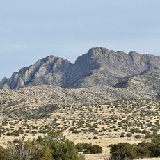
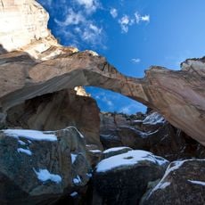
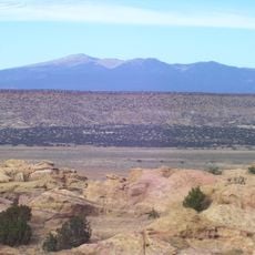
El Malpais National Conservation Area is a vast protected landscape filled with ancient lava flows, cinder cones, towering sandstone cliffs, and natural stone arches. The terrain displays different types of volcanic and geological formations that create diverse and dramatic scenery throughout the conservation area.

The federal government established this conservation area in 1987 to protect the geological and archaeological resources of the region's volcanic fields. This official designation recognized the scientific importance and cultural significance that the landscape holds.

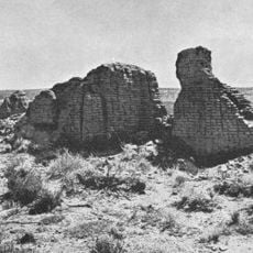
The Acoma, Laguna, and Zuni peoples have used this land for generations to gather plants and perform ceremonies that remain part of their daily life today. Visitors can see signs of these practices throughout the conservation area as it continues to hold spiritual and practical meaning for these communities.

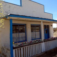
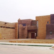
A ranger station at the site provides visitor information, hiking permits, and educational programs about the volcanic landscape and local wildlife. Stopping here before exploring helps you understand trail conditions and safety guidelines for the area.

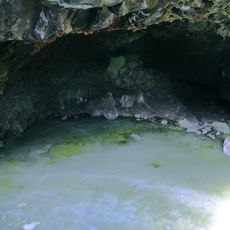
The lava fields were created by five major lava flows and eight volcanic vents that formed an extensive network of underground tubes and caves. These underground passages are partially accessible to visitors and reveal the hidden geology beneath the surface.

Location: Cibola County

Inception: 1987

GPS coordinates: 34.85900,-108.02100

Latest update: December 12, 2025 12:02

Photos
Around this place
Karl G. Jansky Very Large Array
United States of America

Karl G. Jansky Very Large Array

94.4 km
United States of America

Los Lunas Decalogue Stone

94 km
Mount Taylor
United States of America

Mount Taylor

56.6 km
The Lightning Field
United States of America

The Lightning Field

38.9 km
Very Long Baseline Array
United States of America

Very Long Baseline Array

94.4 km
Fort Wingate
United States of America

Fort Wingate

82.6 km
Hawikuh Ruins
United States of America

Hawikuh Ruins

88.4 km
El Rancho Hotel & Motel
United States of America

El Rancho Hotel & Motel

98.5 km
Bandera Volcano Ice Cave
United States of America

Bandera Volcano Ice Cave

15.8 km
Bluewater Lake State Park
United States of America

Bluewater Lake State Park

49.1 km
United States of America

Enchanted Mesa

43.4 km
San Estevan Del Rey Mission Church
United States of America

San Estevan Del Rey Mission Church

40.3 km
United States of America

Dowa Yalanne

73.6 km
Ladron Peak
United States of America

Ladron Peak

97.9 km
Cebolla Wilderness
United States of America

Cebolla Wilderness

15.2 km
Acoma Curio Shop
United States of America

Acoma Curio Shop

46.1 km
Datil-Mogollon Section
United States of America

Datil-Mogollon Section

47.9 km
Sacred Heart Cathedral
United States of America

Sacred Heart Cathedral

98.7 km
Grant meteorite
United States of America

Grant meteorite

36.6 km
Kin Ya-ah
United States of America

Kin Ya-ah

91.3 km
San Jose de la Laguna Mission and Convento
United States of America

San Jose de la Laguna Mission and Convento

60.9 km
Bowlin's Old Crater Trading Post
United States of America

Bowlin's Old Crater Trading Post

47.4 km
Grants-Milan Flight Service Station
United States of America

Grants-Milan Flight Service Station

36 km
Roy T. Herman's Garage and Service Station
United States of America

Roy T. Herman's Garage and Service Station

62.7 km
Charley's Automotive Service
United States of America

Charley's Automotive Service

36 km
Sky City Cultural Center and Haak'u Museum

Sky City Cultural Center and Haak'u Museum

39.8 km
Shiva:Shiwana
United States of America

Shiva:Shiwana

94.7 km
Bracewell Radio Sundial
United States of America

Bracewell Radio Sundial

94.7 km
Show the full map
Reviews

Visited this place? Tap the stars to rate it and share your experience / photos with the community! Try now! You can cancel it anytime.

« El Malpais National Conservation Area - Conservation area with volcanic fields in Cibola County, United States » is provided by Around Us (aroundus.com). Images and texts are derived from Wikimedia project under a Creative Commons license. You are allowed to copy, distribute, and modify copies of this page, under the conditions set by the license, as long as this note is clearly visible.

Discover hidden gems everywhere you go!

From secret cafés to breathtaking viewpoints, skip the crowded tourist spots and find places that match your style. Our app makes it easy with voice search, smart filtering, route optimization, and insider tips from travelers worldwide. Download now for the complete mobile experience.

Around Us App Screenshot

A unique approach to discovering new places

Le Figaro

All the places worth exploring

France Info

A tailor-made excursion in just a few clicks

20 Minutes