Las Conchas Natural Park, Natural park in Chahal, Guatemala
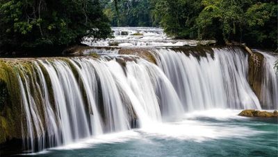
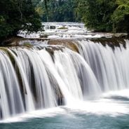
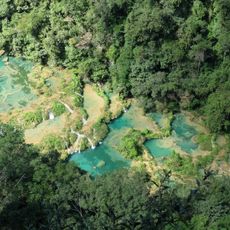
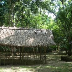
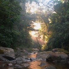
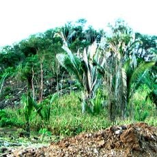
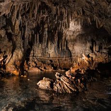
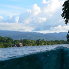
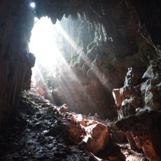
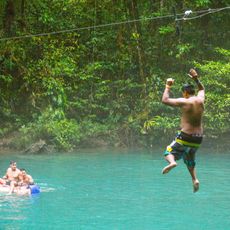
The park contains multiple natural swimming pools formed by limestone rocks, with waterfalls cascading over different levels throughout the area.
The establishment of Las Conchas Natural Park marked an important step in protecting Guatemala's natural resources against agricultural expansion in the Alta Verapaz region.
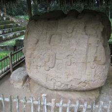
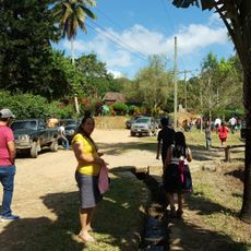
Local indigenous communities maintain traditional ecological practices within the park boundaries, contributing to the preservation of native plant species.
The park entrance fee costs 50 quetzales for international visitors and includes access to swimming areas and hiking trails along the river.
The natural pools feature different water temperatures at various levels, creating a sequence of swimming spots connected by small waterfalls.
Location: Chahal
GPS coordinates: 15.85208,-89.46229
Latest update: May 6, 2025 16:28
Guatemala contains several photographic subjects within its borders. Maya ruins such as Tikal, Yaxha and Quiriguá stand in the tropical forests of Petén and Izabal. Colonial architecture appears in Antigua Guatemala, where the Santa Catalina Arch and painted facades line cobblestone streets. Lake Atitlán sits between three volcanoes, with towns like Santiago Atitlán and San Marcos La Laguna offering different perspectives on the water. Active volcanoes including Pacaya and Acatenango provide opportunities to photograph lava flows and crater landscapes. The highland areas of Alta Verapaz hold Semuc Champey, a natural limestone pool, and the caves of Lanquín and Candelaria. Hot springs at Fuentes Georginas lie near Quetzaltenango in the western highlands. Chichicastenango Market documents textile trade and indigenous ceremonies. Livingston on the Rio Dulce shows Garifuna culture on the Caribbean coast, while Monterrico offers black sand beaches on the Pacific. Less visited sites like Dos Pilas, Takalik Abaj and Iximche add pre-Columbian contexts. The collection covers both well known and remote locations across Guatemala's varied geography.
Semuc Champey
64.2 km
Quiriguá
79.1 km
Castillo de San Felipe de Lara
55.6 km
Reserva de la biosfera Sierra de las Minas
80.1 km
Aguateca
99.8 km
Nim Li Punit
87.7 km
Puente de Río Dulce
54.2 km
Cancuén
64.7 km
Chocón Machacas
62.7 km
Naj Tunich
51.2 km
El Chal
89.3 km
Ixkun
80.5 km
Sacul
83.2 km
Bladen Nature Reserve
94.1 km
Ixtutz
52 km
Chamá
97.6 km
Xnaheb
87.7 km
Museo Regional del Sureste de Petén
74.1 km
Museo de Paleontologia y Arqueología de Estanzuela
95.7 km
Rey Marcos Caves
99.8 km
Parque Nacional Río Dulce
64.3 km
Museo
78.6 km
Rio Dulce National Park
60.6 km
Calvario Poptun
53.6 km
Cuevas de B'omb'il Pek
88.4 km
Cementerio Senahú
62.1 km
Hun Nal Ye
93.9 km
Finca El Cisne
95.4 kmReviews
Real people, real opinions — but not verified.
Visited this place? Tap the stars to rate it and share your experience / photos with the community! Try now! You can cancel it anytime.
A very pleasant place to share with Guatemalans. Avoid Sunday if you do not like crowds.
Discover hidden gems everywhere you go!
From secret cafés to breathtaking viewpoints, skip the crowded tourist spots and find places that match your style. Our app makes it easy with voice search, smart filtering, route optimization, and insider tips from travelers worldwide. Download now for the complete mobile experience.
A unique approach to discovering new places❞
— Le Figaro
All the places worth exploring❞
— France Info
A tailor-made excursion in just a few clicks❞
— 20 Minutes
