Chaquicocha, Mountain summit in Cusco Region, Peru.
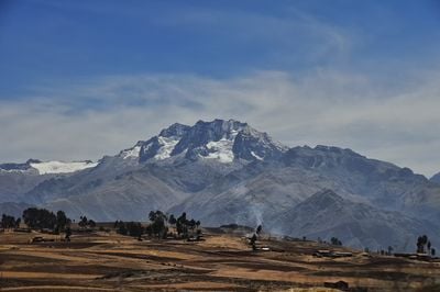
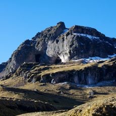
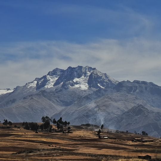
Chaquicocha is a 4,895-metre summit in the Urubamba range, on the border of Calca District and the Huayllabamba and Yucay districts in Cusco Region. It lies southwest of Huamanchoque and southeast of Chicon. Its crest is a jagged ridge of dark grey rock, with snow and ice filling gullies and ledges below the top, while the lower flanks are bare pale grey and brown stone above brown fields and scattered trees.
Chaquicocha lies in the Urubamba range, southwest of Huamanchoque and southeast of Chicon, on the border of Calca District and the districts of Huayllabamba and Yucay. Its name, from Quechua ch'aki (dry) and qucha (lake), refers to the small lake of the same name south of the summit, about 8 m deep and roughly two hectares in area, ringed by queñua woodland.
The name comes from two Quechua words: ch'aki meaning dry and qucha meaning lake, showing the indigenous language roots of the region. Local communities have long recognized this peak as part of their traditional geography and the stories passed down through their families.
Chaquicocha lies in the Urubamba range, southwest of Huamanchoque and southeast of Chicon, on the border of Calca and Urubamba provinces. The small lake of the same name sits south of the summit in Yucay District, about 8 m deep and two hectares in area, ringed by queñua woods. Access is from the Calca and Huayllabamba side.
The lake named Chaquicocha, which gives the mountain its name, lies south of the summit in Yucay District at 13°16′40″S 72°03′01″W. It covers about two hectares, reaches roughly 8 m deep, and is ringed by queñua (Polylepis) woods, as is nearby Yanacocha, the "black lake".
The community of curious travelers
AroundUs brings together thousands of curated places, local tips, and hidden gems, enriched daily by 92,644 contributors worldwide.