Perené District, Administrative district in Chanchamayo Province, Peru
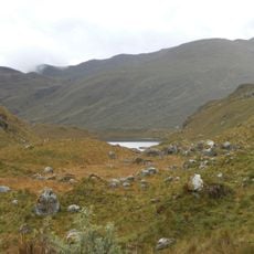
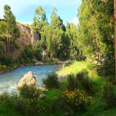
Perené District is an administrative area in Chanchamayo Province covering roughly 1,200 square kilometers of Amazon rainforest with hills, rivers, and waterfalls. The district sits at about 650 meters elevation and serves as a territorial subdivision of central Peru.
This district was established on January 14, 1986, following an administrative reorganization of Chanchamayo Province in central Peru. The creation reflected efforts to improve territorial governance and administrative structure in the region.
Indigenous communities in this district continue farming coffee and cocoa using methods passed down through generations, shaping daily life and local identity. These agricultural practices remain central to how people work and interact with the land around them.
The district capital Perené functions as the main administrative hub offering basic services to residents and visitors. Being located in the Amazon rainforest, the area experiences humid conditions and has limited infrastructure in many areas.
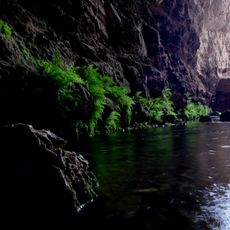
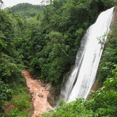
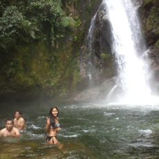
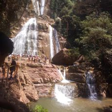
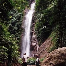
The Catarata Bayoz waterfall within the district creates natural pools surrounded by dense rainforest vegetation and home to native bird species. This hidden spot often goes unnoticed by visitors despite offering a remarkable natural experience.
Location: Chanchamayo Province
Capital city: Perené
Elevation above the sea: 650 m
Shares border with: Pichanaqui District, Puerto Bermúdez, Villa Rica, San Luis de Shuaro District, Chanchamayo District, Vitoc District
Website: http://muniperene.gob.pe
GPS coordinates: -10.94962,-75.22682
Latest update: December 7, 2025 20:43
Junin National Reservation
101.9 km
Huaytapallana
108.4 km
Huagapo
70.7 km
Chacamarca Historical Sanctuary
86.4 km
Velo de la Novia, Perené
16.8 km
Colegio de Propaganda Fide de Santa Rosa de Ocopa
103.1 km
Pampa Hermosa National Sanctuary
29.4 km
Tunanmarka
94.9 km
Pui Pui Protection Forest
39.3 km
Catarata Bayoz
16.2 km
Yanesha Communal Reserve
70.3 km
Torre Torre
123.7 km
San Matías–San Carlos Protection Forest
50.4 km
Huayllay National Sanctuary
122.1 km
Cunas River
132.9 km
Catarata El Tirol
23.8 km
Saint Anne Church (Tarma)
72.7 km
Tarmatambo
77.2 km
Pumpu
115.3 km
Oxapampa-Ashaninka-Yanesha
41.4 km
Huaytapallana Regional Conservation Area
108.6 km
Capilla Cristo Pobre
96.6 km
Puente Centenario
124.2 km
Waqurunchu
90.2 km
Estadio Mariscal Castilla
122.3 km
Iglesia San Pedro de Ninacaca
97.3 km
Iglesia Matriz Santa Rosa de Oxapampa
46 km
Casa del pintor Guillermo Guzmán Manzaneda
124.1 kmVisited this place? Tap the stars to rate it and share your experience / photos with the community! Try now! You can cancel it anytime.
Discover hidden gems everywhere you go!
From secret cafés to breathtaking viewpoints, skip the crowded tourist spots and find places that match your style. Our app makes it easy with voice search, smart filtering, route optimization, and insider tips from travelers worldwide. Download now for the complete mobile experience.
A unique approach to discovering new places❞
— Le Figaro
All the places worth exploring❞
— France Info
A tailor-made excursion in just a few clicks❞
— 20 Minutes